Hamley Bridge–Gladstone railway line

Last updated

Hamley Bridge–Gladstone railway line
Railway bridge over Gilbert River at Hamley Bridge.JPG
Bridge over the Gilbert River at Hamley Bridge
Overview
StatusClosed
Termini
Continues from Roseworthy-Peterborough line
Continues as Wilmington line
Service
System South Australian Railways
Operator(s) South Australian Railways
Australian National
History
Opened Hamley Bridge-Balaklava: 15 January 1880
Balaklava-Blyth: 14 March 1876
Blyth to Gladstone: 2 July 1894
Closed Gulnare-Gladstone: 11 May 1988
Balaklava-Gulnare: 29 March 1989
Technical
Line length147.7 km (91.8 mi)
Track gauge 1,600 mm (5 ft 3 in)
Old gauge1,067 mm (3 ft 6 in)
Route map

Contents

BSicon uSTRc2.svg
BSicon uCONT3.svg
BSicon uSTR+1.svg
BSicon exCONT4+f.svg
BSicon uSTRc4.svg
Wilmington line (narrow gauge)
BSicon ueBHF.svg
Gladstone
BSicon uCONTgq.svg
BSicon xmABZrf.svg
BSicon exBHF.svg
George Town
BSicon exWBRUCKE1.svg
BSicon exBHF.svg
Gulnare
BSicon exWBRUCKE1.svg
BSicon exBHF.svg
Yacka
BSicon exBHF.svg
Koolunga
BSicon exBHF.svg
Brinkworth
BSicon exCONTgq.svg
BSicon exABZrf.svg
BSicon exBHF.svg
Anama
BSicon exBHF.svg
Blyth
BSicon exBHF.svg
Kybunga
BSicon exBHF.svg
Hoyleton
BSicon exBHF.svg
Halbury
BSicon exWBRUCKE1.svg
BSicon exCONTgq.svg
BSicon exBHFq.svg
BSicon exABZr+r.svg
Balaklava
BSicon exBHF.svg
Ridgeway
BSicon exBHF.svg
Woods
BSicon exBHF.svg
Owen
BSicon exBHF.svg
Stockyard Creek
BSicon exWBRUCKE1.svg
BSicon exABZrg.svg
BSicon exCONTfq.svg
BSicon exBHF.svg
Hamley Bridge
BSicon exCONTff.svg

BSicon STRq.svg
BSicon exSTRq.svg
BSicon uSTRq.svg
BSicon uexSTRq.svg
[1]

The Hamley Bridge-Gladstone railway line was a railway line on the South Australian Railways network. It extended from a junction at Hamley Bridge on the Roseworthy-Peterborough line (which provided connection through to Adelaide) through Balaklava and Brinkworth to Gladstone.

History

The earliest part of the narrow gauge Hamley Bridge-Gladstone line opened from Balaklava to Blyth on 14 March 1876 as part of the Port Wakefield line. On 15 January 1880, the line opened from Hamley Bridge to Balaklava. [2] It was extended north from Blyth to Gladstone on 2 July 1894 where it joined the Port Pirie-Cockburn and Wilmington lines. The line was gauge converted to 5 ft 3 in (1,600 mm) on 1 August 1927. The line from Gulnare to Gladstone closed on 11 May 1988, followed by the Balaklava to Gulnare section on 29 March 1989. [3] The section track between Balaklava and Gladstone was removed in late 1989, and the 10 km section between Halbury and Balaklava has now been converted into the Shamus Liptrot Cycling Trail. [4]

As Balaklava railway station was originally on the Port Wakefield to Blyth line, before the railway from Hamley Bridge was built, and the new line entered the town from the south-east, trains using the route between Gladstone and Adelaide needed to change direction at Balaklava, as both the north and south lines entered the station from the east, with Port Wakefield being to the west. [5]

The "Western System" included the railway from Hamley Bridge to Gladstone, along with the lines from Balaklava through Port Wakefield, Kadina and Wallaroo, and the line from Kadina through Snowtown to Brinkworth. All of these lines were prepared for conversion from narrow to broad gauge in the mid-1920s, [6] with the switch made on 1 August 1927. [3] [7]

Related Research Articles

<span class="mw-page-title-main">Adelaide railway station</span> Railway station in Adelaide, South Australia

Adelaide railway station is the central terminus of the Adelaide Metro railway system. All lines approach the station from the west, and it is a terminal station with no through lines, with most of the traffic on the metropolitan network either departing or terminating here. It has nine below-ground platforms, all using broad gauge track. The station is located on the north side of North Terrace, west of Parliament House.

<span class="mw-page-title-main">Gladstone, South Australia</span> Town in South Australia

Gladstone is a small rural town in the Mid North of South Australia in the approach to the lower Flinders Ranges. At the 2006 census, Gladstone had a population of 629.

<span class="mw-page-title-main">Snowtown, South Australia</span> Town in South Australia

Snowtown is a town located in the Mid North of South Australia 145 km north of Adelaide and lies on the main road and rail routes between Adelaide and Perth – the Augusta Highway and Adelaide-Port Augusta railway line. The town's elevation is 103 metres and on average the town receives 389 mm of rainfall per annum.

<span class="mw-page-title-main">Wakefield Regional Council</span> Local government area in South Australia

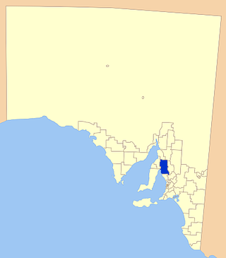
Wakefield Regional Council is a local government area in the Yorke and Mid North region of South Australia. The council seat is at Balaklava.

<span class="mw-page-title-main">Wallaroo, South Australia</span> Town in South Australia

Wallaroo is a port town on the western side of Yorke Peninsula in South Australia, 160 kilometres (100 mi) northwest of Adelaide. It is one of the three Copper Triangle towns famed for their historic shared copper mining industry, and known together as "Little Cornwall", the other two being Kadina, about 8 kilometres (5 mi) to the east, and Moonta, about 18 kilometres (11 mi) south. In 2016, Wallaroo had a population of 3,988 according to the census held.

<span class="mw-page-title-main">Rail transport in South Australia</span> Rail transport in South Australia

The first railway in colonial South Australia was a line from the port of Goolwa on the River Murray to an ocean harbour at Port Elliot, which first operated in December 1853, before its completion in May 1854.

<span class="mw-page-title-main">Hoyleton, South Australia</span> Town in South Australia

Hoyleton is a former railway town in South Australia, west of the Clare Valley, halfway between Leasingham and Halbury.

<span class="mw-page-title-main">Brinkworth, South Australia</span> Town in South Australia

Brinkworth is a town in the Mid North region of South Australia with a current population of 401. It is 31 km (19 mi) north west of the regional centre of Clare.

<span class="mw-page-title-main">Kadina, South Australia</span> Town in South Australia

Kadina is a town on the Yorke Peninsula of the Australian state of South Australia, approximately 144 kilometres north-northwest of the state capital of Adelaide. The largest town of the Peninsula, Kadina is one of the three Copper Triangle towns famous for their shared copper mining history. The three towns are known as "Little Cornwall" for the significant number of immigrants from Cornwall who worked at the mines in the late 19th century.

<span class="mw-page-title-main">Balaklava, South Australia</span> Town in South Australia

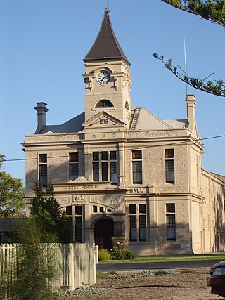
The town of Balaklava is located in South Australia, 92 kilometres north of Adelaide in the Mid North region. It is on the south bank of the Wakefield River, 25 kilometres east of Port Wakefield.

<span class="mw-page-title-main">Blyth, South Australia</span> Town in South Australia

Blyth is a small town in the Mid North of South Australia, located 13 kilometres (8.1 mi) west of the renowned Clare Valley. The town is located on the lands of the Kaurna people, the indigenous people who lived there before European settlement. It has a population of 306, the farming community spanning the plains between the Clare Hills and the Barunga/Hummocks ranges. Altitude is 189 metres (620 ft), and rainfall is approximately 400 millimetres (16 in) per annum.

<span class="mw-page-title-main">Halbury, South Australia</span> Town in South Australia

Halbury is a former railway town in South Australia, west of the Clare Valley, halfway between Balaklava and Auburn.

<span class="mw-page-title-main">Hamley Bridge, South Australia</span> Town in South Australia

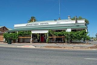
Hamley Bridge is a community in South Australia located at the junction of the Gilbert and Light rivers, as well as the site of a former railway junction.

<span class="mw-page-title-main">Gulnare, South Australia</span> Town in South Australia

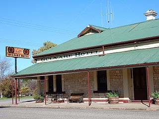
Gulnare is a settlement in South Australia. At the 2006 census, Gulnare had a population of 95. It is where the east–west Goyder Highway crosses the former Gladstone-Balaklava railway, and about a kilometre east of the south–north Horrocks Highway, 188 kilometres (117 mi) north of Adelaide. The railway was built as a narrow gauge in 1894 and converted to broad gauge in 1927. The railway had been closed by 1993.

<span class="mw-page-title-main">Gladstone railway station, South Australia</span> Railway station in South Australia

Gladstone railway station is located on the Crystal Brook-Broken Hill line in Gladstone, South Australia.

<span class="mw-page-title-main">Balaklava-Moonta railway line</span> Former railway line in South Australia

The Balaklava-Moonta railway line was a railway line on the South Australian Railways network. It ran across the top of the Yorke Peninsula.

The Kadina-Brinkworth railway line was a railway line on the South Australian Railways network.

The Plains Producer is a weekly newspaper published Wednesdays by Papers and Publications Pty. Ltd. in Balaklava, South Australia. It was founded in 1903 and was printed until 1941, when it was stopped by the second world war. The publication was revived in 1946 and it has been published continuously since then.

References

  1. South Australia. Chief Engineer for Railways; Vaughan, A. (Alfred); South Australia. Surveyor-General's Office (1910), Map shewing lines of railways in South Australia, Novr. 1910, Surveyor General's Office, retrieved 1 December 2015
  2. "Hamley Bridge and Balaklava Railway". South Australian Register . Adelaide, SA: National Library of Australia. 26 November 1879. p. 5. Retrieved 30 November 2015.
  3. 1 2 Quinlan, Howard; Newland, John (2000). Australian Railway Routes 1854 - 2000. Redfern: Australian Railway Historical Society. pp. 56, 58. ISBN   0 909650 49 7.
  4. Steve Hudson (13 October 2017). "Shamus Liptrot Trail". Weekend Notes. Retrieved 15 November 2018.
  5. "Railway Carriage Derailed". South Australian Register . Adelaide, SA: National Library of Australia. 20 May 1914. p. 9. Retrieved 1 December 2015.
  6. "Braodening Narrow Gauge Railways". The Advertiser . Adelaide, SA: National Library of Australia. 16 October 1923. p. 8. Retrieved 2 December 2015.
  7. "Kadina & Wallaroo Times". The Kadina and Wallaroo Times . SA: National Library of Australia. 30 July 1927. p. 2. Retrieved 2 December 2015.