
Sidi Bel Abbès (Arabic: ولاية سيدي بلعباس is one of the provinces of Algeria. Its name is derived from the name of its capital, the city of Sidi Bel Abbès. It is situated in the northwestern part of the country.

Sétif Province is a province (wilaya) in north-eastern Algeria. Its capital and largest city is Sétif; the next largest city is El Eulma. There is also the World Heritage Site of Djémila there.

Aïn Defla is a wilaya (province) in northern Algeria. It is located to the southwest of Algiers, the capital. Localities in Ain Delfa include Khemis Miliana, Miliana, Hammam Righa, Oued Zebboudj and Aïn Torki.
Tizi Ouzou is a province (wilayah) of Algeria in the Kabylie region. Its capital is Tizi Ouzou.

The Sétif and Guelma massacre was a series of terrorist attacks by French colonial authorities and Pied-noir settler terrorist militias on Algerian civilians in 1945 around the French Algerian market town of Sétif, west of Constantine, Algeria. French police fired on demonstrators at a protest on 8 May 1945. Riots in the town were followed by attacks on French colons (colonizers) in the surrounding countryside, resulting in 102 deaths. Subsequent attacks by the French Colonial authorities and European settler terrorists caused deaths among the Muslim population of the region; estimates ranged between 1,020 and 45,000 people killed. Both the outbreak and the indiscriminate nature of its repression are thought to have marked a turning point in Franco-Algerian relations, leading to the Algerian War of 1954–1962.

Tlemcen is a province (wilaya) in northwestern Algeria. The Tlemcen National Park is located there.

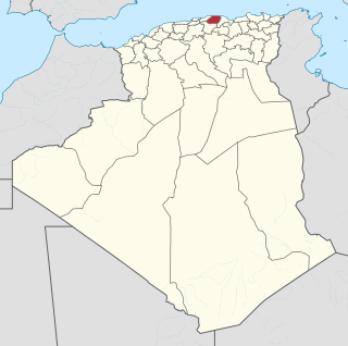
M'Sila is a province (wilaya) of northern Algeria. It has a population of 1 million people and an area of 18,718 km², while its capital, also called M'sila, home to M'Sila University, has a population of about 100,000. Some localities in this wilaya are Bou Saada and Maadid. Chott El Hodna, a salt lake, crosses into M'Sila. However, most of the region is semi-arid and undeveloped.

Hammam Debagh is a district in Guelma Province, Algeria. It was named after its capital, the spa of Hammam Debagh.
Bouchegouf is a district in Guelma Province, Algeria. It was named after its capital, the spa of Hammam N'Bails.

Hammam Righa is a town in northern Algeria. During the period of Roman occupation, Hammam Righa was a Roman colony called Aquae Calidae. It is located at 36.379474n, 2.395618e near the railway town of Boumedfaa, and is on the Oued Djer River. The population in 2008 was 8488. and the population dencity is 369 persons/km².
Hammam Ghezèze is a town and commune in the Nabeul Governorate, Tunisia. As of 2004 it had a population of 7,806.

Aïn Makhlouf is a town and commune in Guelma Province, Algeria. According to the 1998 census it has a population of 11,018.

Hammam Maskhoutine (Arabic: حمام المسطوطين, English: "bath of the damned") is a thermal complex and commune located in Hammam Debagh, of Guelma Province, Algeria. The dramatic, multicolored travertine walls of the spring have attracted attention from locals and tourists alike since the era of the Roman Empire.
Hammam Nbail is a town and commune in Guelma Province, Algeria. According to the 1998 census it has a population of 15,854.
El Hammam is a commune in Khénifra Province, Béni Mellal-Khénifra, Morocco. At the time of the 2004 census, the commune had a total population of 15,438 people living in 2887 households.
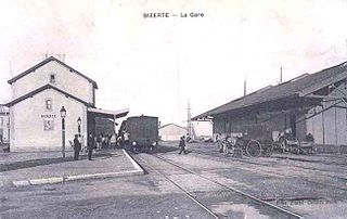
The Compagnie des chemins de fer Bône-Guelma built and operated railway lines in Algeria and Tunisia between 1875 and 1923 during the French colonial period. In 1923 it became the Compagnie fermière des chemins de fer tunisiens.

The Larbaâ Nath Irathen district is an Algerian administrative district in the Tizi-Ouzou province and the region of Kabylie. Its chief town is located on the common namesake of Larbaâ Nath Irathen.


