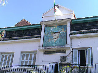
Larbaâ Nath Irathen is a town in Tizi Ouzou Province, in the central part of northern Algeria. It was formerly known as Fort National. The population in 2001 was 28,000. The area is renowned for its majestic scenery.
Grarem is a municipality in Mila Province, Algeria. Grarem Gouga is the administrative center. At the 2008 census it had a population of 28,552.

Hoceinia is a town in northern Algeria. It is situated near the National Road N 14. Also, it is bordered by the municipality of Boumedfaa, Djendel, Ain-Torki, and Ain Al-Banyan.
Sued Chorfa is a coastal town in northern Algeria.

At Mlikec is a town and commune in northern Algeria.

Ighram is a town and commune of Kabylie in northern Algeria. The town is located on the Soummam, on its left bank. It is located south-west of the wilaya of Bejaia, a distance of more than 70 km from the provincial capital and less than 5 km from Akbou. It covers an area of 50.11 square kilometers and the population of the town of Ighram is estimated at 16 878 inhabitants, 8 472 men and 8 406 women with a density of 332 inhabitants / km ².

Tamokra is a small town in the Kabylie region in northern Algeria, it is a part of the province of Béjaïa.
Guerrouaou is a town and commune in Blida Province, Algeria.

Labiod Medjadja is a town and commune in Chlef Province, Algeria. According to the 1998 census it has a population of 13,920.

Sendjas is a town and commune in Chlef Province, Algeria. According to the 1998 census it has a population of 26,228.
Boumahra Ahmed is a town and commune in Guelma Province, Algeria. According to the 1998 census it has a population of 15,273.

Baghai is a town and commune in Khenchela Province, Algeria. It is located at 35°30'59.99"N 7°06'60.00" E. According to the 1998 census it has a population of 6,414.
Chellal is a town and commune in M'Sila Province, Algeria. According to the 1998 census it has a population of 4,268.
Zerouala is a town and commune in Sidi Bel Abbès Province in north-western Algeria.

El Ouricia is a town and commune in Sétif Province in north-eastern Algeria.
Sidi Hosni is a town and commune in Tiaret Province in north-western Algeria.
Beni Bahdel is a town and commune in Tlemcen Province in northwestern Algeria.

Hadjout formerly Marengo during French colonization is a town and commune in Tipaza Province in northern Algeria, approximately 78km to the west of the capital Algiers..

Babadıl Islands are two small Mediterranean islands in Turkey. They are named after the former name of the village Sipahili in the mainland facing the islands. According to the British captain Francis Beaufort who was tasked to map the Mediterranean coasts of Turkey in 1811–12, the names of the islands were Papadoulae, in the antiquity. Modern scholarship identifies the island group with Akonesiai, and the northern island with ancient Crambusa or Krambousa (Κράμβουσα).