
Ethelbert is an unincorporated urban community in the Municipality of Ethelbert within the Canadian province of Manitoba that held village status prior to January 1, 2015. It is 370 kilometres northwest of Winnipeg and 60 kilometres north of Dauphin, Manitoba. The community is located near Duck Mountain Provincial Park on PTH 10. It was originally incorporated as a village in 1950.
Dakhiliyah is a town located in Al-Hasakah Governorate, Syria.
Zir Ab is a village in the Razavi Khorasan Province in the north-east of Iran. The next larger city is Sabzevar.
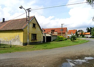
Čakovičky is a village in the Mělník District, Central Bohemian Region of the Czech Republic. On the date July 3, 2006 it has 393 inhabitants. First written notice about village is from year 1266. It is a member of Mikroregion Povodí Mratínského potoka.
Bouïnian is a district in Blida Province, Algeria. It was named after its capital, Bouïnian.

Kaługa is a village in the administrative district of Gmina Zbiczno, within Brodnica County, Kuyavian-Pomeranian Voivodeship, in north-central Poland. It lies 11 kilometres (7 mi) east of Zbiczno, 16 km (10 mi) north-east of Brodnica, and 71 km (44 mi) north-east of Toruń.
Teolog is a village in the administrative district of Gmina Lubiewo, within Tuchola County, Kuyavian-Pomeranian Voivodeship, in north-central Poland. It lies approximately 8 kilometres (5 mi) north of Lubiewo, 12 km (7 mi) south-east of Tuchola, and 46 km (29 mi) north of Bydgoszcz.

Mahmudlu is a village in the Qubadli Rayon of Azerbaijan.
Qımır is a village in the Zaqatala Rayon of Azerbaijan. The village forms part of the municipality of Çobankol.
Nowiny is a village in the administrative district of Gmina Leoncin, within Nowy Dwór Mazowiecki County, Masovian Voivodeship, in east-central Poland.
Bolęcin is a village in the administrative district of Gmina Sochocin, within Płońsk County, Masovian Voivodeship, in east-central Poland.
Rudy is a village in the administrative district of Gmina Strzałkowo, within Słupca County, Greater Poland Voivodeship, in west-central Poland. It lies approximately 7 kilometres (4 mi) north of Strzałkowo, 9 km (6 mi) north-west of Słupca, and 61 km (38 mi) east of the regional capital Poznań.
Rypławki is a settlement in the administrative district of Gmina Srokowo, within Kętrzyn County, Warmian-Masurian Voivodeship, in northern Poland, close to the border with the Kaliningrad Oblast of Russia. It lies approximately 8 kilometres (5 mi) south of Srokowo, 12 km (7 mi) north-east of Kętrzyn, and 79 km (49 mi) north-east of the regional capital Olsztyn.
Đồng Cốc is a commune (xã) and village in Lục Ngạn District, Bắc Giang Province, in northeastern Vietnam.
Hvožďany is a village and municipality in Příbram District in the Central Bohemian Region of the Czech Republic.
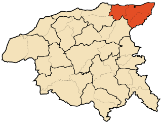
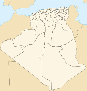
Béni Haoua District is a district of Chlef Province, Algeria.
Bougous is a town and commune in El Taref Province, Algeria. According to the 1998 census it has a population of 10,576.
Kuke is a village in Saaremaa Parish, Saare County in western Estonia.
Virita is a village in Saaremaa Parish, Saare County in western Estonia.
Chal Anjir is a village in Sepidar Rural District, in the Central District of Boyer-Ahmad County, Kohgiluyeh and Boyer-Ahmad Province, Iran. At the 2006 census, its existence was noted, but its population was not reported.


