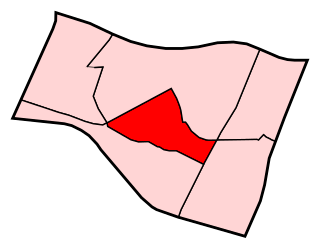
Blue Diamond is a census-designated place (CDP) in Clark County, Nevada, United States. The population was 290 at the 2010 census.

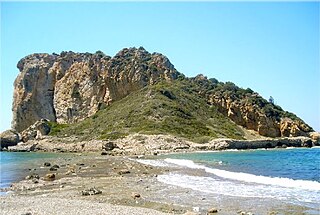
Cape Gelidonya, formerly Kilidonia or Killidonia is a cape or headland on the Teke Peninsula in the chain of Taurus Mountains, located on the southern coast of Anatolia between the Gulf of Antalya and the Bay of Finike.
Sing Buri is a town in Thailand, capital of the Sing Buri Province. It lies 141 km north of Bangkok. The town covers the whole tambon Bang Phutsa and parts of Bang Man, Muang Mu, Ton Pho, and Bang Krabue, all within Mueang Sing Buri District. As of 2006, it had a population of 19,470.

Janfida, is a village in the Armavir Province of Armenia.

Khachpar is a town in the Ararat Province of Armenia.

Jałowy Róg is a settlement in the administrative district of Gmina Płaska, within Augustów County, Podlaskie Voivodeship, in north-eastern Poland, close to the border with Belarus. It lies approximately 11 kilometres (7 mi) east of Płaska, 30 km (19 mi) east of Augustów, and 89 km (55 mi) north of the regional capital Białystok.

The Fiat Mephistopheles is a one-off racing car created by Ernest A.D. Eldridge in 1923 by combining a Fiat racing car chassis and Fiat aeroplane engine. The name is from the demon of the same name. The name alluded to the infernal noise emitted from the unmuffled engine, and it was "baptised" by the Frenchmen.

Oleszno is a village in the administrative district of Gmina Krasocin, within Włoszczowa County, Świętokrzyskie Voivodeship, in south-central Poland. It lies approximately 8 kilometres (5 mi) north-west of Krasocin, 12 km (7 mi) north-east of Włoszczowa, and 41 km (25 mi) west of the regional capital Kielce.

Długie is a village in the administrative district of Gmina Zarszyn, within Sanok County, Subcarpathian Voivodeship, in south-eastern Poland. It lies approximately 3 kilometres (2 mi) east of Zarszyn, 13 km (8 mi) west of Sanok, and 51 km (32 mi) south of the regional capital Rzeszów.

Gałki is a village in the administrative district of Gmina Repki, within Sokołów County, Masovian Voivodeship, in east-central Poland. It lies approximately 5 kilometres (3 mi) north-east of Repki, 14 km (9 mi) east of Sokołów Podlaski, and 101 km (63 mi) east of Warsaw.

Morzyczyn is a village in the administrative district of Gmina Wierzbinek, within Konin County, Greater Poland Voivodeship, in west-central Poland. It lies approximately 8 kilometres (5 mi) west of Wierzbinek, 26 km (16 mi) north of Konin, and 101 km (63 mi) east of the regional capital Poznań.

Stara Różanka is a village in the administrative district of Gmina Kętrzyn, within Kętrzyn County, Warmian-Masurian Voivodeship, in northern Poland. It lies approximately 4 kilometres (2 mi) north-east of Kętrzyn and 70 km (43 mi) north-east of the regional capital Olsztyn.
Nowe Grodziczno is a village in the administrative district of Gmina Grodziczno, within Nowe Miasto County, Warmian-Masurian Voivodeship, in northern Poland.

San Clemente State Beach is a beach located in the south end of the city of San Clemente, California. Located halfway between Los Angeles and San Diego, it has been the most popular beach in the state of California since 1937.

Southwood is an unincorporated community in Honey Creek Township, Vigo County, in the U.S. state of Indiana.
Mäeküla, Pärnu County is a village in Põhja-Pärnumaa Parish, Pärnu County in southwestern Estonia.
Kaarma-Kungla is a village in Saaremaa Parish, Saare County in western Estonia.
Shenyang South railway station is a railway station on the Harbin–Dalian high-speed railway and Shenyang–Dandong intercity railway scheduled to open in 2015. The station is located in the Hunnan New Area district in the town of Shenyang, Liaoning, China.

Vinateros is a ward (barrio) of Madrid belonging to the district of Moratalaz.

Çıfıtkalesi Islet is an uninhabited Aegean islet in Turkey.


