Harich | |
|---|---|
Village | |
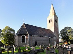 Harich church | |
 Location in the former Gaasterlân Sleat municipality | |
 Harich Location in the Netherlands  Harich Harich (Netherlands) | |
| Coordinates: 52°54′10″N5°33′58″E / 52.90278°N 5.56611°E | |
| Country | |
| Province | |
| Municipality | |
| Area | |
• Total | 17.23 km2 (6.65 sq mi) |
| Elevation | 2 m (7 ft) |
| Population (2021) [1] | |
• Total | 485 |
| • Density | 28/km2 (73/sq mi) |
| Postal code | 8571 [1] |
| Dialing code | 0514 |
Harich is a village in De Fryske Marren municipality in the province of Friesland, the Netherlands. It had a population of around 470 in 2017. [3]


