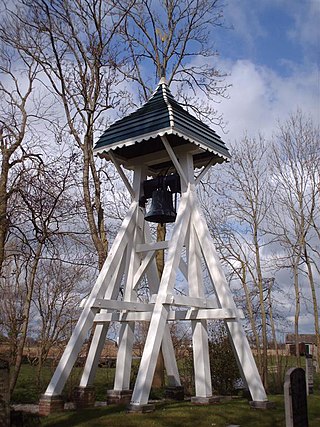
Oldeouwer

Last updated
Oldeouwer
Alde Ouwer
Village
Klokkenstoel Oldeouwer 04w.JPG
Oldeouwer bell tower
Map NL Skarsterlan Alde Ouwer.png
Location in the former Skarsterlân municipality
2010-NL-P02-Fryslan-positiekaart-gemnamen.jpg
Red pog.svg
Oldeouwer
Location in the Netherlands
Netherlands location map.svg
Red pog.svg
Oldeouwer
Oldeouwer (Netherlands)
Coordinates: 52°55′14″N5°47′57″E / 52.92056°N 5.79917°E / 52.92056; 5.79917
Country Flag of the Netherlands.svg Netherlands
Province Frisian flag.svg Friesland
Municipality De Friese Meren vlag.svg De Fryske Marren
Area
[1]
  Total
8.76 km2 (3.38 sq mi)
Elevation
[2]
−1.3 m (−4.3 ft)
Population
 (2021) [1]
  Total
80
  Density9.1/km2 (24/sq mi)
Postal code
8515 [1]
Dialing code 0513

Oldeouwer (West Frisian : Alde Ouwer) is a village in De Fryske Marren municipality in the province of Friesland, the Netherlands. It had a population of around 85 in 2017. [3]

Contents

History

It was first mentioned in the 13th century as Antiqua huer, and means "old bank". [4] In 1840, it was home to 46 people. [5]

Before 2014, Oldeouwer was part of the Skarsterlân municipality and before 1984 it was part of Doniawerstal. [5]

Related Research Articles

<span class="mw-page-title-main">Akmarijp</span> Village in Friesland, Netherlands

Akmarijp is a village in the Dutch province of Friesland. It is in the municipality De Fryske Marren, about 5 km north of the town of Joure.

<span class="mw-page-title-main">Eesterga</span> Village in Friesland, Netherlands

Eesterga is a small village in De Fryske Marren in the province of Friesland, the Netherlands. It had a population of around 45 in 2017.

<span class="mw-page-title-main">Terherne</span> Village in Friesland, Netherlands

Terherne is a village in De Fryske Marren in the province of Friesland, the Netherlands. It had a population of around 780 in 2017.

<span class="mw-page-title-main">Kolderwolde</span> Village in Friesland, Netherlands

Kolderwolde is a village in De Fryske Marren municipality in the province of Friesland, the Netherlands. It had a population of around 55 in (2017).

<span class="mw-page-title-main">Oudega, De Fryske Marren</span> Village in Friesland, Netherlands

Oudega is a small village in De Fryske Marren municipality in the province of Friesland, the Netherlands. It had a population of around 265 in 2017.

<span class="mw-page-title-main">Nijemirdum</span> Village in Friesland, Netherlands

Nijemirdum is a village in De Fryske Marren municipality in the province of Friesland, the Netherlands, with a population of around 555 as of 2004.

<span class="mw-page-title-main">Dijken</span> Village in Friesland, Netherlands

Dijken is a small village in De Fryske Marren in the province of Friesland, the Netherlands. It had a population of around 65 in 2017.

<span class="mw-page-title-main">Legemeer</span> Village in Friesland, Netherlands

Legemeer is a village in De Fryske Marren in the province of Friesland, the Netherlands. It had a population of around 40 in 2017.

<span class="mw-page-title-main">Idskenhuizen</span> Village in Friesland, Netherlands

Idskenhuizen is a village in De Fryske Marren municipality in the province of Friesland, the Netherlands. It had a population of around 480 in 2017.
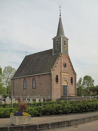
<span class="mw-page-title-main">Haskerhorne</span> Village in Friesland, Netherlands

Haskerhorne is a village in De Fryske Marren municipality in the province of Friesland, the Netherlands. It had a population of around 565 in 2017.
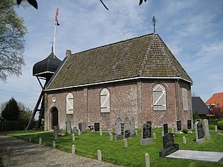
<span class="mw-page-title-main">Goingarijp</span> Village in Friesland, Netherlands

Goingarijp is a small village in De Fryske Marren municipality in the province of Friesland, the Netherlands. It had a population of around 250 in 2017.

<span class="mw-page-title-main">Doniaga</span> Village in Friesland, Netherlands

Doniaga is a small village in De Fryske Marren municipality in the province Friesland of the Netherlands and has around 100 citizens (2017).

<span class="mw-page-title-main">Nijehaske</span> Neighbourhood and village in Friesland, Netherlands

Nijehaske is a village in De Fryske Marren municipality, west of Heerenveen in the province of Friesland, the Netherlands. It had a population of around 55 in 2017. In 1934, most of Nijehaske was transferred to Heerenveen and has become a neighbourhood.

<span class="mw-page-title-main">Ouwster-Nijega</span> Village in Friesland, Netherlands

Ouwster-Nijega is a village in De Fryske Marren in the province of Friesland, the Netherlands. It had a population of around 85 in 2017.

<span class="mw-page-title-main">Rotsterhaule</span> Village in Friesland, Netherlands

Rotsterhaule is a village in De Fryske Marren municipality in the province of Friesland, the Netherlands. It had a population of around 565 in 2017.

<span class="mw-page-title-main">Rotstergaast</span> Village in Friesland, Netherlands

Rotstergaast is a village in Skarsterlân in De Fryske Marren municipality in the province of Friesland, the Netherlands. It had a population of around 185 in 2017.

<span class="mw-page-title-main">Rohel</span> Village in Friesland, Netherlands

Rohel is a village in De Fryske Marren municipality in the province of Friesland, the Netherlands. It had a population of around 270 in 2017.

<span class="mw-page-title-main">Snikzwaag</span> Village in Friesland, Netherlands

Snikzwaag is a village in De Fryske Marren in the province of Friesland, the Netherlands. It had a population of around 65 in 2017.

<span class="mw-page-title-main">Terkaple</span> Village in Friesland, Netherlands

Terkaple is a village in De Fryske Marren municipality in the province of Friesland, the Netherlands. It had a population of around 220 in 2017.

<span class="mw-page-title-main">Teroele</span> Village in Friesland, Netherlands

Teroele is a village in De Fryske Marren in the province of Friesland, the Netherlands. It had a population of around 20 in 2017.

References

  1. 1 2 3 "Kerncijfers wijken en buurten 2021". Central Bureau of Statistics. Retrieved 29 March 2022.
  2. "Postcodetool for 8515CB". Actueel Hoogtebestand Nederland (in Dutch). Het Waterschapshuis. Retrieved 29 March 2022.
  3. Kerncijfers wijken en buurten 2017 - CBS
  4. "Oldeouwer - (geografische naam)". Etymologiebank (in Dutch). Retrieved 29 March 2022.
  5. 1 2 "Oldeouwer". Plaatsengids (in Dutch). Retrieved 29 March 2022.

Commons-logo.svg Media related to Oldeouwer at Wikimedia Commons