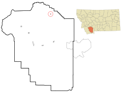
Harrison, Montana

Last updated
Harrison, Montana
Madison County Montana Incorporated and Unincorporated areas Harrison Highlighted.svg
Location of Harrison, Montana
Coordinates: 45°42′9″N111°47′7″W / 45.70250°N 111.78528°W / 45.70250; -111.78528 Coordinates: 45°42′9″N111°47′7″W / 45.70250°N 111.78528°W / 45.70250; -111.78528
Country United States
State Montana
County Madison
Area
[1]
  Total0.17 sq mi (0.45 km2)
  Land0.17 sq mi (0.45 km2)
  Water0.00 sq mi (0.00 km2)
Elevation
4,918 ft (1,499 m)
Population
 (2020)
  Total105
  Density600.00/sq mi (232.28/km2)
Time zone UTC-7 (Mountain (MST))
  Summer (DST) UTC-6 (MDT)
ZIP code
59735
Area code 406
FIPS code 30-34525
GNIS feature ID0784573

Harrison is a census-designated place (CDP) in Madison County, Montana, United States. The population was 137 at the 2010 census, [2] down from 162 in 2000.

Contents

The town began as Ferguson, a stage stop on the road to Virginia City. The Northern Pacific Railroad constructed a branch line in 1889. Eventually the town was called Harrison after an early settler, Henry C. Harrison. [3]

Geography

Harrison is located at 45°42′9″N111°47′7″W / 45.70250°N 111.78528°W / 45.70250; -111.78528 (45.702507, -111.785376). [4] U.S. Route 287 passes through town. Willow Creek Reservoir is to the east.

According to the United States Census Bureau, the CDP has a total area of 0.2 square miles (0.52 km2), all land.

Demographics

Historical population
CensusPop.Note
2020 105
U.S. Decennial Census [5]

As of the census of 2000, there were 162 people, 64 households, and 44 families residing in the CDP. The population density was 704.9 inhabitants per square mile (272.2/km2). There were 75 housing units at an average density of 326.3 per square mile (126.0/km2). The racial makeup of the CDP was 96.91% White, 1.85% Native American, 0.62% Asian, and 0.62% from two or more races. Hispanic or Latino of any race were 1.23% of the population. [6]

There were 64 households, out of which 39.1% had children under the age of 18 living with them, 56.3% were married couples living together, 9.4% had a female householder with no husband present, and 29.7% were non-families. 25.0% of all households were made up of individuals, and 17.2% had someone living alone who was 65 years of age or older. The average household size was 2.53 and the average family size was 3.07.

In the CDP, the population was spread out, with 32.7% under the age of 18, 3.7% from 18 to 24, 24.7% from 25 to 44, 21.0% from 45 to 64, and 17.9% who were 65 years of age or older. The median age was 38 years. For every 100 females, there were 107.7 males. For every 100 females age 18 and over, there were 87.9 males.

The median income for a household in the CDP was $36,875, and the median income for a family was $39,167. Males had a median income of $28,750 versus $16,250 for females. The per capita income for the CDP was $13,287. About 5.3% of families and 13.8% of the population were below the poverty line, including 22.7% of those under the age of eighteen and 14.8% of those 65 or over.

The median age for residents in Harrison is 44.7

18.1% of Harrison's residents live in poverty.

Education

Harrison Public School educates students from kindergarten through 12th grade. [7] Harrison High School's team name is the Wildcats. [8]

See also

Related Research Articles

<span class="mw-page-title-main">Fort Smith, Montana</span> Census-designated place in Montana, United States

Fort Smith is a census-designated place (CDP) in Big Horn County, Montana, United States. The population was 161 at the 2010 census. The town is named for the former Fort C.F. Smith. The North District of Bighorn Canyon National Recreation Area is accessed at Fort Smith.

<span class="mw-page-title-main">Muddy, Montana</span> Census-designated place in Montana, United States

Muddy or Heóvonėheo'hé'e is a census-designated place (CDP) in Big Horn County, Montana, United States and home to the Heóvonėheo'hé'etaneo'o or Heóvonêheo'he'é-taneno Cheyenne people. The population was 617 at the 2010 census.

<span class="mw-page-title-main">Fort Belknap Agency, Montana</span> Census-designated place in Montana, United States

Fort Belknap Agency is a census-designated place (CDP) in Blaine County, Montana, United States. As of the 2010 census, its population was 1,293.

<span class="mw-page-title-main">Radersburg, Montana</span> Census-designated place in Montana, United States

Radersburg is a census-designated place (CDP) in Broadwater County, Montana, United States. The population was 66 at the 2010 census.

<span class="mw-page-title-main">Toston, Montana</span> Census-designated place in Montana, United States

Toston is a census-designated place (CDP) in Broadwater County, Montana, United States. The population was 108 at the 2010 census.

<span class="mw-page-title-main">Winston, Montana</span> Census-designated place in Montana, United States

Winston is a census-designated place (CDP) in Broadwater County, Montana, United States. The population was 147 at the 2010 census.

<span class="mw-page-title-main">Fort Shaw, Montana</span> CDP in Montana, United States

Fort Shaw is a census-designated place (CDP) in Cascade County, Montana, United States. The population was 280 at the 2010 census. Named for a former United States military outpost, it is part of the Great Falls, Montana Metropolitan Statistical Area.

<span class="mw-page-title-main">Simms, Montana</span> CDP in Montana, United States

Simms is a census-designated place (CDP) in Cascade County, Montana, United States. The population was 354 at the 2010 census. It is part of the Great Falls, Montana Metropolitan Statistical Area.

<span class="mw-page-title-main">Sun Prairie, Montana</span> CDP in Montana, United States

Sun Prairie is a census-designated place (CDP) in Cascade County, Montana, United States. The population was 1,630 at the 2010 census. It is part of the Great Falls Metropolitan Statistical Area and may have evolved as a remote suburb of Great Falls.

<span class="mw-page-title-main">Ulm, Montana</span> CDP in Montana, United States

Ulm is a census-designated place (CDP) in Cascade County, Montana, United States. It was originally a large ranch owned by Indiana-born cattleman William Ulm. The population was 738 at the 2010 census. It is part of the Great Falls, Montana Metropolitan Statistical Area.

<span class="mw-page-title-main">Four Corners, Montana</span> Census-designated place in Montana, United States

Four Corners is a census-designated place (CDP) in Gallatin County, Montana, United States. The population was 5,901 at the 2020 census, up from 3,146 in 2010. It is part of the Bozeman, MT Micropolitan Statistical Area.

<span class="mw-page-title-main">Willow Creek, Montana</span> Census-designated place in Gallatin County, Montana, United States.

Willow Creek is a census-designated place (CDP) in Gallatin County, Montana, United States. The population was 210 at the 2010 census. It is part of the Bozeman, MT Micropolitan Statistical Area.

<span class="mw-page-title-main">Starr School, Montana</span> Census-designated place in Montana, United States

Starr School is a census-designated place (CDP) in Glacier County, Montana, United States. The population was 252 at the 2010 census.

<span class="mw-page-title-main">Gildford, Montana</span> Census-designated place in Montana, United States

Gildford is an unincorporated community and census-designated place (CDP) in Hill County, Montana, United States. The population was 179 at the 2010 census.

<span class="mw-page-title-main">Montana City, Montana</span> Census-designated place in Montana, United States

Montana City is an unincorporated community and census-designated place (CDP) in Jefferson County, Montana, United States. The population was 2,715 at the 2010 census, up from 2,094 in 2000. It is part of the Helena Micropolitan Statistical Area.

<span class="mw-page-title-main">Victor, Montana</span> Census-designated place in Montana, United States

Victor is a census-designated place (CDP) in Ravalli County, Montana, United States. The population was 745 at the 2010 census.

<span class="mw-page-title-main">Cardwell, Montana</span> Census-designated place in Montana, United States

Cardwell is a census-designated place (CDP) in Jefferson County, Montana, United States. The population was 50 at the 2010 census. It is part of the Helena Micropolitan Statistical Area.

<span class="mw-page-title-main">Clancy, Montana</span> Census-designated place in Montana, United States

Clancy is an unincorporated community and census-designated place (CDP) in Jefferson County, Montana, United States. The population was 1,661 at the 2010 census, up from 1,406 in 2000. It is part of the Helena Micropolitan Statistical Area.

<span class="mw-page-title-main">Parker School, Montana</span> Census-designated place in Montana, United States

Parker School is a census-designated place (CDP) in Hill and Chouteau counties in the U.S. state of Montana. The population was 340 at the 2010 census.

<span class="mw-page-title-main">Power, Montana</span> CDP in Montana, United States

Power is a census-designated place (CDP) in Teton County, Montana, United States. The population was 171 at the 2000 census. The town is named after Montana pioneer, Thomas Charles Power, who platted the townsite in 1910.

References

  1. "ArcGIS REST Services Directory". United States Census Bureau. Retrieved September 5, 2022.
  2. "Geographic Identifiers: 2010 Census Summary File 1 (G001): Harrison CDP, Montana". American Factfinder. U.S. Census Bureau. Archived from the original on February 13, 2020. Retrieved March 14, 2018.
  3. "Harrison". Montana Place Names Companion. Montana Historical Society. Retrieved 5 April 2021.
  4. "US Gazetteer files: 2010, 2000, and 1990". United States Census Bureau. 2011-02-12. Retrieved 2011-04-23.
  5. "Census of Population and Housing". Census.gov. Retrieved June 4, 2016.
  6. "Profile of General Population and Housing Characteristics: 2010 Census Summary File 1 (G001): Harrison CDP, Montana". American Factfinder. U.S. Census Bureau. Archived from the original on February 13, 2020. Retrieved March 14, 2018.
  7. "Harrison Public School". Harrison Public School. Retrieved 20 April 2021.
  8. "Member Schools". Montana High School Association. Retrieved 19 April 2021.

Commons-logo.svg Media related to Harrison, Montana at Wikimedia Commons