Hatibandha Upazila

Last updated • 1 min readFrom Wikipedia, The Free Encyclopedia
Hatibandha
হাতিবান্ধা
tistaa byaarej, haatiibaandhaa, laalmnirhaatt /  Teesta Barrage,Hatibandha, Lalmonirhat.jpg
Teesta Bararge, Hatibandha
Hatibandha in Rangpur division (Bangladesh).svg
Coordinates: 26°6.8′N89°8′E / 26.1133°N 89.133°E / 26.1133; 89.133
Bangladesh Flag of Bangladesh.svg  Bangladesh
Division Rangpur
District Lalmonirhat
Area
  Total288.42 km2 (111.36 sq mi)
Population
 (2022) [1]
  Total264,107
Time zone UTC+6 (BST)
Postal code
5530 [2]
Website Official Map of Hatibandha

Hatibandha (Bengali : হাতিবান্ধা) is an upazila of Lalmonirhat District [3] in Rangpur Division, Bangladesh.

Contents

Geography

Hatibandha is located at 26°06′45″N89°08′00″E / 26.1125°N 89.1333°E / 26.1125; 89.1333 . It has 53,122 households and total area 288.42 km2.

Demographics

Religions in Hatibandha Upazila (2022) [4]
ReligionPercent
Islam
88.31%
Hinduism
11.69%
Other or not stated
0.00%

According to the 2011 Census of Bangladesh, Hatibandha Upazila had 53,122 households and a population of 233,927. 59,558 (25.46%) were under 10 years of age. Hatibandha had a literacy rate (age 7 and over) of 45.30%, compared to the national average of 51.8%, and a sex ratio of 1002 females per 1000 males. 9,476 (4.05%) lived in urban areas. [5] [6]

As of the 1991 Bangladesh census, Hatibandha has a population of 172,417. Males constitute 51.39% of the population, and females 48.61%. This upazila's eighteen up population is 85,064. Hatibandha has an average literacy rate of 21.4% (7+ years), and the national average of 32.4% literate. [7]

Administration

Hatibandha Upazila is divided into 12 union parishads: Barokhata, Dawabari, Fakirpara, Goddimari, Gotamari, Nowdabas, Paticapara, Shaniajan, Sindurna, Singimari, Tongvhanga, and Vhelaguri. The union parishads are subdivided into 63 mauzas and 65 villages. [5]

See also

Related Research Articles

<span class="mw-page-title-main">Chandpur Sadar Upazila</span> Upazila in Chattogram Division, Bangladesh

Chandpur Sadar is an upazila of the Chandpur District in Chattogram Division, Bangladesh.

<span class="mw-page-title-main">Kotalipara Upazila</span> Upazila in Dhaka, Bangladesh

Kotalipara is an upazila of Gopalganj District in the Division of Dhaka, Bangladesh..It was a Hindu majority thana of Bangladesh.

<span class="mw-page-title-main">Sarishabari Upazila</span> Upazila in Mymensingh Division, Bangladesh

Sarishabari is an upazila of Jamalpur District in the Division of Mymensingh, Bangladesh.

<span class="mw-page-title-main">Sakhipur Upazila</span> Upazila in Dhaka, Bangladesh

Sakhipur is an upazila of Tangail District in the division of Dhaka, Bangladesh.

<span class="mw-page-title-main">Sarankhola Upazila</span> Upazila in Khulna, Bangladesh

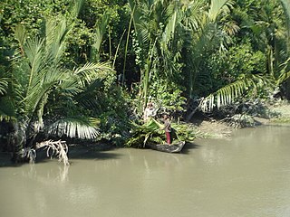
Sarankhola is an upazila of Bagerhat District in the Division of Khulna, Bangladesh. Sarankhola was formed as a Thana in 1907. A major part of the upazila belongs to the Sundarbans.

<span class="mw-page-title-main">Terokhada Upazila</span> Upazila in Khulna, Bangladesh

Terokhada is an upazila in Khulna District, Khulna, Bangladesh.

<span class="mw-page-title-main">Tala Upazila</span> Upazila in Khulna, Bangladesh

Tala is an upazila of the Satkhira District in the Khulna Division of Bangladesh.

<span class="mw-page-title-main">Phulchhari Upazila</span> Upazila in Rangpur, Bangladesh

Phulchhari or Fulchhari is an upazila of Gaibandha District in the Division of Rangpur, Bangladesh.

<span class="mw-page-title-main">Phulbari Upazila, Kurigram</span> Upazila in Rangpur, Bangladesh

Phulbari is an upazila of Kurigram District in the Division of Rangpur, Bangladesh.

<span class="mw-page-title-main">Rajarhat Upazila</span> Upazila in Rangpur, Bangladesh

Rajarhat is an upazila of Kurigram District in the Division of Rangpur, Bangladesh. Since 1981 it has been a Thana and later on September 14, 1983, it was turned into an upazila by the government.

<span class="mw-page-title-main">Aditmari Upazila</span> Upazila in Rangpur, Bangladesh

Aditmari is the smallest upazila (sub-district) of Lalmonirhat District in Rangpur Division, Bangladesh.

<span class="mw-page-title-main">Kaliganj Upazila, Lalmonirhat</span> Upazila in Rangpur, Bangladesh

Kaliganj is an upazila of the Lalmonirhat District in Rangpur Division, Bangladesh.

<span class="mw-page-title-main">Lalmonirhat Sadar Upazila</span> Upazila in Rangpur, Bangladesh

Lalmonirhat Sadar is an upazila of Lalmonirhat District in the Division of Rangpur, Bangladesh. Its headquarters are in Lalmonirhat.

<span class="mw-page-title-main">Patgram Upazila</span> Upazila in Rangpur, Bangladesh

Patgram is an upazila of Lalmonirhat District in Rangpur Division, Bangladesh. It had 27 enclaves, most notably Dahagram–Angarpota which is connected to the Bangladeshi mainland through the Tin Bigha Corridor.

<span class="mw-page-title-main">Gurudaspur Upazila</span> Upazila in Rajshahi, Bangladesh

Gurudaspur is an upazila of Natore District in the Division of Rajshahi, Bangladesh.

<span class="mw-page-title-main">Dimla Upazila</span> Upazila in Rangpur, Bangladesh

Dimla is an upazila of Nilphamari District in the Rangpur Division, Bangladesh. It is the oldest thana of Nilphamari region.

<span class="mw-page-title-main">Jaldhaka Upazila</span> Upazila in Rangpur, Bangladesh

Jaldhaka is an upazila of Nilphamari District in the Division of Rangpur, Bangladesh.

<span class="mw-page-title-main">Faridpur Upazila</span> Upazila in Rajshahi, Bangladesh

Faridpur is an upazila of Pabna District in the Division of Rajshahi, Bangladesh. Faridpur is located at 24.1583°N 89.4528°E.

<span class="mw-page-title-main">Kamarkhanda Upazila</span> Upazila in Rajshahi, Bangladesh

Kamarkhanda is an upazila, or sub-district of Sirajganj District, located in Rajshahi Division, Bangladesh.

<span class="mw-page-title-main">Goalanda Upazila</span> Upazila in Dhaka, Bangladesh

Goalanda is an upazila of Rajbari District in the Division of Dhaka, Bangladesh.

References

  1. National Report (PDF). Population and Housing Census 2022. Vol. 1. Dhaka: Bangladesh Bureau of Statistics. November 2023. p. 403. ISBN   978-9844752016.
  2. "Bangladesh Postal Code". Dhaka: Bangladesh Postal Department under the Department of Posts and Telecommunications of the Ministry of Posts, Telecommunications and Information Technology of the People's Republic of Bangladesh. 21 October 2024.
  3. Sirajul Islam; Miah, Sajahan; Khanam, Mahfuza; Ahmed, Sabbir, eds. (2012). "Hatibandha Upazila". Banglapedia: the National Encyclopedia of Bangladesh (Online ed.). Dhaka, Bangladesh: Banglapedia Trust, Asiatic Society of Bangladesh. ISBN   984-32-0576-6. OCLC   52727562. OL   30677644M . Retrieved 23 October 2024.
  4. Population and Housing Census 2022 - District Report: Lalmonirhat (PDF). District Series. Dhaka: Bangladesh Bureau of Statistics. June 2024. ISBN   978-984-475-253-5.
  5. 1 2 "Bangladesh Population and Housing Census 2011 Zila Report – Lalmonirhat" (PDF). Bangladesh Bureau of Statistics.
  6. "Community Tables: Lalmonirhat district" (PDF). Bangladesh Bureau of Statistics. 2011.
  7. "Population Census Wing, BBS". Archived from the original on 2005-03-27. Retrieved November 10, 2006.