Demographics
Hauraki covers 1.09 km2 (0.42 sq mi) [1] and had an estimated population of 4,210 as of June 2023, [2] with a population density of 3,862 people per km2.
Historical population| Year | Pop. | ±% p.a. |
|---|
| 2006 | 3,792 | — |
|---|
| 2013 | 3,969 | +0.65% |
|---|
| 2018 | 4,131 | +0.80% |
|---|
| Source: [4] |
Hauraki had a population of 4,131 at the 2018 New Zealand census, an increase of 162 people (4.1%) since the 2013 census, and an increase of 339 people (8.9%) since the 2006 census. There were 1,434 households, comprising 1,998 males and 2,133 females, giving a sex ratio of 0.94 males per female. The median age was 37.0 years (compared with 37.4 years nationally), with 861 people (20.8%) aged under 15 years, 774 (18.7%) aged 15 to 29, 1,977 (47.9%) aged 30 to 64, and 522 (12.6%) aged 65 or older.
Ethnicities were 73.3% European/Pākehā, 6.0% Māori, 2.4% Pacific peoples, 22.6% Asian, and 3.3% other ethnicities. People may identify with more than one ethnicity.
The percentage of people born overseas was 40.4, compared with 27.1% nationally.
Although some people chose not to answer the census's question about religious affiliation, 56.9% had no religion, 32.6% were Christian, 0.3% had Māori religious beliefs, 1.2% were Hindu, 1.2% were Muslim, 1.4% were Buddhist and 1.5% had other religions.
Of those at least 15 years old, 1,329 (40.6%) people had a bachelor's or higher degree, and 207 (6.3%) people had no formal qualifications. The median income was $44,800, compared with $31,800 nationally. 1,008 people (30.8%) earned over $70,000 compared to 17.2% nationally. The employment status of those at least 15 was that 1,773 (54.2%) people were employed full-time, 459 (14.0%) were part-time, and 96 (2.9%) were unemployed. [4]
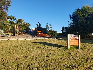
Primary school
Hauraki Primary School is a coeducational contributing primary (years 1-6) school with a roll of 482 as of April 2023. [5] [6] The school was founded in 1954. [7] Hauraki Primary has students from New Entrant to Year Six when they move on to intermediate school. The majority of year sixes transferring to Belmont Intermediate School or Takapuna Normal Intermediate School. School facilities include 14 classrooms, 3 playgrounds, 2 fields, Hall, Music room, Swimming pool and various courts.
History
Hauraki Primary School was established in May 1954 and on Labour Weekend in 2004 the school celebrated its Silver Jubilee. The first few decades involved times without an ICT suite, personal computers, collaborative learning and mufti every day (though as of 2007, uniform is compulsory for all starting students).
In 2000, Clarinda Franklin took over the job of being principal and as of 2022 no one has succeeded her in the job. In the 1990s the school adopted the DARE programme which informs year six students about: peer pressure, drugs, smoking and alcohol along with other safety procedures. Also in 2003, Hauraki Primary School introduced the Walking School Bus to the Devonport peninsula, which is a programme that gives parents the opportunity to let their children walk to school along with their peers and other students with various parents controlling their walk to school.
In 2005 Hauraki Primary decided to take part in the North Shore Schools kapa haka day which is held at Onepoto Intermediate every year and is a festival for all schools wishing to participate and show off their kapa haka groups. In that year the Kapa Haka role was succeeded by Ali Logan-Daughty who gave the school the idea to participate in the festival. In term 4 of 2007 the Board of Trustees and Parent Teachers Association voted for a change in the school with a huge impact as they unanimously voted towards a school uniform to be introduced for all starting or new students in the school but optional for existing students. Hauraki Primary hopes that in 2010 everyone in the school will be in uniform. The uniform includes a silver shirt/blouse, green shorts/ skirt (skirts are styled to the Westlake Girls High School skirts) grey socks, plain black sandals/polishable black lace up shoes and a hat.
Sporting Opportunities: Sports available for students from year 3-6
- 1stXI and 2ndXI Cricket teams playing in a quadrangular tournament annually.
- Various hockey teams.
- Various netball teams.
- Various miniball teams, practise available for players in hall at break times.
- A 1stXV (or 2ndXV) rugby team.
- Two soccer teams to compete at an annual tournament at Belmont Intermediate School.
- Compulsory activities for students during the year include
- Swimming Sports, Cross Country and Athletics all with inter-school competitions held a few weeks after.
Extra-curricular activities (for year sixes only; some relation to sport):
- Waterwise programs at Narrow Neck Beach in Devonport
- A 4-day, 3 night camp in Hunua at the YMCA's Camp Adair.
Cultural opportunities for students year 3-6:
- Middle School Choir (Years 3 and 4)
- Senior School Choir (Years 5 and 6)
- Boys Choir (Year 5 and 6, segment of the Senior Choir)
- Kapa Haka Group
- School Orchestra
- Middle and Senior School Speech Competitions (Compulsory)
- School Production held biennially

Great Barrier Island lies in the outer Hauraki Gulf, New Zealand, 100 kilometres (62 mi) north-east of central Auckland. With an area of 285 square kilometres (110 sq mi) it is the sixth-largest island of New Zealand and fourth-largest in the main chain. Its highest point, Mount Hobson, is 627 metres (2,057 ft) above sea level. The local authority is the Auckland Council.

Coromandel, also called Coromandel Town to distinguish it from the wider district, is a town on the Coromandel Harbour, on the western side of the Coromandel Peninsula, which is in the North Island of New Zealand. It is 75 kilometres east of the city of Auckland, although the road between them, which winds around the Firth of Thames and Hauraki Gulf coasts, is 190 km long. The population was 1,930 as of June 2023.

Haka are a variety of ceremonial dances in Māori culture. Haka are often performed by a group, with vigorous movements and stamping of the feet with rhythmically shouted accompaniment. Haka have been traditionally performed by both men and women for a variety of social functions within Māori culture. They are performed to welcome distinguished guests, or to acknowledge great achievements, occasions, or funerals.

Three Kings is a suburb of Auckland, New Zealand that is built around the Te Tātua-a-Riukiuta volcano. It is home to an ethnically diverse population of about 3,500 people.

Ngatea is a small town on the Hauraki Plains in the North Island of New Zealand. It is located 18 kilometres southwest of Thames and 70 kilometres southeast of Auckland. Ngatea lies on the Piako River, eight kilometres south of its outflow into the Firth of Thames.

Tāmaki is a small suburb of East Auckland, 11 kilometres from the Auckland CBD, in the North Island of New Zealand. It is located by the banks of the estuarial Tāmaki River, which is a southern arm of the Hauraki Gulf. The suburb is between the suburbs of Point England to the north and Panmure to the south.

Kelston is a residential suburb of West Auckland, New Zealand. Originally a ceramics manufacturing centre, the area is now mostly residential, including a number of schools. Kelston is located in, and its name has been given to, the Kelston parliamentary electorate.

Waima is a suburb of West Auckland, New Zealand. It is under the local governance of the Auckland Council. The majority of the modest population is clustered around the comparatively prominent Waima superette, situated just off the main arterial road Woodlands Park Road, on such streets as Waima Crescent, Hollywood Avenue, Boylan Road and Rimutaka Place. The central "hub" could be considered Waima reserve, which consists of various public amenities such as a playground, basketball court, toilets and a sport field.

Birkdale is a suburb of the contiguous Auckland metropolitan area located in New Zealand. It comprises statistical area units such as 'Birkdale North' and 'Birkdale South'. The suburb is located in the North Shore, and is under the governance of Auckland Council.

Belmont is a suburb of Auckland, New Zealand. The name Belmont, which means "good view or hill", derives from a farm estate called "Belmont" which was subdivided in 1885. The suburb is in the North Shore ward, one of the thirteen administrative divisions of Auckland Council.
McLaren Park is a suburb of West Auckland, New Zealand. It is named after New Zealand Formula One driver and founder of the McLaren Formula One Team Bruce McLaren. The local State secondary schools are Henderson High School, Rutherford College, St Dominic's College and Liston College.
Sunnynook is a suburb on the North Shore in the Auckland metropolitan area in New Zealand. It is currently under the governance of Auckland Council.

Papakura is a southern suburb of Auckland, in northern New Zealand. It is located on the shores of the Pahurehure Inlet, approximately 32 kilometres south of the Auckland CBD. It is under the authority of the Auckland Council.

Red Beach is a suburb surrounding the beach of the same name on the Hibiscus Coast, Auckland, New Zealand, at the base of the Whangaparaoa Peninsula. The suburb of Silverdale is to the south-west, and Orewa to the north.

Boulcott is a central suburb of Lower Hutt City situated in the south of the North Island of New Zealand. The suburb lies about a kilometre north-east of the Lower Hutt CBD.
Northcross is a northern suburb of the North Shore in the contiguous Auckland metropolitan area in New Zealand. It is located in the East Coast Bays, a string of small suburbs that make up the northern North Shore. It is located north of the Waitematā Harbour and is currently under local governance of Auckland Council.

Te Matatini is a nationwide Māori performing arts festival and competition for kapa haka performers from all of New Zealand. The name was given by Professor Wharehuia Milroy, a composite of Te Mata meaning "the face" and tini denoting "many" — hence the meaning of Te Matatini is "many faces".

Clendon Park is a suburb of Auckland in northern New Zealand. It is located to the west of Manurewa and north of Weymouth. The suburb is in the Manurewa-Papakura ward, one of the 21 local boards of Auckland Council.
Balmoral School is a co-educational state primary and intermediate school in Balmoral in Auckland, New Zealand. It teaches students in year levels 1 to 8, however the year 1 to 6 classes of the primary school are separated from the year 7 and 8 classes of the intermediate school. Primary students wear mufti, whilst Intermediate students wear a uniform that consists of a red polo shirt and navy blue shorts. As of November 2018, the school had a population of 926 students.

