
Hawke's Bay is a region on the east coast of New Zealand's North Island. The region is named for Hawke Bay, which was named in honour of Edward Hawke. The region's main centres are the cities of Napier and Hastings, while the more rural parts of the region are served by the towns of Waipukurau, Waipawa, and Wairoa.
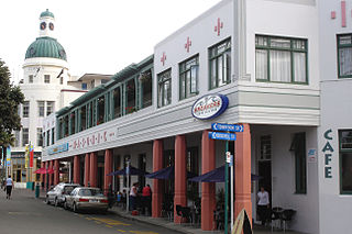
Napier is a city on the eastern coast of the North Island of New Zealand and the seat of the Hawke's Bay region. It is a beachside city with a seaport, known for its sunny climate, esplanade lined with Norfolk pines, and extensive Art Deco architecture. Napier is sometimes referred to as the "Nice of the Pacific", although that is largely outdated and a more common nickname is 'The Art Deco Capital of the world'.

The provinces of the Colony of New Zealand existed as a form of sub-national government. Initially established in 1846 when New Zealand was a Crown colony without responsible government, two provinces were first created. Each province had its own legislative council and governor. With the passing of the New Zealand Constitution Act 1852 the provinces were recreated around the six planned settlements or "colonies". By 1873 the number of provinces had increased to nine, but they had become less isolated from each other and demands for centralised government arose. In 1875 the New Zealand Parliament decided to abolish the provincial governments, and they came to an end in November 1876. They were superseded by counties, which were later replaced by territorial authorities.
Waipukurau is the largest town in the Central Hawke's Bay District on the east coast of the North Island of New Zealand. It is located on the banks of the Tukituki River, 7 kilometres south of Waipawa and 50 kilometres southwest of Hastings.
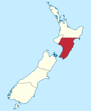
Wellington Province, governed by the Wellington Provincial Council, was one of the provinces of New Zealand from 1853 until the abolition of provincial government in 1876. It covered much of the southern half of the North Island until November 1858, when Hawke's Bay Province split off, taking about a third of its area.

Napier Port is in Napier, New Zealand, on Hawke Bay. It is the North Island's second largest export port by tonnage, and is owned by Napier Port Holdings Limited.
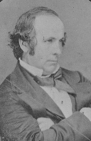
Thomas Henry Fitzgerald was an Irish pioneer in sugar cane farming in the early days of the colony of Queensland, Australia. He was a politician, first in New Zealand, then in Queensland. His descendants went on to become notable names in Queensland politics, business and law. He is best remembered for founding the town of Innisfail.
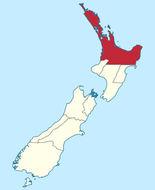
The Auckland Province was a province of New Zealand from 1853 until the abolition of provincial government in 1876.

Nelson Province was constituted in 1853 under the New Zealand Constitution Act 1852, and originally covered the entire upper South Island, including all of present-day Buller, Kaikoura, Marlborough, and Tasman districts, along with Nelson City, Grey District north of the Grey River, and the Hurunui District north of the Hurunui River. It was reduced in size by the creation of Marlborough Province in November 1859, then abolished in 1876, along with all the provinces of New Zealand.

The Marlborough Province operated as a province of New Zealand from 1 November 1859, when it split away from Nelson Province, until the abolition of provincial government in 1876.

Sir Donald McLean was a 19th-century New Zealand politician and government official. He was involved in negotiations between the settler government and Māori from 1844 to 1861, eventually as Native Secretary and Land Purchase commissioner. He was one of the most influential figures in Māori-Pākehā relations in the mid-1800s and was involved in the dispute over the "Waitara Purchase", which led up to the First Taranaki War.
Bay View, previously known as Kai-arero and Petane, is a settlement in the Hawke's Bay region of the eastern North Island of New Zealand. It lies on State Highway 2, nine kilometres north of the city centre of Napier. The Esk River flows into the sea just to the north. Hawke's Bay Airport and the Napier suburb of Westshore lie just to the south. Bay View has been administered by the Napier City Council since the 1989 local government reforms.
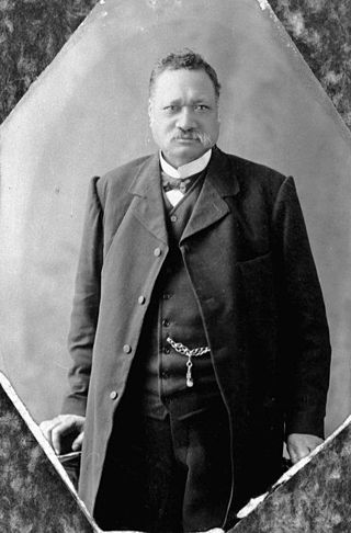
Henare Tomoana was a prominent Māori leader and politician from the Hawke's Bay area in the North Island, New Zealand. He was of Ngāti Kahungunu and Ngāti Te Whatu-i-Apiti tribal lineage. In 1879 he was elected to the New Zealand Parliament for the Eastern Maori electorate, and in 1898 was appointed to the New Zealand Legislative Council. He was a convenor of Te Kotahitanga, the movement for an independent Māori Parliament.
Superintendent was the elected head of each Provincial Council in New Zealand from 1853 to 1876.

John Studholme (1829–1903) was a 19th-century British pioneer of New Zealand, farmer and politician in the Canterbury region of New Zealand.
The Mayor of Napier is the head of the municipal government of Napier, New Zealand, and presides over the Napier City Council. Napier is New Zealand's ninth largest city. The first mayor was elected in 1875. The current mayor is Kirsten Wise.
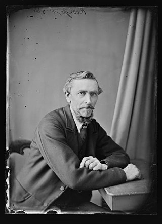
John Rochfort was a New Zealand surveyor and engineer.

Ahuriri Lagoon was a large tidal lagoon at Napier, on the east coast of New Zealand's North Island, that largely drained when the area was raised by the 1931 Hawke's Bay earthquake.
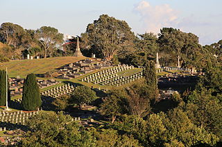
Te Henui Cemetery, also known as New Plymouth Cemetery, is the oldest public cemetery in New Plymouth, New Zealand. It was first used in 1861.

Rissington is a farming settlement 15 km (9.3 mi) north west of Napier, New Zealand. It lies in Hawke's Bay Region, between Sherenden and Napier, in the Mangaone River valley, on the road to Patoka and Puketitiri. A fire station, cemetery and a war memorial are the only remaining public structures, but it once had several more and was home to the country's first Women's Institute, co-founded by Amy Hutchinson and Bessie Spencer.


