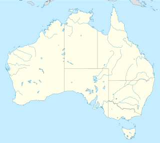
The Territory of Ashmore and Cartier Islands is an uninhabited external territory of Australia consisting of four low-lying tropical islands in two separate reefs, and the 12-nautical-mile territorial sea generated by the islands. The territory is located in the Indian Ocean situated on the edge of the continental shelf, about 320 km (199 mi) off the northwest coast of Australia and 144 km (89 mi) south of the Indonesian island of Rote.

The Australian Capital Territory (ACT), known as the Federal Capital Territory (FCT) until 1938, is a federal territory of Australia containing the Australian capital city of Canberra and some surrounding townships. It is located in the south-east of the country and is an enclave within the state of New South Wales. Founded after Federation as the seat of government for the new nation, all important institutions of the Australian Government are headquartered in the territory.

Christmas Island, officially known as the Territory of Christmas Island, is an Australian external territory comprising the island of the same name. It is located in the Indian Ocean, around 350 kilometres (220 mi) south of Java and Sumatra and around 1,550 km (960 mi) north-west of the closest point on the Australian mainland. It lies 2,600 km (1,600 mi) and 1,327 km (825 mi) northwest of Perth and southeast of Singapore respectively. It has an area of 135 square kilometres (52 sq mi).

The Territory of Cocos (Keeling) Islands is an Australian external territory in the Indian Ocean, comprising a small archipelago approximately midway between Australia and Sri Lanka. It is part of Southeast Asia and is in the Southern Hemisphere. The territory's dual name reflects that the islands have historically been known as either the Cocos Islands or the Keeling Islands.

Darwin is the capital city of the Northern Territory, Australia. With a 2018 estimated population of 148,564, it has more residents than the rest of the sparsely populated Northern Territory. It is the smallest, wettest, and most northerly of the Australian capital cities and serves as the Top End's regional centre.

The Northern Territory is an Australian territory in the central and central northern regions of Australia. It shares borders with Western Australia to the west, South Australia to the south, and Queensland to the east. To the north, the territory looks out to the Timor Sea, the Arafura Sea and the Gulf of Carpentaria, including Western New Guinea and other islands of the Indonesian archipelago.

Canberra is the capital city of Australia. Founded following the federation of the colonies of Australia as the seat of government for the new nation, it is Australia's largest inland city and the eighth-largest city overall. The city is located at the northern end of the Australian Capital Territory, 280 km (170 mi) south-west of Sydney and 660 km (410 mi) north-east of Melbourne.

Sorghum is a genus of flowering plants in the grass family Poaceae, which includes about 25 species. Some of these species have grown as cereals for human consumption and some in pastures for animals. One species, Sorghum bicolor, was originally domesticated in Africa and has since spread throughout the globe. Seventeen of the 25 species are native to Australia, with the range of some extending to Africa, Asia, Mesoamerica, and certain islands in the Indian and Pacific Oceans. One species is grown for grain, while many others are used as fodder plants, either cultivated in warm climates worldwide or naturalized in pasture lands. Sorghum is in the subfamily Panicoideae and the tribe Andropogoneae.
A dependent territory, dependent area, or dependency is a territory that does not possess full political independence or sovereignty as a sovereign state, yet remains politically outside the controlling state's integral area.

The Australian Antarctic Territory (AAT) is a part of East Antarctica administered by the Australian Antarctic Division, an agency of the federal Department of the Environment and Energy. The territory's history dates to a claim on Enderby Land made by the United Kingdom in 1841, which was subsequently expanded and eventually transferred to Australia in 1933. It is the largest territory of Antarctica claimed by any nation by area. In 1961, the Antarctic Treaty came into force. Article 4 deals with territorial claims, and although it does not renounce or diminish any preexisting claims to sovereignty, it also does not prejudice the position of Contracting Parties in their recognition or non-recognition of territorial sovereignty. As a result, only four other countries—New Zealand, the United Kingdom, France, and Norway—recognise Australia's claim to sovereignty in Antarctica.

The Territory of Papua comprised the southeastern quarter of the island of New Guinea from 1883 to 1975. In 1883, the Government of Queensland annexed this territory for the British Empire. The United Kingdom Government refused to ratify the annexation but in 1884 a Protectorate was proclaimed over the territory, then called "British New Guinea". There is a certain ambiguity about the exact date on which the entire territory was annexed by the British. The Papua Act 1905 recites that this happened "on or about" 4 September 1888. On 18 March 1902, the Territory was placed under the authority of the Commonwealth of Australia. Resolutions of acceptance were passed by the Commonwealth Parliament, who accepted the territory under the name of Papua.

In Australia, electoral districts for the Australian House of Representatives are called divisions or more commonly referred to as electorates or seats. There are currently 151 single-member electorates for the Australian House of Representatives.

The Australian Government is the federal government of Australia, a parliamentary constitutional monarchy, and is the first level of government division. It is also referred to as the Commonwealth Government. Like many other Westminster-style systems of government, the Australian Government is made up of three branches: the executive, the legislative, and the judicial.

Central Australia, also known as the Alice Springs Region, is one of the five regions in the Northern Territory of Australia. The term Central Australia is used to describe an area centred on Alice Springs. It is sometimes referred to as Centralia; likewise the people of the area are sometimes called Centralians. The region is located in the southern part of the Northern Territory spanning from the west on the Western Australian Border to the east on the Queensland border.

Australia uses three main time zones: Australian Western Standard Time, Australian Central Standard Time, and Australian Eastern Standard Time. Time is regulated by the individual state governments, some of which observe daylight saving time (DST). Australia's external territories observe different time zones.

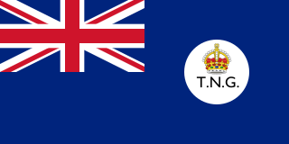
The Territory of New Guinea was an Australian administered territory on the island of New Guinea from 1914 until 1975. In 1949, the Territory and the Territory of Papua were established in an administrative union by the name of the Territory of Papua and New Guinea. That administrative union was renamed as Papua New Guinea in 1971. Notwithstanding that it was part of an administrative union, the Territory of New Guinea at all times retained a distinct legal status and identity until the advent of the Independent State of Papua New Guinea.

The states and territories of Australia are the second level of government division in Australia, between the federal government and local governments. States and territories are self-administered regions with a local legislature, police force and certain civil authorities, and are represented in the Parliament of Australia. Territories though, unlike states, rely on federal legislation and additional financial contributions to operate, and have less representation in the Senate.

Australia, officially the Commonwealth of Australia, is a sovereign country comprising the mainland of the Australian continent, the island of Tasmania, and numerous smaller islands. It is the largest country in Oceania and the world's sixth-largest country by total area. The population of 26 million is highly urbanised and heavily concentrated on the eastern seaboard. Australia's capital is Canberra, and its largest city is Sydney. The country's other major metropolitan areas are Melbourne, Brisbane, Perth, and Adelaide.
A State Electoral District is an electorate within the Lower House or Legislative Assembly of Australian states and territories. Most state electoral districts send a single member to a state or territory's parliament using the preferential method of voting. The area of a state electoral district is dependent upon the Electoral Acts in the various states and vary in area between them. At present, there are 409 state electoral districts in Australia.

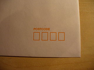
Postcodes in Australia are used to more efficiently sort and route mail within the Australian postal system. Postcodes in Australia have four digits and are placed at the end of the Australian address, before the country. Postcodes were introduced in Australia in 1967 by the Postmaster-General's Department and are now managed by Australia Post, Australia's national postal service. Postcodes are published in booklets available from post offices or online from the Australia Post website.


