
Highway M05 is a state international highway in Ukraine connecting the two largest cities: Kyiv and Odessa.

The Russian route M2 is a major trunk road that connects Moscow to Crimea. It is part of the European route E105. It is 720 kilometers long.
State highways in Ukraine are subdivided into three categories: international (M-network), national (H-network), and regional (P-network). The letter's indexes are in Cyrillic, standing for their respective abbreviations in Ukrainian.

Highway M23 is one of the shortest Ukrainian international highway (M-highway) which connects Berehove with Khust and runs in the southern portion of the region next to the Hungarian and Romanian borders. From Berehove to the little settlement of Vylok the M23 is part of European route E58 and European route E81 which drift of towards the Romanian border at the border checkpoint Okli on a regional route.

Highway M20 is the second shortest Ukraine international highway (M-highway) which connects Kharkiv to the border with Russia at Hoptivka in Kharkiv Raion in Kharkiv Oblast (Kharkivshchyna) and Nehoteevka in Belgorodsky Raion in Belgorodskaya Oblast. The section from Lisne to the Russian border is part of European route E105, known as the Crimea Highway in Russia.
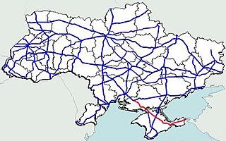
Highway M17 is a Ukrainian international highway (M-highway) connecting Kherson to the Russian border over the Kerch Strait, where it continues into Russia as the A290. The M17 is part of European route E97.
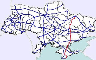
Highway M18 is a Ukrainian international highway (M-highway) connecting Kharkiv to the southern coast of Crimea in Yalta. The highway is also has an alternative route (M29) which runs parallel and designed as an expressway between Kharkiv and Novomoskovsk. The section from Novomoskovsk to Yalta is part of European route E105. The section from Kharkiv to Krasnohrad was previously P51.
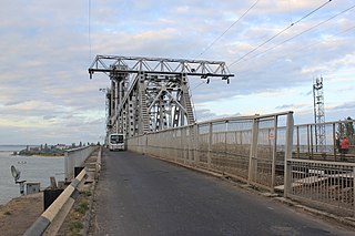
H33 is a Ukrainian national highway (H-highway), passing through the territory of the Odessa region. The route was previously designated as territorial road T-16-04 until 2013 and regional road P-70 from 2013 to 2017, when it was redesignated as national highway H33.

H28 is a national road (H-Highway) in Chernihiv Oblast, Ukraine. It runs north-south and connected Chernihiv with a tri-side border. Before 2017, H28 was numbered as P13.
P14 is a regional road (P-Highway) in Volyn Oblast, Ukraine. It runs north-south and connects Lutsk with the Belarus-Ukraine border.
P53 road is a regional road (P-Highway) in Zakarpattia Oblast, Ukraine. It runs north-south and connects Malyi Bereznyi with a Slovakia-Ukraine border. It is one of the shortest routes.
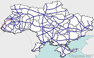
H13 is a national road (H-Highway) in Lviv Oblast and Zakarpattia Oblast, Ukraine. It runs north-south and connects Uzhhorod with Lviv.
P21 road is a regional road (P-Highway) in Zakarpattia Oblast and Ivano-Frankivsk, Ukraine. It runs north-south and connects cities of Dolyna and Khust.
H09 is a national road (H-Highway) in Lviv Oblast, Ivano-Frankivsk Oblast and Zakarpattia Oblast, Ukraine. It runs north-south and connects Mukachevo with Lviv.
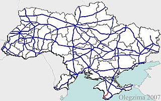
H06 is a regional road (H-Highway) in Crimea and Sevastopol. It runs northeast-south-southwest and connects Simferopol with Sevastopol. Since the 2014 annexation of Crimea by the Russian Federation, the route was given another code 35P-001 and 67P-1.
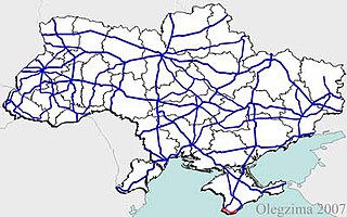
H19 is a regional road (H-Highway) in Crimea and Sevastopol, Ukraine. It is a western part of the so-called Yuzhnoberezhne shose. It runs east-west and connects Yalta with Sevastopol. Since the 2014 annexation of Crimea by the Russian Federation, the route was given another code 35K-002 and 67K-1.
Medvenka is an urban locality in Medvensky District of Kursk Oblast, Russia. Population: 4,398 (2010 Census); 4,595 (2002 Census); 4,446 (1989 Census).
P61 is a regional Ukraine road (P-highway) in Sumy Oblast, Ukraine, running mainly west-east and connecting Baturyn with Sumy in a more or less straight line. It begins at Highway M01/European route E101 and passes through Mytchenky, Krasne, Popivka, Konotop, Simyanivka, Dubovyazivka, Krasne, Chernecha Sloboda, Terny, Bobryk, Tuchne, Mykolaivka, Stepanivka, and ends in Sumy at Stepana Bandera Street and Illinska Street. There is also a branch road starting at Highway M03/European route E101 to Hetman's Capital National Park.
P46 is a regional Ukraine road (P-highway) in Sumy Oblast and Kharkiv Oblast, Ukraine, running mainly west–east and connecting Okhtyrka with Kharkiv in a more or less straight line. It begins at Highway H12 in Okhtyrka and passes through Khodunaivka, Kupjevakha, Hubarivka, Bohodukhiv, Musiyki, Krysynska, Maksymivka, Horkoho, Vilshany, Dvorichnyi Kut, Peresichne, Solonytsivka, Podvirky, and finally arrives to the Kholodnohirsk District of Kharkiv at Zalyutynska Street and Poltavskyi Shlyakh Street.
Verkhny Lyubazh is a rural locality and the administrative center of Verkhnelyubazhsky Selsoviet Rural Settlement, Fatezhsky District, Kursk Oblast, Russia. Population: 1,674 (2010 Census); 1,925 (2002 Census);


