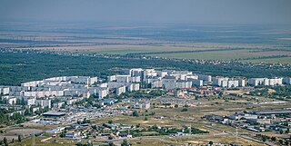
Zaporizhzhia, formerly known as Oleksandrivsk until 1921, is a city in southeast Ukraine, situated on the banks of the Dnieper River. It is the administrative centre of Zaporizhzhia Oblast. Zaporizhzhia has a population of 710,052.

The Dnieper Hydroelectric Station, also known as the Dnipro Dam, is a hydroelectric power station in the city of Zaporizhzhia, Ukraine. Operated by Ukrhydroenergo, it is the fifth and largest station in the Dnieper reservoir cascade, a series of hydroelectric stations on the Dnieper river that supply power to the Donets–Kryvyi Rih industrial region. Its dam has a length of 800 metres (2,600 ft), a height of 61 metres (200 ft), and a flow rate of 38.7 metres (127 ft) per second.

Enerhodar is a city and municipality in the northwest of Zaporizhzhia Oblast, Ukraine. It is on the south bank of the Dnieper River, on the opposite side of the Kakhovka Reservoir from Nikopol and Chervonohryhorivka.

Prydnipro Railway or Cisdnieper Railway(Ukrainian: Придніпровська залiзниця, romanized: Prydniprovska zaliznytsia , lit. 'Near-Dnipro railway') is a regional operator of Ukrainian Railways in the south of Ukraine with headquarters in Dnipro city.

Solone is a rural settlement in Dnipro Raion, Dnipropetrovsk Oblast, Ukraine. It hosts the administration of Solone settlement hromada, one of the hromadas of Ukraine. Population: 7,380.
Auly is a rural settlement in Kamianske Raion, Dnipropetrovsk Oblast, Ukraine. It is located on the right bank of the Kamianske Reservoir northwest of the city of Kamianske. Auly belongs to Krynychky settlement hromada, one of the hromadas of Ukraine. Population: 3,922.

Kurylivka is a rural settlement in Dnipro Raion, Dnipropetrovsk Oblast, Ukraine. It is located on the right bank of the Dnieper, downstream of the Kamianske Reservoir, across the river from the city of Kamianske. Kurylivka belongs to Petrykivka settlement hromada, one of the hromadas of Ukraine. Population: 2,432.
Mykolaivka is a rural settlement in Dnipro Raion, Dnipropetrovsk Oblast, Ukraine. It is located on the right bank of the Dnieper, across from the city of Kamianske. Mykolaivka belongs to Obukhivka settlement hromada, one of the hromadas of Ukraine. It has a population of 1,132.
Lykhivka is a rural settlement in Kamianske Raion, Dnipropetrovsk Oblast, Ukraine. It is located in the northwest of the oblast, on the banks of the Omelnyk, a right tributary of the Dnieper. Lykhivka hosts the administration of Lykhivka settlement hromada, one of the hromadas of Ukraine. Population: 1,822.
Vyshneve is a rural settlement in Kamianske Raion, Dnipropetrovsk Oblast, Ukraine. The settlement is located on the banks of the Lozuvatka, a tributary of the Saksahan in the basin of the Dnieper. Vyshneve hosts the administration of Vyshneve settlement hromada, one of the hromadas of Ukraine. Population: 2,255.
Ilarionove is a rural settlement in Synelnykove Raion, Dnipropetrovsk Oblast, Ukraine. It is located midway between Dnipro and Synelnykove. Ilarionove hosts the administration of Ilarionove settlement hromada, one of the hromadas of Ukraine. Population: 8,610.
Sad is a rural settlement in Synelnykove Raion, Dnipropetrovsk Oblast, Ukraine. It is located midway between Dnipro and Synelnykove. Sad belongs to Ilarionove settlement hromada, one of the hromadas of Ukraine. Population: 496.
Rozivka is a rural settlement in Zaporizhzhia Oblast, southern Ukraine. It was the administrative center of Rozivka Raion until the raion was dissolved in 2020. It is located close to the source of the Karatysh, a right tributary of the Berda. Its population is 2,939. During the Russian invasion of Ukraine, it has been occupied by Russian-allied forces.
Babai is a rural settlement in Kharkiv Raion, Kharkiv Oblast, Ukraine. It is located on the right bank of the Udy in the drainage basin of the Don. Babai belongs to Vysokyi settlement hromada, one of the hromadas of Ukraine. Population: 6,487.
Khorosheve is a rural settlement in Kharkiv Raion of Kharkiv Oblast in Ukraine. It is located on the right bank of the Udy, in the drainage basin of the Don, south of the city of Kharkiv. Khorosheve belongs to Bezliudivka settlement hromada, one of the hromadas of Ukraine. Population: 3,984.
Pokotylivka is a rural settlement in Kharkiv Raion of Kharkiv Oblast in Ukraine. It is a southwestern suburb of Kharkiv and is located on the left bank of the Udy, in the drainage basin of the Don. Pokotylivka belongs to Vysokyi settlement hromada, one of the hromadas of Ukraine. Population: 9,121.
Utkivka is a rural settlement in Kharkiv Raion of Kharkiv Oblast in Ukraine. It is located on the left bank of the Mzha, in the drainage basin of the Don. Utkivka belongs to Merefa urban hromada, one of the hromadas of Ukraine. Population: 1,145.
Krasnopavlivka is a rural settlement in Lozova Raion of Kharkiv Oblast in Ukraine. It is located on the left bank of the Orilka, a tributary of the Oril in the drainage basin of the Dnieper. The Dnieper - Donbas canal, which follows the Orilka, is dammed as Krasnopavlivka Reservoir. Krasnopavlivka belongs to Lozova urban hromada, one of the hromadas of Ukraine. Population: 6,637.
Komysh-Zoria is a rural settlement in Polohy Raion, Zaporizhzhia Oblast, southern Ukraine. It is located in the steppe between Zaporizhzhia and Mariupol. Komish-Zoria hosts the administration of Komysh-Zoria settlement hromada, one of the hromadas of Ukraine. Population: 2,090.

H16 is a national road (H-Highway) in Cherkasy Oblast, Ukraine.


