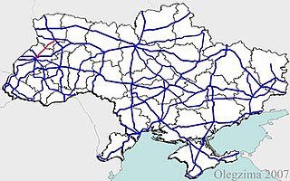
Roads in Ukraine is a network of automobile roads that includes various types of roadways. The roads are usually categorized into general (public) use including streets and roads within populated areas, and other including official, private, and special use. The general use roadways are the main traveling routes and some better are part of the E-road network. High-speed highways (motorways), however, locally known as avtomahistrali or expressways are rare and only available on selected segments of major routes. Big construction projects to improve the national road infrastructure was announced in early 2010 in preparation to the Euro 2012 football competition and there was established Ministry of Infrastructure of Ukraine headed by Borys Kolesnikov. The reality turned to be more prosaic and the road infrastructure continues to be among main problems in the country.

Highway M10 is a Ukrainian international highway (M-highway) connecting Lviv to Krakovets on the border with Poland, where it continues as the A4 motorway.

M12 was a Ukrainian international highway (M-highway) connecting Lviv Oblast to Central Ukraine, where after crossing the Dnieper it continued further as the M04. On 28 April 2021, the M12 was decommissioned and merged with the M04 to form the new M30.

Highway M20 is the second shortest Ukraine international highway (M-highway) which connects Kharkiv to the border with Russia at Hoptivka in Kharkiv Raion in Kharkiv Oblast (Kharkivshchyna) and Nehoteevka in Belgorodsky Raion in Belgorodskaya Oblast. The section from Lisne to the Russian border is part of European route E105, known as the Crimea Highway in Russia.

Highway H01 is a Ukrainian national highway (H-highway) connecting the capital of Ukraine Kyiv with the central regions. It runs through Kyiv, Kyiv Oblast, Cherkasy Oblast, and ends in Kirovohrad Oblast.
Lysovychi is a village in Stryi Raion, Lviv Oblast in western Ukraine. It belongs to Morshyn urban hromada, one of the hromadas of Ukraine. Local government is administered by Lysovytska village council. The population of the village is about 1770 people.
Dubanevychi is a village in Lviv Raion, Lviv Oblast in western Ukraine. It belongs to Horodok urban hromada, one of the hromadas of Ukraine. The population of the village is about 1277 people. Local government is administered by Dubanevytska village council.

H28 is a national road (H-Highway) in Chernihiv Oblast, Ukraine. It runs north-south and connected Chernihiv with a tri-side border. Before 2017, H28 was numbered as P13.
Highway H17 is a Ukrainian national highway (H-highway) connecting the city of Lviv with Lutsk.
P14 is a regional road (P-Highway) in Volyn Oblast, Ukraine. It runs north-south and connects Lutsk with the Belarus-Ukraine border.
P15 is a regional road (P-Highway) in Volyn Oblast and Lviv Oblast Ukraine. It runs north-south and connects Kovel with Zhovkva.
P21 road is a regional road (P-Highway) in Zakarpattia Oblast and Ivano-Frankivsk, Ukraine. It runs north-south and connects cities of Dolyna and Khust.
H09 is a national road (H-Highway) in Lviv Oblast, Ivano-Frankivsk Oblast and Zakarpattia Oblast, Ukraine. It runs north-south and connects Mukachevo with Lviv.
European route E 40 (E 40) is a west–east European route, running from the port of Calais in France to Altai Mountains near Ridder in Kazakhstan.
Pidbuzh is an urban-type settlement in Drohobych Raion of Lviv Oblast in Ukraine. It is located in the Carpathian Mountains, at the banks of the Bystrytsia Pysmenytska, a right tributary of the Dniester. It belongs to Skhidnytsia settlement hromada, one of the hromadas of Ukraine. Population: 3,362
Dobrotvir is an urban-type settlement in Chervonohrad Raion of Lviv Oblast in Ukraine. The settlement is located on the left bank of the Western Bug, which is dammed here forming Dobrotvir Reservoir. It hosts the administration of Dobrotvir settlement hromada, one of the hromadas of Ukraine. Population: 6,381
P61 is a regional Ukraine road (P-highway) in Sumy Oblast, Ukraine, running mainly west-east and connecting Baturyn with Sumy in a more or less straight line. It begins at Highway M01/European route E101 and passes through Mytchenky, Krasne, Popivka, Konotop, Simyanivka, Dubovyazivka, Krasne, Chernecha Sloboda, Terny, Bobryk, Tuchne, Mykolaivka, Stepanivka, and ends in Sumy at Stepana Bandera Street and Illinska Street. There is also a branch road starting at Highway M03/European route E101 to Hetman's Capital National Park.
P46 is a regional Ukraine road (P-highway) in Sumy Oblast and Kharkiv Oblast, Ukraine, running mainly west–east and connecting Okhtyrka with Kharkiv in a more or less straight line. It begins at Highway H12 in Okhtyrka and passes through Khodunaivka, Kupjevakha, Hubarivka, Bohodukhiv, Musiyki, Krysynska, Maksymivka, Horkoho, Vilshany, Dvorichnyi Kut, Peresichne, Solonytsivka, Podvirky, and finally arrives to the Kholodnohirsk District of Kharkiv at Zalyutynska Street and Poltavskyi Shlyakh Street.

H10 is an important Ukraine national highway (H-highway) in Lviv, Ivano-Frankivsk, and Chernivtsi Oblasts.

P39 is a regional road (P-Highway) in Lviv and Ternopil Oblast, Ukraine. It runs northwest-southeast and connects Brody with Ternopil.