Bucha is a city in Ukraine's Kyiv Oblast. Administratively, it serves as the administrative center of Bucha Raion. It hosts the administration of Bucha urban hromada, one of the hromadas of Ukraine. Its population is approximately 37,321 . Bucha Day is celebrated in the city between 11 and 13 September.

Highway M05 is a state international highway in Ukraine connecting the two largest cities: Kyiv and Odesa.

P04road is a state regional road in Ukraine connecting the capital of Ukraine, Kyiv and town Zvenyhorodka in Cherkasy Oblast. It is 212.6 km (132.1 mi) long. The route starts in Kyiv, goes through Fastiv, Bila Tserkva, Tarashcha and ends in Zvenyhorodka.

M01 is a Ukraine international highway (M-highway) that stretches from the state capital, Kyiv, to the northern border with Belarus.

Ukraine has a variety of road types within its road network. The roads are divided into two main categories: general-use roads, which consist of streets and roads in populated areas like cities and villages, and specialized roads, which include official, private, and special-use roads. The general use roadways are the main traveling routes and some better are part of the E-road network. High-speed highways (motorways), however, locally known as avtomahistrali or expressways are rare and only available on selected segments of major routes. Big construction projects to improve the national road infrastructure was announced in early 2010 in preparation to the Euro 2012 football competition and there was established Ministry of Infrastructure of Ukraine headed by Borys Kolesnikov. The reality turned out to be more prosaic, and the road infrastructure continues to required additional improvements.
The following outline is provided as an overview of and topical guide to Ukraine:

Highway M04 was a Ukraine international highway connecting Znamianka to Sorokyne on the border with Russia, where it continued into Russia as the A260.

Highway M02 is a Ukraine international highway (M-highway) connecting the M01 near Kipti with Bachivsk on the border with Russia, where it continues as the M3 to Moscow. The entire route is part of European route E101 and the section from Hlukhiv to the Russian border is part of European route E391.

Highway M03 is a Ukrainian international highway (M-highway) connecting Kyiv with Dovzhansky on the border with Russia, where it continues into Russia as the A270. It is part of European route E40 from Kyiv to Debaltseve at which it is part of European route E50 to the border with Russia. At 844 km (524 mi), the M03 is the longest international state highway in Ukraine.
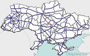
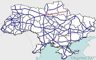
Highway M06 is a Ukrainian international highway (M-highway) connecting Kyiv to the Hungarian border near Chop, where it continues as Hungarian main road 4 to Záhony and Budapest.

Highway M07 is a Ukrainian international highway (M-highway) connecting Kyiv to Yahodyn on the border with Poland, where it continues into Poland as National Road 12 (DK12).

Highway M20 is the second shortest Ukraine international highway (M-highway) which connects Kharkiv to the border with Russia at Hoptivka in Kharkiv Raion in Kharkiv Oblast (Kharkivshchyna) and Nehoteevka in Belgorodsky Raion in Belgorodskaya Oblast. The section from Lisne to the Russian border is part of European route E105, known as the Crimea Highway in Russia.

Highway M16 is a Ukrainian international highway (M-highway) connecting Odesa to Kuchurhan on the border with Moldova, where it continues as national road M5. The M16 is part of European route E58 and European route E581.
European route E 40 (E 40) is a west–east European route, running from the port of Calais in France to Altai Mountains near Ridder in Kazakhstan.
Ponornytsia is an urban-type settlement in Novhorod-Siverskyi Raion, Chernihiv Oblast, northern Ukraine. It hosts the administration of Ponornytsia settlement hromada, one of the hromadas of Ukraine. Population: 1,931.
Oleksandrivka, (Ukrainian: Олександрівка, is an urban-type settlement in Kropyvnytskyi Raion of Kirovohrad Oblast in Ukraine. It is located on the Tiasmyn, a right tributary of the Dnieper. Oleksandrivka hosts the administration of Oleksandrivka settlement hromada, one of the hromadas of Ukraine. As of 2022, it had an estimated population of 8,012
H07 is an important Ukraine national highway (H-highway) in Kyiv, Chernihiv, and Sumy Oblasts, Ukraine, running mainly west-east, and connecting Kyiv with Yunakivka in a more or less straight line. It begins in Brovary at Highway M01/Highway E95, and passes through Krasylivka, Hoholiv, Rusaniv, Peremoha, Nova Basan, Novyi Bykiv, Pohreby, Rudivka, Pryluky, Okhyrky, Sribne, Kharkove, Lavirkove, Romny, Korovyntsi, Nedryhailiv, Vylshana, Komyshanka, Shtepivka, Sula, Sad, Sumy, Stetskivka, Pysarivka, and Yunakivka, before ending at the Russian border. The road then continues as the R200 to Kursk.
P61 is a regional Ukraine road (P-highway) in Sumy Oblast, Ukraine, running mainly west-east and connecting Baturyn with Sumy in a more or less straight line. It begins at Highway M01/European route E101 and passes through Mytchenky, Krasne, Popivka, Konotop, Simyanivka, Dubovyazivka, Krasne, Chernecha Sloboda, Terny, Bobryk, Tuchne, Mykolaivka, Stepanivka, and ends in Sumy at Stepana Bandera Street and Illinska Street. There is also a branch road starting at Highway M03/European route E101 to Hetman's Capital National Park.
Yelyzavethradka is an urban-type settlement in Kropyvnytskyi Raion of Kirovohrad Oblast in Ukraine. It is located on the right bank of the Inhulets, a right tributary of the Dnieper. Yelyzavethradka belongs to Oleksandrivka settlement hromada, one of the hromadas of Ukraine. Population: 1,112.

H08 is an important Ukraine national highway (H-highway) in Kyiv, Cherkasy, Poltava, Kirovohrad, Dnipropetrovsk, Zaporizhzhia and Donetsk Oblasts.