Halych is a historic city on the Dniester River in western Ukraine. The city gave its name to the Principality of Halych, the historic province of Galicia (Halychyna), and the Kingdom of Galicia–Volhynia, of which it was the capital until the early 14th century, when the seat of the local rulers moved to Lviv.

Ivano-Frankivsk Oblast, also referred to as Ivano-Frankivshchyna is an oblast (region) in western Ukraine. Its administrative center is the city of Ivano-Frankivsk. As is the case with most other oblasts of Ukraine this region has the same name as its administrative center – which was renamed by the Soviet Ukrainian authorities after the Ukrainian writer Ivan Franko on 9 November 1962. Population: 1,361,109 .

Ivano-Frankivsk, formerly Stanyslaviv, is a city located in Western Ukraine. It is the administrative centre of Ivano-Frankivsk Oblast and Ivano-Frankivsk Raion. Ivano-Frankivsk hosts the administration of Ivano-Frankivsk urban hromada. Its population is 237,855.
Ugartsthal, a former German colony in the Kingdom of Galicia and Lodomeria which is today part of the village Sivka-Kaluska in Kalush Raion, is located 7 km (4 mi) west of Kalush.

Morshyn is a small city located at the Eastern Carpathian Foothills within Ukraine's Stryi Raion, Lviv Oblast (region). It hosts the administration of Morshyn urban hromada, one of the hromadas of Ukraine. The population is 5,690 .

Yaremche is a city in Nadvirna Raion, Ivano-Frankivsk Oblast (province) of west Ukraine. The city is located at the altitude of around 580 metres (1,900 ft) above mean sea level. Yaremche hosts the administration of Yaremche urban hromada, one of the hromadas of Ukraine. Population: 8,004 .

Lviv Railways is a territorial branch company of Ukrzaliznytsia headquartered in Lviv.

Prykarpattia is a Ukrainian term for Ciscarpathia, a physical geographical region for the northeastern Carpathian foothills.
Khryplyn is a village in Ivano-Frankivsk Raion located in the Ivano-Frankivsk Oblast, Ukraine. It was first mentioned in 1436. Khryplyn belongs to Ivano-Frankivsk urban hromada, one of the hromadas of Ukraine.

Ivano-Frankivsk Municipality is an administrative subdivision of Ivano-Frankivsk Oblast located within the Tysmenytsia Raion and is completely surrounded by that raion. It consists of the city of Ivano-Frankivsk, the administrative center of the oblast, and a number of rural localities. Population: 263,359 .

Highway M06 is a Ukrainian international highway (M-highway) connecting Kyiv to the Hungarian border near Chop, where it continues as Hungarian main road 4 to Záhony and Budapest.

Highway M09 is a Ukrainian international highway (M-highway) which is part of the Warsaw - Lviv route. It starts as a split-off from the M12 near Ternopil, runs through Lviv, then turns north and heads towards the border with Poland. The highway terminates at the border checkpoint Rava-Ruska. Across the Polish border it continues as National Road 17 (DK17). The entire route is part of European route E372.
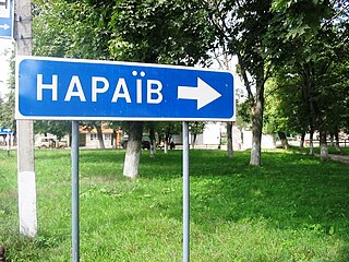
Naraiv, also Narayiv, Narajiv is a selo in Ternopil Raion of Ternopil Oblast, Ukraine. It hosts the administration of Naraiv rural hromada, one of the hromadas of Ukraine.

Stratyn is a village and rural municipality in western Ukraine. It lies in Ivano-Frankivsk Raion of Ivano-Frankivsk Oblast of Ukraine, in the centre of the historic area of Halychyna, formerly in Austrian empire (1772–1918), Poland and USSR. The current population is 561 inhabitants. The old name of the village was Striatyn. Stratyn belongs to Rohatyn urban hromada, one of the hromadas of Ukraine.

Lopushnia, Lopushnya, sometimes Lopushna is a village of 282 people in Ivano-Frankivsk Raion of Ivano-Frankivsk Oblast in the western part of Ukraine. It is the first village on the highway when entering Ivano-Frankivsk Oblast from the side of Berezhany and Ternopil Oblast. Lopushnia belongs to Rohatyn urban hromada, one of the hromadas of Ukraine. The river Narayivka flows through Lopushnia.
Lysovychi is a village in Stryi Raion, Lviv Oblast in western Ukraine. It belongs to Morshyn urban hromada, one of the hromadas of Ukraine. Local government is administered by Lysovytska village council. The population of the village is about 1770 people.

Bilshivtsi is an urban-type settlement in Ivano-Frankivsk Raion in Ivano-Frankivsk Oblast. Between 1940 and 1963 it was the center of a raion. Bilshivtsi hosts the administration of Bilshivtsi settlement hromada, one of the hromadas of Ukraine. Its population was 1,888 .
Ivan Pavlovich Maksimovich was a Ukrainian colonel of the UGA.