A postage stamp is a small piece of paper issued by a post office, postal administration, or other authorized vendors to customers who pay postage, who then affix the stamp to the face or address-side of any item of mail—an envelope or other postal cover —that they wish to send. The item is then processed by the postal system, where a postmark or cancellation mark—in modern usage indicating date and point of origin of mailing—is applied to the stamp and its left and right sides to prevent its reuse. The item is then delivered to its addressee.

South Dakota is a U.S. state in the upper Midwestern United States. It is named after the Lakota and Dakota Sioux Native American tribes, who comprise a large portion of the population and historically dominated the territory. South Dakota is the seventeenth largest by area, but the 5th least populous, and the 5th least densely populated of the 50 United States. As the southern part of the former Dakota Territory, South Dakota became a state on November 2, 1889, simultaneously with North Dakota. It is either the 39th or 40th state admitted to the union. President Benjamin Harrison shuffled the statehood papers before signing them so that no one could tell which became a state first. Pierre is the state capital, and Sioux Falls, with a population of about 187,200, is South Dakota's largest city.

Beverly Hills is a city in Los Angeles County, California. Located within 5.71 square miles (14.8 km2) and surrounded by the cities of Los Angeles and West Hollywood, it had a population of 34,109 at the 2010 census and an estimated population of 33,792 in 2019.

Agoura Hills is a city in the Santa Monica Mountains region of Los Angeles County, California. Its population was 20,330 at the 2010 census and an estimated 20,222 in 2019. It is in the eastern Conejo Valley between the Simi Hills and the Santa Monica Mountains. The city is in western Los Angeles County and is bordered to the north by Ventura County. It is 35 miles (56 km) northwest of Downtown Los Angeles and less than 10 miles (16 km) west of the Los Angeles city limits at Woodland Hills. Agoura Hills and unincorporated Agoura sit next to Calabasas, Oak Park, and Westlake Village.

Forest Hills is a borough in Allegheny County, Pennsylvania, United States. The population was 6,518 at the 2010 census, as compared to 6,831 in 2000, and 7,335 in 1990.

Penn Hills is a township with home rule status in Allegheny County, Pennsylvania, United States. The population as of the 2010 census was 42,329. Penn Hills is the second-largest municipality in Allegheny County, after the city of Pittsburgh.

Royal Air Force Menwith Hill is a Royal Air Force station near Harrogate, North Yorkshire, England, which provides communications and intelligence support services to the United Kingdom and the United States. The site contains an extensive satellite ground station and is a communications intercept and missile warning site. It has been described as the largest electronic monitoring station in the world.
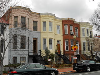
Capitol Hill, in addition to being a metonym for the United States Congress, is the largest historic residential neighborhood in Washington, D.C., stretching easterly in front of the United States Capitol along wide avenues. It is one of the oldest residential neighborhoods in Washington, D.C., and, with roughly 35,000 people in just under 2 square miles (5 km2), it is also one of the most densely populated.

The Louisville metropolitan area or Kentuckiana, also known as the Louisville–Jefferson County, Kentucky–Indiana, metropolitan statistical area, is the 45th largest metropolitan statistical area (MSA) in the United States. The principal city is Louisville, Kentucky.
141 is the natural number following 140 and preceding 142.

This is a list of the National Register of Historic Places listings in Franklin County, Massachusetts.

The Nashville metropolitan area is centered on Nashville, Tennessee, in the United States. It includes 13 counties in Middle Tennessee, reduced from 14 in September 2018 when Hickman County was removed.

This is a list of the National Register of Historic Places listings in Franklin County, Virginia.

This is a list of the National Register of Historic Places listings in Mecklenburg County, Virginia.
Cherry Hill is a township within Camden County, in the U.S. state of New Jersey. As of the 2010 United States Census, the township had a population of 71,045, reflecting an increase of 1,080 (+1.5%) from the 69,965 counted in the 2000 Census, which had in turn increased by 617 (+0.9%) from the 69,348 counted in the 1990 Census. As of 2010, the township was the state's 15th most populous municipality and the second-largest in Camden County, after having been the state's 13th most populous municipality in the 2000 Census. An edge city of Philadelphia, Cherry Hill is situated on the Delaware Valley coastal plain, approximately eight miles southeast of Center City, Philadelphia.

The Real Housewives of Beverly Hills is an American reality television series that premiered on October 14, 2010, on Bravo. Developed as the sixth installment of The Real Housewives franchise, it has aired eleven seasons and focuses on the personal and professional lives of several women residing in Beverly Hills, California.

This is a list of the National Register of Historic Places listings in Buchanan County, Missouri.
This is a list of the National Register of Historic Places listings in Rock Hill, South Carolina.

The Pennsylvania State Game Lands Number 274 are Pennsylvania State Game Lands in Berks and Lancaster Counties in Pennsylvania in the United States providing hunting, bird watching, and other activities.
The Pennsylvania State Game Lands Number 37 are Pennsylvania State Game Lands in Tioga County in Pennsylvania in the United States that provide hunting, bird watching, and other activities.


