
The Bismarck Range is a mountain range in the Western Highlands Province of Papua New Guinea. The range is named after the German Chancellor, Otto von Bismarck. From the 1880s to 1914 this part of the island was a German colony.

Cenderawasih Bay, also Teluk Sarera, formerly Geelvink Bay is a large bay in northern Province of Papua and West Papua, New Guinea, Indonesia.

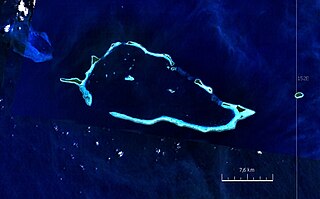
Steffen Strait is a strait near Selapiu Island, generally between New Hanover and New Ireland.
Sebakor Bay, is a bay on the west of Bomberai Peninsula in northern Province of Papua.

Bintuni Bay is the eastward extension or inner bay of Berau Bay off Bird's Head Peninsula of New Guinea. Administratively it is part of West Papua (region), Indonesia. The bay is 12 miles (19.3 km) wide at its entrance and the land on both sides is marsh.
Mount Victory is an active volcano on the north east coast of Oro Province, Papua New Guinea with a height of 1,884 metres (6,181 ft). It is bounded by the Ajova River.
Auriroa Island is an island in Milne Bay Province of Papua New Guinea.

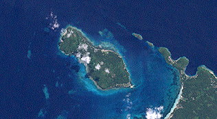
Kabakon or Kaka Kon Island is a small island in group of Duke of York Islands in the Bismark Archipelago, Papua New Guinea. August Engelhardt chose Kabakon as the island to establish his Sun-worshiping sect, notable for only eating coconuts, from 1902 until his death.
The Tua River is a tributary of the Purari River of Papua New Guinea. It originates in the Eastern Highlands Province and flows through the highlands of the Simbu Province, where it joins the Pio River, giving rise to the Purari.
Staniforth Range is a mountain range located in Gulf Province, Papua New Guinea. Yeripa and Taripa villages are the nearest populated places to the range.
Lamari River is a river that originates in Kratke Range in the south central highlands of Eastern Highlands Province of Papua New Guinea. It flows into the Purari River basin.

Nubara is island in Papua New Guinea. It is located in the east of the country, in the Milne Bay Province, about 700 km to the east of the Port Moresby.
Mioko is island in Duke of York Islands archipelago in Papua New Guinea. Located in East New Britain Province, in the east of the country, about 800 km north of Port Moresby. Island is populated.
Makada is island in Duke of York Islands archipelago in Papua New Guinea. It is located in the east of the country, in the East New Britain Province, about 800 km to the east of the Port Moresby.
Kerawara is island in Duke of York Islands archipelago in Papua New Guinea. It is located in the east of the country, in the East New Britain Province, about 800 km to the east of the Port Moresby.
Soaru Range also known as Sewori Range is a mountain range in the Southern Highlands Province in central part of Papua New Guinea, 500 km north-west of Port Moresby is the nation's capitol.
April Salome Forest Management Area also known as April Salumei Rainforest is a forest management area in April — Salumei tropical forest covering about 521,500 hectares in Ambunti-Dreikikir District of East Sepik Province, of Papua New Guinea. Forest resides in the basins of two rivers: April and Salumei. Town Ambunti serves as a gateway to the April Salome Forest Management Area.
Panarakuum Island also known as Panarakiim Island is an island in Milne Bay Province of Papua New Guinea.
Pingirip is a settlement is the Mendi-Munihu District of the Southern Highlands Province of Papua New Guinea.
Mualim is island in Duke of York Islands archipelago in Papua New Guinea. It is located in the east of the country, in the East New Britain Province, about 800 km to the east of the Port Moresby. The island is populated.


