The Global 200 is the list of ecoregions identified by the World Wide Fund for Nature (WWF), the global conservation organization, as priorities for conservation. According to WWF, an ecoregion is defined as a "relatively large unit of land or water containing a characteristic set of natural communities that share a large majority of their species dynamics, and environmental conditions". For example, based on their levels of endemism, Madagascar gets multiple listings, ancient Lake Baikal gets one, and the North American Great Lakes get none.

The Solomon Islands rain forests are a terrestrial ecoregion covering the Solomon Islands archipelago.

The Bird's Head Peninsula or Doberai Peninsula is a large peninsula that makes up the northwest portion of the island of New Guinea, comprising the Indonesian provinces of Southwest Papua and West Papua. It is often referred to as The Vogelkop, and is so named because its shape looks like a bird's head on the island of New Guinea. The peninsula at the opposite end of the island is called the Bird's Tail Peninsula. The peninsula just to the south is called the Bomberai Peninsula.
The Torricelli Mountains are a mountain range in Sandaun Province, north-western Papua New Guinea. The highest peak in the range is Mount Sulen at 1650 meters. The Bewani Mountains are located to the west, and the Prince Alexander Mountains are located to the east. To the north, the mountains slope down to the Pacific Ocean, and to the south lies the basin of the Sepik River. The mountains are named after the Italian physicist and mathematician Evangelista Torricelli during the German colonial period.

New Ireland, or Latangai, is a large island in Papua New Guinea, approximately 7,404 km2 (2,859 sq mi) in area with c. 120,000 people. It is named after the island of Ireland. It is the largest island of New Ireland Province, lying northeast of the island of New Britain. Both islands are part of the Bismarck Archipelago, named after Otto von Bismarck, and they are separated by Saint George's Channel.
The Hans Meyer Range is a mountain range in the southern part of New Ireland, Papua New Guinea. This range was named after German geographer Hans Meyer (1858–1929).
The Prince Alexander Mountains are a mountain range in Papua New Guinea. The range is located on the northern coast of New Guinea. The Torricelli Mountains lie to the west, and the basin of the Sepik River lies to the south. Mount Turu is a notable peak, located towards the eastern end of the range.

The Northern New Guinea lowland rain and freshwater swamp forests is a tropical moist broadleaf forest ecoregion of northern New Guinea.

The Central Range montane rain forests is a tropical moist forest ecoregion on the island of New Guinea. The ecoregion covers the Central Range of the New Guinea Highlands, which extends along the spine of the island. The montane rain forests of the ecoregion are distinct from the surrounding lowland forests, and are home to many endemic plants and animals.
The Huon Peninsula montane rain forests is a tropical moist forest ecoregion in New Guinea. The ecoregion covers the mountains of northeastern New Guinea's Huon Peninsula.
New Guinea, lying within the tropics and with extensive mountain areas, comprises a wide range of ecoregions. These include rainforests, grasslands and mangrove.
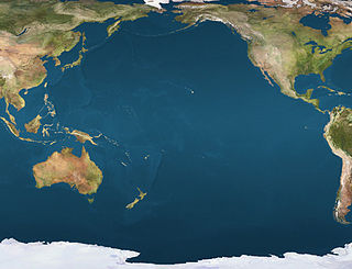
Pierre-Antoine Véron (1736–1770) was a French astronomer and mathematician. He was a disciple of astronomer and writer Jérôme Lalande at the Collège Royal. Véron is famous for having made a historical observation of the size of the Pacific Ocean. Together with Philibert Commerson, Véron was one of the main scientists that accompanied Louis Antoine de Bougainville on his voyage of exploration. He died of illness in Timor in 1770.

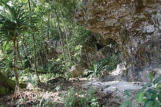
The Vogelkop–Aru lowland rain forests is a tropical moist forest ecoregion in Indonesia. The ecoregion covers the peninsular lowlands of western New Guinea, along with the Aru Islands and other nearby islands.

The Vogelkop montane rain forests is a tropical moist forest ecoregion in western New Guinea. The ecoregion covers the mountains of western New Guinea's Bird's Head and Bomberai peninsulas.
The New Britain-New Ireland lowland rain forests is a tropical moist forest ecoregion in Papua New Guinea. The ecoregion covers the lowland rain forests of New Britain, New Ireland, and nearby islands in the Bismarck Archipelago.
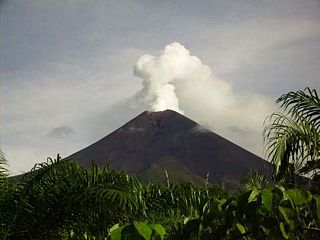
The New Britain–New Ireland montane rain forests is a tropical moist forest ecoregion in Papua New Guinea. The ecoregion includes the mountain rain forests on the islands of New Britain and New Ireland, which lie northeast of New Guinea.

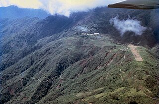
The Northern New Guinea montane rain forests is a tropical moist forest ecoregion in northern New Guinea. The ecoregion covers several separate mountain ranges lying north of New Guinea's Central Range and south of the Pacific Ocean.

The Southeastern Papuan rain forests is a tropical moist forest ecoregion in southeastern New Guinea. The ecoregion covers the mountainous center and coastal lowlands of the Papuan Peninsula.
