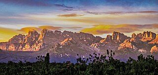
Lorentz National Park is an Indonesian national park located in the provinces of Central Papua, Highland Papua and South Papua, in the southwest of western New Guinea. With an area of 25,056 km2 (9,674 mi2), it is the largest national park in Southeast Asia. In 1999 Lorentz was declared a World Heritage Site by UNESCO.

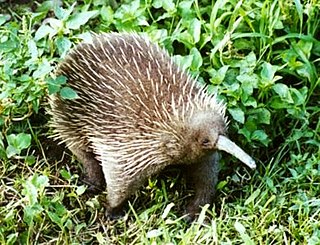
The long-beaked echidnas make up one of the two extant genera of echidnas: there are three extant species, all living in New Guinea. They are medium-sized, solitary mammals covered with coarse hair and spines made of keratin. They have short, strong limbs with large claws, and are powerful diggers. They forage in leaf litter on the forest floor, eating earthworms and insects.

Zaglossus attenboroughi, also known as Attenborough's long-beaked echidna or locally as Payangko, is one of three species from the genus Zaglossus that inhabits the island of New Guinea. It lives in the Cyclops Mountains, which are near the cities of Sentani and Jayapura in the Indonesian province of Papua. It is named in honour of naturalist Sir David Attenborough.

The eastern long-beaked echidna, also known as Barton's long-beaked echidna, is one of three species from the genus Zaglossus to occur in New Guinea. It is found mainly in the eastern half at elevations between 2,000 and 3,000 metres.

The Foja Mountains are located just north of the Mamberamo river basin in Papua, Indonesia. The mountains rise to 2,193 metres (7,195 ft), and have 3,000 square kilometers of old growth tropical rainforest in the interior part of the range. The Foja forest tract covers 9,712 square kilometers and is the largest tropical forest without roads in the Asia Pacific region.

The fauna of New Guinea comprises a large number of species of mammals, reptiles, birds, fish, invertebrates and amphibians.

The fauna of Indonesia is characterised by high levels of biodiversity and endemicity due to its distribution over a vast tropical archipelago. Indonesia divides into two ecological regions; western Indonesia which is more influenced by Asian fauna, and the east which is more influenced by Australasian species.

Lake Kutubu is the second-largest lake in Papua New Guinea, after Lake Murray, and, at 800 m above sea level, the largest upland body of water, with an area of 49.24 km², and a total catchment area of 250 km². Lake Kutubu and Lake Sentani form an ecoregion on the WWF's Global 200. Kutubu lies in the Southern Highlands Province of Papua New Guinea, east of the Kikori River into which it drains, and about 50 km southwest of Mendi, the provincial capital. It is one of the few lakes in the country that occurs in a depression in the rugged interior mountains. The lake has a few islands, the largest of which is Wasemi in its northern part. The water of Lake Kutubu, fed by several streams originating mostly from underground sources, is clear and reaches a depth of 70 m (230 feet). The catchment is inhabited by two main ethnic groups, the Foe to the south and the Fasu to the north. Thirty-three villages lie in the catchment area, with a total estimated population of 10,885.

The New Guinea Highlands, also known as the Central Range or Central Cordillera, is a long chain of mountain ranges on the island of New Guinea, including the island's highest peak, Puncak Jaya, Indonesia, 16,024 ft (4,884 m), the highest mountain in Oceania. The range is home to many intermountain river valleys, many of which support thriving agricultural communities. The highlands run generally east-west the length of the island, which is divided politically between Indonesia in the west and Papua New Guinea in the east. These mountains stretch from the Weyland Mountains starting in Wondama Bay Regency in the west to the Milne Bay Province in the east.

The Northern New Guinea lowland rain and freshwater swamp forests is a tropical moist broadleaf forest ecoregion of northern New Guinea.

New Guinea is the world's second-largest island, with an area of 785,753 km2 (303,381 sq mi). Located in Melanesia in the southwestern Pacific Ocean, the island is separated from Australia by the 150-kilometre wide Torres Strait, though both landmasses lie on the same continental shelf, and were united during episodes of low sea level in the Pleistocene glaciations as the combined landmass of Sahul. Numerous smaller islands are located to the west and east. The island's name was given by Spanish explorer Yñigo Ortiz de Retez during his maritime expedition of 1545 due to the resemblance of the indigenous peoples of the island to those in the African region of Guinea.

The Central Range montane rain forests is a tropical moist forest ecoregion on the island of New Guinea. The ecoregion covers the Central Range of the New Guinea Highlands, which extends along the spine of the island. The montane rain forests of the ecoregion are distinct from the surrounding lowland forests, and are home to many endemic plants and animals.

The Central Range sub-alpine grasslands is a montane grasslands and shrublands ecoregion on the island of New Guinea. The ecoregion covers the highest-elevation portions of the New Guinea Highlands, which extend along the spine of the island. The high elevations support rare tropical sub-alpine and alpine habitats, including many endemic plants and animals.

The Pegunungan Arfak Nature Reserve lies in the north-east corner of the Bird's Head Peninsula in the Indonesian province of West Papua. It is located 25 km south of the provincial capital Manokwari. It spans from near the coast up to the highest point in the province, Pegunungan Arfak, at 2,955 m (9,695 ft).

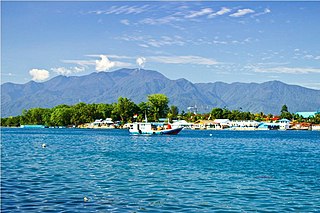
Lake Sentani is a tropical, shallow, and at low-altitude open lake located at the northeast extremity of the Jayapura Regency in the Indonesian province of Papua, about 20 kilometres (12 mi) from the provincial capital, Jayapura City. It is located just to the south of the town of Sentani.

The Vogelkop–Aru lowland rain forests is a tropical moist forest ecoregion in Indonesia. The ecoregion covers the peninsular lowlands of western New Guinea, along with the Aru Islands and other nearby islands.

The Vogelkop montane rain forests is a tropical moist forest ecoregion in western New Guinea. The ecoregion covers the mountains of western New Guinea's Bird's Head and Bomberai peninsulas.

The Northern New Guinea montane rain forests is a tropical moist forest ecoregion in northern New Guinea. The ecoregion covers several separate mountain ranges lying north of New Guinea's Central Range and south of the Pacific Ocean.

The Southeastern Papuan rain forests is a tropical moist forest ecoregion in southeastern New Guinea. The ecoregion covers the mountainous center and coastal lowlands of the Papuan Peninsula.

Highland Papua is a province of Indonesia, which roughly follows the borders of the Papuan customary region of Lano-Pago. It covers an area of 51,213.33 km2 (19,773.58 sq mi) and had a population of 1,448,360 according to the official estimates as at mid 2023.


