Related Research Articles
The Five Barbarians, or Wu Hu, is a Chinese historical exonym for five ancient non-Han "Hu" peoples who immigrated to northern China in the Eastern Han dynasty, and then overthrew the Western Jin dynasty and established their own kingdoms in the 4th–5th centuries. The peoples categorized as the Five Barbarians were:

The Northern Liang was a dynastic state of China and one of the Sixteen Kingdoms in Chinese history. It was ruled by the Juqu (沮渠) family of Lushui Hu (盧水胡) ethnicity, though they are sometimes categorized as Xiongnu in some historiographies. Although Duan Ye of Han ethnicity was initially enthroned as the Northern Liang ruler with support from the Juqu clan, Duan was subsequently overthrown in 401 and Juqu Mengxun was proclaimed monarch.

Turpan, generally known in English as Turfan, is a prefecture-level city located in the east of the autonomous region of Xinjiang, China. It has an area of 69,759 km2 (26,934 sq mi) and a population of 693,988 (2020). The historical center of the prefectural area has shifted a number of times, from Yar-Khoto to Qocho and to Turpan itself.
Heqin, also known as marriage alliance, refers to the historical practice of Chinese monarchs marrying princesses—usually members of minor branches of the ruling family—to rulers of neighboring states. It was often adopted as an appeasement strategy with an enemy state that was too powerful to defeat on the battlefield. The policy was not always effective. It implied an equal diplomatic status between the two monarchs. As a result, it was controversial and had many critics.

The Tarim Basin is an endorheic basin in Xinjiang, Northwestern China occupying an area of about 888,000 km2 (343,000 sq mi) and one of the largest basins in Northwest China. Located in China's Xinjiang region, it is sometimes used synonymously to refer to the southern half of the province, that is, Southern Xinjiang or Nanjiang, as opposed to the northern half of the province known as Dzungaria or Beijiang. Its northern boundary is the Tian Shan mountain range and its southern boundary is the Kunlun Mountains on the edge of the Tibetan Plateau. The Taklamakan Desert dominates much of the basin. The historical Uyghur name for the Tarim Basin is Altishahr, which means 'six cities' in Uyghur. The region was also called Little Bukhara or Little Bukharia.

The Hexi Corridor (Chinese: 河西走廊; pinyin: Héxī Zǒuláng; Wade–Giles: Ho2-hsi1 Tsou3-lang2, Xiao'erjing: حْسِ ظِوْلاْ, Mandarin pronunciation:[xɤ˧˥ɕi˥tsoʊ˨˩˦lɑŋ˧˥]), also known as the Gansu Corridor, is an important historical region located in the modern western Gansu province of China. It refers to a narrow stretch of traversable and relatively arable plain west of the Yellow River's Ordos Loop (hence the name Hexi, meaning "west of the river"), flanked between the much more elevated and inhospitable terrains of the Mongolian and Tibetan Plateaus.

Gaochang, also called Khocho, Karakhoja, Qara-hoja, Kara-Khoja or Karahoja, was a ruined ancient oasis city on the northern rim of the inhospitable Taklamakan Desert in present-day Sanbu Township, Xinjiang, China. The site is also known in published reports as Chotscho, Khocho, Qocho or Qočo. During the Yuan dynasty and Ming dynasty, Gaochang was referred to as "Halahezhuo" (Qara-khoja) and Huozhou. Artistic depictions of the city have been published by Albert von Le Coq. Gaochang is considered in some sources to have been a "Chinese colony", that is, it was located in a region otherwise occupied at the time by West Eurasian peoples.

Ban Chao, courtesy name Zhongsheng, was a Chinese diplomat, explorer, and military general of the Eastern Han dynasty. He was born in Fufeng, now Xianyang, Shaanxi. Three of his family members—father Ban Biao, elder brother Ban Gu, younger sister Ban Zhao—were well known historians who wrote the historical text Book of Han, which recorded the history of the Western Han dynasty. As a Han general and cavalry commander, Ban Chao was in charge of administrating the "Western Regions" while he was in service. He also led Han forces for over 30 years in the war against the Xiongnu and re-established Han control over the Tarim Basin region. He was made Protector General of the Western Regions by the Han government for his efforts in protecting and governing the regions. Ban Chao is depicted in the Wu Shuang Pu by Jin Guliang.
The Battle of Jushi took place between the Han dynasty and the Xiongnu for control of the people of the Jushi culture in the Turpan Basin in 67 BC. The battle was a success for the Han, who were led by Zheng Ji. The king of Jushi Wugui surrendered to the Han after the Han launched the attack from the Tarim Basin and besieged the city Jiaohe, capital of Jushi. The Xiongnu came with aid to Jushi, but escaped after Zheng Ji and Sima Xi confronted the armies. Zheng Ji then left 20 men with a general to protect the king of Jushi, but he was afraid of the return of Xiongnu, and fled to Wusun. The Xiongnu installed Doumo as the king of Jushi, and moved the population further east from Jiaohe. Zheng Ji then sent 300 men to seize the city.

The Han–Xiongnu War, also known as the Sino–Xiongnu War, was a series of military conflicts fought over two centuries between the Chinese Han Empire and the nomadic Xiongnu confederation, although extended conflicts can be traced back as early as 200 BC and ahead as late as 188 AD.
Liang was a traditional Chinese fief centered on present-day Kaifeng. It was held by various powers over the course of Chinese history. It generally comprised modern Henan with a small part of Shanxi.
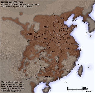
You Prefecture or YouProvince, also known by its Chinese name Youzhou, was a prefecture (zhou) in northern China during its imperial era.

The Protectorate of the Western Regions (simplified Chinese: 西域都护府; traditional Chinese: 西域都護府; pinyin: Xīyù Dūhù Fǔ; Wade–Giles: Hsi1-yü4 Tu1-hu4 Fu3) was an imperial administration (a protectorate) situated in the Western Regions administered by Han dynasty China and its successors on and off from 59 or 60 BCE until the end of the Sixteen Kingdoms period in 439 AD. The "Western Regions" refers to areas west of Yumen Pass, especially the Tarim Basin in southern Xinjiang. These areas would later be termed Altishahr (southern Xinjiang, excluding Dzungaria) by Turkic-speaking peoples. The term "western regions" was also used by the Chinese more generally to refer to Central Asia.
The Protectorate General to Pacify the West, initially the Protectorate to Pacify the West, was a protectorate established by the Chinese Tang dynasty in 640 to control the Tarim Basin. The head office was first established at the prefecture of Xi, now known as Turpan, but was later shifted to Qiuci (Kucha) and situated there for most of the period.

Jiaohe or Yarkhoto is a ruined city in the Yarnaz Valley, 10 km west of the city of Turpan in Xinjiang Uyghur Autonomous Region, China. It was the capital of the Tocharian kingdom of Jushi. It is a natural fortress located atop a steep cliff on a leaf-shaped plateau between two deep river valleys, and was an important stop along the Silk Road.
The Jushi, or Gushi, were a people probably associated with the Subeshi culture, who established a kingdom during the 1st millennium BC in the Turpan basin. The kingdom included the area of Ayding Lake, in the eastern Tian Shan range. During the late 2nd and early 1st century BC, the area was increasingly dominated by the Han dynasty and the northern neighbours of the Jushi, the Xiongnu, and became one of the many minor states of the Western Regions of Han dynasty China. In 450 AD the Northern Liang destroyed the state of Jushi (車師) and occupied its capital city of Jiaohe 交河 (Yarkhoto). Jiaohe, later known as Yarkhoto and Yarghul, was destroyed in a Mongol attack in the 13th century.
The Sixteen Kingdoms, less commonly the Sixteen States, was a chaotic period in Chinese history from AD 304 to 439 when northern China fragmented into a series of short-lived dynastic states. The majority of these states were founded by the "Five Barbarians", non-Han peoples who had settled in northern and western China during the preceding centuries, and had launched a series of rebellions against the Western Jin dynasty in the early 4th century. However, several of the states were founded by the Han people, and all of the states—whether ruled by Xiongnu, Xianbei, Di, Jie, Qiang, Han, or others—took on Han-style dynastic names. The states frequently fought against both one another and the Eastern Jin dynasty, which succeeded the Western Jin in 317 and ruled southern China. The period ended with the unification of northern China in 439 by the Northern Wei, a dynasty established by the Xianbei Tuoba clan. This occurred 19 years after the Eastern Jin collapsed in 420, and was replaced by the Liu Song dynasty. Following the unification of the north by Northern Wei, the Northern and Southern dynasties era of Chinese history began.

The Guiyi Circuit, also known as the Guiyi Army, Golden Mountain Kingdom of Western Han, Dunhuang Kingdom of Western Han, was a Chinese regional military command and later an autonomous dynastic regime nominally subordinate to the Tang dynasty, the Five Dynasties, and the Northern Song dynasty. The Guiyi Circuit was controlled by the Zhang family from the second half of the 9th century to the 10th century and then the Cao family until the 11th century. The Guiyi Circuit was headquartered in Shazhou.

The Shule Kingdom was an ancient oasis kingdom of the Taklamakan Desert that was on the Northern Silk Road, in the historical Western Regions of what is now Xinjiang in Northwest China. Its capital was Kashgar, the source of Kashgar's water being a river of the same name. Much like the neighboring people of the Kingdom of Khotan, people of Kashgar spoke Saka, one of the Eastern Iranian languages.

The military of the Han dynasty was the military apparatus of China from 202 BC to 220 AD, with a brief interregnum by the reign of Wang Mang and his Xin dynasty from 9 AD to 23 AD, followed by two years of civil war before the refounding of the Han.
References
- ↑ Elizabeth Wayland Barber (2000). Mummies of Ürümchi. W. W. Norton, Incorporated. pp. 166–. ISBN 978-0-393-32019-0.
- ↑ Grousset, Rene (1970). The Empire of the Steppes. Rutgers University Press. pp. 35, 37, 42. ISBN 0-8135-1304-9.
- ↑ Baij Nath Puri (December 1987). Buddhism in Central Asia. Motilal Banarsidass. p. 70. ISBN 978-8120803725.
- ↑ "Section 26 – The Kingdom of Nearer [i.e. Southern] Jushi 車師前 (Turfan)".
- ↑ Valerie Hansen (2015). The Silk Road: A New History. Oxford University Press. pp. 83–. ISBN 978-0-19-021842-3.
- ↑ HANSEN, Valerie. "The Impact of the Silk Road Trade on a Local Community: The Turfan Oasis, 500–800" (PDF). Yale University Press. Archived from the original (PDF) on 18 April 2009. Retrieved 14 July 2010.
- ↑ Wang, Y (1995). "A study on the migration policy in ancient China". Chin J Popul Sci. 7 (1): 27–38. PMID 12288967.
- ↑ "The Christian Library from Turfan". SOAS, University of London. Archived from the original on 14 August 2014. Retrieved 5 August 2014.
- ↑ "关于明代前期土鲁番统治者世系的几个问题". Chinese Academy of Social Sciences.[ permanent dead link ]
- ↑ Morris Rossabi (28 November 2014). From Yuan to Modern China and Mongolia: The Writings of Morris Rossabi. BRILL. pp. 45–. ISBN 978-90-04-28529-3.
- ↑ Bellér-Hann., Ildikó (1995). A History of Cathay: a translation and linguistic analysis of a fifteenth-century Turkic manuscript. Bloomington: Indiana University, Research Institute for Inner Asian Studies. p. 159. ISBN 0-933070-37-3.