Homestead Township, Chase County, Kansas

Last updated

Homestead Township
Map highlighting Homestead Township, Chase County, Kansas.svg
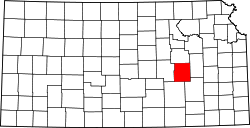
Location within Chase County
USA Kansas location map.svg
Red pog.svg
Homestead Township
Location within the state of Kansas
Coordinates: 38°09′30″N096°41′41″W / 38.15833°N 96.69472°W / 38.15833; -96.69472
Country United States
State Kansas
County Chase
Area
  Total
54.64 sq mi (141.51 km2)
  Land54.49 sq mi (141.12 km2)
  Water0.15 sq mi (0.38 km2)  0.27%
Elevation
1,430 ft (440 m)
Population
 (2000)
  Total
52
  Density1/sq mi (0.39/km2)
GNIS feature ID 0477799

Homestead Township is a township in Chase County, Kansas, United States. As of the 2000 census, its population was 52.

Contents

Geography

Homestead Township covers an area of 54.64 square miles (141.5 km2).

History

A post office under the name Homestead opened in 1876 and was discontinued in 1913. [1]

Communities

The township contains the following settlements:

Cemeteries

The township contains the following cemeteries:

References

  1. "Kansas Post Offices, 1828-1961 - Kansas Historical Society". www.kshs.org. Retrieved January 23, 2024.

Further reading