
Ellinor is a ghost town in Toledo Township, Chase County, Kansas, United States. [1] It was located southwest of Saffordville, where the BNSF Railway splits.
Ellinor is a ghost town in Toledo Township, Chase County, Kansas, United States. [1] It was located southwest of Saffordville, where the BNSF Railway splits.
Ellinor (or Elinor) had a post office from 1871 until 1881. [2]
The Atchison, Topeka and Santa Fe Railway formerly provided passenger rail service to Ellinor along their mainline until at least 1936. [3] As of 2025, the nearest passenger rail station is located in Newton, where Amtrak's Southwest Chief stops once daily on a route from Chicago to Los Angeles. [4]
Municipalities and communities of Chase County, Kansas, United States | ||
|---|---|---|
| Cities | 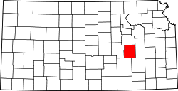 | |
| Unincorporated communities | ||
| Ghost towns | ||
| Townships | ||
| Footnotes | ‡This community also has portions in an adjacent county or counties. | |
38°23′36″N96°25′41″W / 38.39333°N 96.42806°W
| | This article about a location in Chase County, Kansas is a stub. You can help Wikipedia by expanding it. |