Matfield Township | |
|---|---|
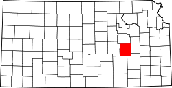
 Location within Chase County | |
| Coordinates: 38°08′40″N096°29′36″W / 38.14444°N 96.49333°W | |
| Country | United States |
| State | Kansas |
| County | Chase |
| Area | |
• Total | 122.43 sq mi (317.08 km2) |
| • Land | 122.07 sq mi (316.16 km2) |
| • Water | 0.36 sq mi (0.92 km2) 0.29% |
| Elevation | 1,424 ft (434 m) |
| Population (2000) | |
• Total | 155 |
| • Density | 1.3/sq mi (0.5/km2) |
| GNIS feature ID | 0477823 |

Matfield Township is a township in Chase County, Kansas, United States. As of the 2000 census, its population was 155.