This article includes a list of references, related reading, or external links, but its sources remain unclear because it lacks inline citations .(September 2024) |
Toledo Township | |
|---|---|
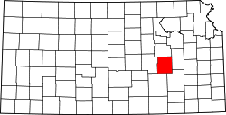
 Location within Chase County | |
| Coordinates: 38°27′00″N096°24′31″W / 38.45000°N 96.40861°W | |
| Country | United States |
| State | Kansas |
| County | Chase |
| Area | |
• Total | 90.21 sq mi (233.64 km2) |
| • Land | 89.81 sq mi (232.61 km2) |
| • Water | 0.40 sq mi (1.03 km2) 0.44% |
| Elevation | 1,198 ft (365 m) |
| Population (2000) | |
• Total | 302 |
| • Density | 3.4/sq mi (1.3/km2) |
| GNIS feature ID | 0477171 |

Toledo Township is a township in Chase County, Kansas, United States. As of the 2000 census, its population was 302.