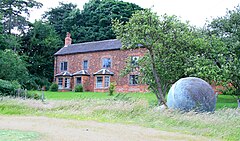
Bretby is a village and civil parish in the south of Derbyshire, England, north of Swadlincote and east of Burton upon Trent, on the border between Derbyshire and Staffordshire. The population of the civil parish as of the 2011 census was 893. The name means "dwelling place of Britons". On the A511 road, there is a secondary settlement, Stanhope Bretby, which was the site of Bretby Colliery.

Perry is a village and civil parish in Cambridgeshire, England, approximately 6 miles (10 km) south-west of Huntingdon. Perry is in Huntingdonshire, a non-metropolitan district of Cambridgeshire and historic county of England. Perry is on the shore of a reservoir, Grafham Water, a few miles from the market town of St Neots.

Hathersage is a village and civil parish in the Peak District in Derbyshire, England. It lies slightly to the north of the River Derwent, approximately 10 miles (16.1 km) south-west of Sheffield.

Chaddesden, also known locally as Chadd, is a large residential suburb of Derby, in the ceremonial county of Derbyshire, England. Historically a separate village centred on Chaddesden Hall and the 14th century St Mary's Church, the area was significantly expanded by 20th-century housing developments, and became part of the then County Borough of Derby in 1968, prior to Derby's city status in 1977.

Stilton is a village and civil parish in Cambridgeshire, England, about 12 miles (19 km) north of Huntingdon in Huntingdonshire, which is a non-metropolitan district of Cambridgeshire as well as a historic county of England.

Diddington is a small village and civil parish in Cambridgeshire, England. Diddington lies approximately 5 miles (8 km) south-west of Huntingdon, near to Buckden. Diddington is situated within Huntingdonshire which is a non-metropolitan district of Cambridgeshire as well as being a historic county of England. Its population at the time of the 2011 census was 139.

Waresley is a village and former civil parish, now in the parish of Waresley-cum-Tetworth, in Cambridgeshire, England. Waresley lies approximately 11 miles (18 km) south of Huntingdon and 5 miles (8 km) south-east of the town of St Neots. Waresley is situated within Huntingdonshire which is a non-metropolitan district of Cambridgeshire as well as being a historic county of England.
Elton is a village and civil parish in Cambridgeshire, England. Elton lies approximately 7 miles (11 km) south-west of Peterborough. Elton is situated within Huntingdonshire which is a non-metropolitan district of Cambridgeshire as well as being a historic county of England. Elton is a small village within the historic boundaries of Huntingdonshire, England. It lies on the B671 road. Elton Hall and the hamlet of Over End are located on the same road a mile south of the village.

Great Wilne is a small village in Derbyshire, England on the border with Leicestershire. It is 7 miles (11 km) south east of Derby. It is a village split from its church of St Chad's by the river. The church is at the very small hamlet of Church Wilne which can only be approached by a short walk via the bridge over the River Derwent, or by a fair car journey which necessitates travelling out of the county. The population at the 2011 Census is included in the civil parish of Shardlow and Great Wilne.
South East Derbyshire was a rural district in Derbyshire, England from 1894 to 1974. It covered an area to the south-east of Derby.

Ockbrook is a village in the Erewash district, in the county of Derbyshire, England. It is almost contiguous with the village of Borrowash, the two only separated by the A52. The civil parish is Ockbrook and Borrowash. The population of this civil parish at the 2011 Census was 7,335. Ockbrook lies about 5 miles (8.0 km) east of Derby.

Breaston is a large village and civil parish in the Erewash district, in the south-east of Derbyshire and lies approximately 6.81 miles (10.96 km) east of the city of Derby and 8 miles (13 km) west of the city of Nottingham. The population of the civil parish as taken at the 2011 Census was 4,455. The settlement name Breaston means 'Braegd's farm/settlement': for a personal name and 'tūn' for either an enclosure, farmstead, village, etc.

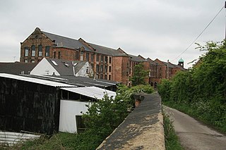
Brimington is a large village and civil parish in the Borough of Chesterfield in Derbyshire, England. The population of the parish taken at the 2011 census was 8,788. The town of Staveley is to the east, and Hollingwood is nearby. The parish includes Brimington Common along the Calow Road, and New Brimington, a late 19th-century extension towards the Staveley Iron Works.
Draycott is a village in the Erewash district of Derbyshire, England. It lies around 6 miles east of Derby and 3 miles south-west of Long Eaton. Draycott is part of the civil parish of Draycott and Church Wilne. The population of this civil parish was 3,090 as taken at the 2011 Census. The meandering course of the River Derwent forms the southwestern boundary of the parish.

Draycott and Church Wilne is a civil parish within the Borough of Erewash, which is in the county of Derbyshire, England. Partially built up and otherwise rural, its population was 3,090 residents in the 2011 census. The parish is 100 miles (160 km) north west of London, 5+1⁄2 miles (8.9 km) south east of the county city of Derby, and 3 miles (4.8 km) west of the nearest market town of Long Eaton. It shares a boundary with the parishes of Breaston, Elvaston, Hopwell, Ockbrook and Borrowash, Risley and Shardlow and Great Wilne.
Lullington is a village and civil parish in the district of South Derbyshire in Derbyshire, England. The population of the civil parish at the 2011 Census was 121. It has an All Saints' Church, a village hall and a pub, the Colvile Arms. Together with neighbouring Netherseal, it is the southernmost village in Derbyshire.

Stanton by Dale, also written as Stanton-by-Dale and sometimes referred to as simply Stanton, is a village and civil parish in the south east of Derbyshire, England. According to the University of Nottingham English Place-names project, the settlement name Stanton-by-Dale could mean 'Stony farm or settlement', stān for stone or rock; and tūn for an enclosure; farmstead; village; or an estate. It lies 2.65 miles (4.26 km) south of Ilkeston and 1.31 miles (2.11 km) north of Sandiacre. Since 1974 it has been part of the Erewash borough. The village is halfway between the cities of Derby 6.98 miles (11.23 km) and Nottingham 6.81 miles (10.96 km), as the crow flies, from each city. The population of the civil parish at the 2011 census was 505.

Cusworth is a village and suburb of Doncaster in South Yorkshire, England, located 2 miles (3.2 km) to its north-west within the civil parish of Sprotbrough and Cusworth and the City of Doncaster, with a population of 4,728. It is home to Cusworth Hall, an 18th century country house, and its surrounding parkland. Some buildings in the old village can be dated back to the 16th century.
Elections to Erewash District Council were held on 10 May 1973 as part of nationwide local elections. The new district was formed by the merger of the Borough of Ilkeston, the Long Eaton urban district and the parishes of Breadsall, Breaston, Dale Abbey, Draycott and Church Wilne, Hopwell, Little Eaton, Morley, Ockbrook, Risley, Sandiacre, Stanley, Stanton by Dale and West Hallam from the South East Derbyshire Rural District. The new council became a shadow authority before taking over from the existing local authorities on 1 April 1974. The election saw the Labour Party gain control of the Council. Erewash District Council was granted Borough Status in 1975 and from thereon became known as Erewash Borough Council.
The Hundreds of Derbyshire were the geographic divisions of the historic county of Derbyshire for administrative, military and judicial purposes. They were established in Derbyshire some time before the Norman conquest. In the Domesday Survey of 1086 AD the hundreds were called wapentakes. By 1273 the county was divided into 8 hundreds with some later combined, becoming 6 hundreds over the following centuries. The Local Government Act 1894 replaced hundreds with districts. Derbyshire is now divided into 8 administrative boroughs within the Derbyshire County Council area.