Leyton is a town in East London, England, within the London Borough of Waltham Forest. It borders Walthamstow to the north, Leytonstone to the east, and Stratford to the south, with Clapton, Hackney Wick and Homerton, across the River Lea, to the west. The area includes New Spitalfields Market, Leyton Orient Football Club, as well as part of the Queen Elizabeth Olympic Park. The town consists largely of terraced houses built between 1870 and 1910, interspersed with some modern housing estates. It is 6.2 miles (10 km) north-east of Charing Cross.

Walthamstow is a town in the London Borough of Waltham Forest, around 7.5 miles (12 km) north-east of Central London. The town borders Chingford to the north, Snaresbrook and South Woodford to the east, Leyton and Leytonstone to the south, and Tottenham to the west. At the 2011 census, the town had a population of approximately 109,424.

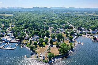
Essex is a town in Essex County, New York, United States overlooking Lake Champlain. The population was 621 at the 2020 census. The town is named after locations in England.

Maidenhead is a market town in the Royal Borough of Windsor and Maidenhead in the county of Berkshire, England, on the southwestern bank of the River Thames. In the 2021 Census, it had an estimated population of 70,374 and forms part of the border with southern Buckinghamshire. The town is situated 27 miles (43 km) west of Charing Cross, London and 13 miles (21 km) east-northeast of the county town of Reading. The town differs from the Parliamentary constituency of Maidenhead, which includes a number of outer suburbs and villages, including villages which form part of the Borough of Wokingham such as Twyford, Charvil, Remenham, Ruscombe and Wargrave.

Boreham is a village and civil parish in Essex, England. The parish is in the City of Chelmsford and Chelmsford Parliament constituency. The village is approximately 3.7 miles (6.0 km) northeast of the county town of Chelmsford.

Waltham Abbey is a town and civil parish in the Epping Forest District of Essex, within the metropolitan and urban area of London, England, 13.5 miles (21.7 km) north-east of Charing Cross. It lies on the Greenwich Meridian, between the River Lea in the west and Epping Forest in the east, with large sections forming part of the Metropolitan Green Belt.

Chartham is a village and civil parish in the Canterbury district of Kent, England. It is situated on the Ashford side of the city, and is in the North Downs area of Outstanding Natural Beauty, 2.3 mi (4 km) south west of Canterbury, England. The Great Stour Way path passes through the village. A paper mill in the village that had specialised in the production of tracing paper since 1938 has in 2022 closed down. There are numerous arable farms and orchards in the parish. The village has an unstaffed station, Chartham, and has recently upgraded its staffed level crossing to an automatic barrier. It has an outlying locality sharing in many of the community resources, Chartham Hatch. Its current

Tillingham is a small village and civil parish with 1,015 inhabitants in 2001, increasing to 1,058 at the 2011 Census. Located 8 miles (13 km) from Burnham-on-Crouch and 3 miles (4.8 km) from Bradwell-on-Sea, on the Dengie Peninsula which is a Maldon District part of the ceremonial county of Essex in England. It is one of the villages that make up the ancient Dengie Hundred, which is bounded by the North Sea, River Blackwater and River Crouch.

Stapleford Abbotts is a village and civil parish in the Epping Forest district of Essex, approximately 5.5 mi (9 km) SW of Ongar, 4.5 mi (7 km) N of Romford and 5 mi (8 km) SSE of Epping. The whole parish is within the M25 motorway. The village covers 957 hectares and had a population of 959 in 2001, increasing to 1,008 at the 2011 Census.

For the historic house in Essex called Langley's, see Great Waltham.

The A130 is a major road in England linking Howe Green, near Chelmsford, the county town of Essex, with Canvey Island in the south of that county. It is a primary route for some of its length, only losing that status south of the A13 junction at Sadlers Farm roundabout as it nears its terminus on Canvey Island. It was originally a much longer cross-country route.

Little Waltham is a village and civil parish just north of Chelmsford, in Essex, England. It is adjacent to the village of Great Waltham. The Domesday Book refers to the two villages as Waltham, consisting of several manors. The site of an Iron Age village was excavated before upgrading the main road north between the current villages.

Epping is a market town and civil parish in the Epping Forest District of Essex, England. Part of the metropolitan and urban area of London, it is 17 miles (30 km) north-east of Charing Cross. It is surrounded by the northern end of Epping Forest, and on a ridge of land between the River Roding and River Lea valleys.

Great Waltham, also known as Church End, is a village and civil parish in the Chelmsford district, in the county of Essex, England.

Clatterford End is hamlet in the civil parish of Stanford Rivers, and in the Epping Forest district of Essex, England. The hamlet is situated between the parish villages of Toot Hill and Stanford Rivers. It should not be confused with Clatterford End, Fyfield or Clatterford End, High Easter.

Littley Green is a hamlet in the civil parish of Great Waltham and the Chelmsford borough of Essex, England. The hamlet is at the extreme north of Great Waltham, with the nearest settlement the hamlet of Hartford End, less than 1 mile (2 km) west in the civil parish of Felsted.

Epping Upland, formerly just Epping is a village and civil parish in the Epping Forest district of Essex, England.
Monticello is a hamlet west of Richfield Springs located at the corner of CR-24 and CR-25 in the Town of Richfield, Otsego County, New York, United States. The community is known by its historic name of Monticello. It was once a busy hamlet along the Skaneateles Turnpike. The source of Hyder Creek is near the hamlet. Richfield Springs bears a street over a hill on the southwest of the village called Monticello Street, which leads directly to the hamlet.

Coopersale, also termed Coopersale Common, is a village in the civil parish of Epping, within the Epping Forest District of Essex, England. In 2018 it had an estimated population of 1019.

Jacks Hatch, is a hamlet in the Epping Upland civil parish of the Epping Forest district of Essex, England.


