
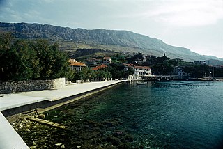
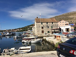
Split-Dalmatia County is a central-southern Dalmatian county in Croatia. The administrative center is Split. The population of the county is 455,242 (2011). The land area is 14.106,40 km2. Split-Dalmatia County is Croatia's most rapidly urbanising and developing region, as economic opportunities and living standards are among the highest alongside capital Zagreb and Istria County.

Sinj is a town in the continental part of Split-Dalmatia County, Croatia.

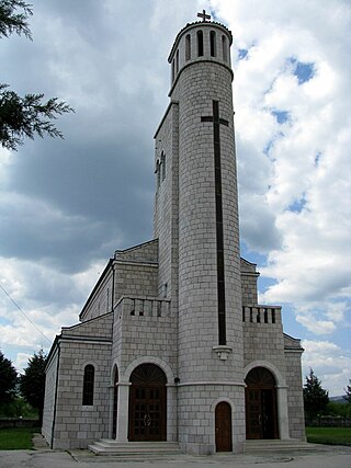
Vrlika is a small town in inland Split-Dalmatia County, Croatia. The closest large towns are Sinj, Knin, and Drniš. Vrlika was given the status of town in 1997. Vrlika is an underdeveloped municipality which is statistically classified as the First Category Area of Special State Concern by the Government of Croatia.
Čitluk is a village near Sinj, Split-Dalmatia County, Croatia. It is located at and has a population of 488.
Otok is a municipality and a village in inland Dalmatia, Croatia, located east of Sinj, approximately 7 kilometers away. Otok is bordered by the river Cetina and mountain Kamešnica.

Smokvica is a village on the island of Korčula and a municipality in the Dubrovnik-Neretva County in Croatia. Smokvica is located in the centre of the island of Korčula, about 4 kilometers west of Čara, 13 kilometers east of Blato and 4 kilometers north from Brna. It is known as the birthplace of one of the best-known Croatian wines - Pošip.
Civljane is a village and municipality in Šibenik-Knin County, Croatia. With only 239 inhabitants, it is the smallest municipality in Croatia by population. Civljane is an underdeveloped municipality which is statistically classified as the First Category Area of Special State Concern by the Government of Croatia.

Cista Provo is a municipality in Croatia in the Split-Dalmatia County. It has a population of 2,335, in an area of 98 km2 (38 sq mi). Around Cista Provo, there are a few villages, including Olujići, Dumancici, and Kasumi.
Dicmo is a municipality in Croatia in the Split-Dalmatia County.
Dugi Rat is a village and a municipality in Croatia in the Split-Dalmatia County.

Dugopolje is a village and a municipality in Croatia in the Split-Dalmatia County.
Seget is a municipality in Croatia in the Split-Dalmatia County.
Zadvarje is a village and a municipality in the Split-Dalmatia County, Croatia. It has a population of 289, 99.3% of which are Croats. The only settlement in Zadvarje municipality is Zadvarje itself.
Viljevo is a village and a municipality in Osijek-Baranja County, Croatia.
Muć is a village and a municipality in Croatia. It is part of the Split-Dalmatia County, located in the Zagora region near Sinj. The total population of the municipality is 4,074, and it is made up of 17 villages.
Otišić is a small village in the Split-Dalmatia County, Croatia. Located in inland Dalmatia, south of Vrlika, on the State route D1 between towns of Sinj and Vrlika. Otišić is a settlement in the Vrlika municipality, with a population of about 20, the majority of whom are ethnic Serbs. The 1991 census, held before the War in Croatia (1991–1995), registered Otišić with a population of 1,006, out of which 996 were ethnic Serbs. During the War, the village was held by the Republic of Serb Krajina. In 2007, the settlement, which had up until then been a part of Sinj, was joined into Vrlika. Otišić spreads on 51.01 km2, between mountain Svilaja on the southwest and 25-km long Peruća Lake - Power Plant Accumulation on the northeast. There are the following hamlets or geographical parts of the village: Draga Otišićka, Gaj, Poljana, Ječmište, Krivošija, Dubrava, Ograde, Poljice Otišićko, Rudopolje Sinjsko, Svilaja, Ševina Njiva, Tavan, and Vlake.
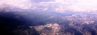
Lake Peruća or Peruča is the second largest artificial lake in Croatia, after Lake Dubrava. It is located in the Split-Dalmatia County.
Koljane is a small village in Split-Dalmatia County, Croatia. Koljane is a settlement in the Vrlika municipality, and the majority of the population are Croats. In the 1991 census, the population of Koljane was 285, and the majority were Serbs with 90% (257).
Bajagić is a village in Sinj municipality, Split-Dalmatia County, Croatia. Population is 562 (2011).
Laktac, is a settlement in the Hrvace municipality in Croatia.

