A caldera is a large cauldron-like hollow that forms shortly after the emptying of a magma chamber in a volcano eruption. When large volumes of magma are erupted over a short time, structural support for the rock above the magma chamber is gone. The ground surface then collapses into the emptied or partially emptied magma chamber, leaving a large depression at the surface. Although sometimes described as a crater, the feature is actually a type of sinkhole, as it is formed through subsidence and collapse rather than an explosion or impact. Compared to the thousands of volcanic eruptions that occur each century, the formation of a caldera is a rare event, occurring only a few times per century. Only seven caldera-forming collapses are known to have occurred between 1911 and 2016. More recently, a caldera collapse occurred at Kīlauea, Hawaii in 2018.

Lake Toba is a large natural lake in North Sumatra, Indonesia, occupying the caldera of a supervolcano. The lake is located in the middle of the northern part of the island of Sumatra, with a surface elevation of about 900 metres (2,953 ft), the lake stretches from 2.88°N 98.52°E to 2.35°N 99.1°E. The lake is about 100 kilometres long, 30 kilometres (19 mi) wide, and up to 505 metres (1,657 ft) deep. It is the largest lake in Indonesia and the largest volcanic lake in the world. Toba Caldera is one of twenty geoparks in Indonesia, and was recognised in July 2020 as one of the UNESCO Global Geoparks.

A volcano is a rupture in the crust of a planetary-mass object, such as Earth, that allows hot lava, volcanic ash, and gases to escape from a magma chamber below the surface.

The Bukit Barisan or the Barisan Mountains are a mountain range on the western side of Sumatra, Indonesia, covering nearly 1,700 km (1,050 mi) from the north to the south of the island. The Bukit Barisan range consists primarily of volcanoes shrouded in dense jungle cover, including Sumatran tropical pine forests on the higher slopes. The highest peak of the range is Mount Kerinci at 3,800 metres (12,467 ft). The Bukit Barisan Selatan National Park is situated towards the southern end of the range Liwa, Indonesia.

Pacaya is an active complex volcano in Guatemala, which first erupted approximately 23,000 years ago and has erupted at least 23 times since the Spanish conquest of Guatemala. It rises to an elevation of 2,552 metres (8,373 ft). After being dormant for over 70 years, it began erupting vigorously in 1961 and has been erupting frequently since then. Much of its activity is Strombolian, but occasional Plinian eruptions also occur, sometimes showering the area of the nearby Departments with ash.

Masaya is a caldera located in Masaya, Nicaragua, 20 km (12 mi) south of the capital Managua. It is Nicaragua's first and largest national park, and one of 78 protected areas of Nicaragua. The complex volcano is composed of a nested set of calderas and craters, the largest of which is Las Sierras shield volcano and caldera. Within this caldera lies a sub-vent, which is Masaya Volcano sensu stricto. The vent is a shield type composing of basaltic lavas and tephras and includes a summit crater. This hosts Masaya caldera, formed 2,500 years ago by an 8 km3 (1.9 cu mi) basaltic ignimbrite eruption. Inside this caldera a new basaltic complex has grown from eruptions mainly on a semi-circular set of vents that include the Masaya and Nindiri cones. The latter host the pit craters of Masaya, Santiago, Nindiri and San Pedro. Observations in the walls of the pit craters indicate that there have been several episodes of cone and pit crater formation.

The Volcán Barú is an active stratovolcano and the tallest mountain in Panama, at 3,474 metres (11,398 ft) high. It lies about 35 km (22 mi) off the border of Costa Rica. It is also the twelfth highest peak in Central America.

Reventador is an active stratovolcano which lies in the eastern Andes of Ecuador. It lies in a remote area of the national park of the same name, which is Spanish for "exploder". Since 1541, it has erupted over 25 times, although its isolated location means that many of its eruptions have gone unreported.

Billy Mitchell is a pyroclastic shield in the central part of the island of Bougainville, just north-east of the Bagana Volcano in Papua New Guinea. It is a small pyroclastic shield truncated by a 2 km wide caldera filled by a crater lake. It is named after Billy Mitchell, a 20th-century United States Army general who is regarded as the father of the United States Air Force.

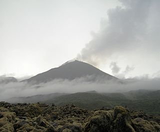
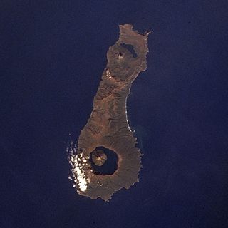
Tao-Rusyr Caldera is a stratovolcano located at the southern end of Onekotan Island, Kuril Islands, Russia. It has 7.5 km wide caldera formed during a catastrophic eruption less than 10,000 years ago. The waters of Kol'tsevoe Lake fill the caldera, along with a large symmetrical andesitic cone, Krenitsyn Peak, that rises as an island within the lake. This volcano was named after Captain Pyotr Krenitsyn of the Imperial Russian Navy.

Mount Silverthrone, officially named Silverthrone Mountain, is a mountain in the Pacific Ranges of the Coast Mountains of British Columbia, Canada, located over 320 km (200 mi) northwest of the city of Vancouver and about 50 km (30 mi) west of Mount Waddington, British Columbia, Canada. It is the highest peak in the Ha-Iltzuk Icefield, which is the largest icefield in the Coast Mountains south of the Alaska Panhandle.

Seulawah Agam is an extensive forested stratovolcano located at the northwestern tip of Sumatra. Several names have been given to the mountain: Seulawaih Agam, Seulawain Agam, Solawa Agam, Solawaik Agam, Selawadjanten and Goldberg.
Sekincau is a volcano with two calderas, Belirang and Balak, located in the south of Sumatra, Indonesia. A 300 m wide of crater is found at the summit. Fumarole activities are found at the foot of calderas.

The volcano Tacaná is the second highest peak in Central America at 4,060 metres (13,320 ft), located in the Sierra Madre de Chiapas of northern Guatemala and southern Mexico. It is also known in Mexico as Volcán Tacina.

Mount Tujuh is a caldera volcano in the Barisan Mountains of Sumatra. It has seven (tujuh) peaks, of which only three have been climbed. Mount Tujuh has a large caldera lake at its centre, Lake Gunung Tujuh. It is located within Kerinci Seblat National Park.

Mount Natib is a dormant stratovolcano and caldera complex in the province of Bataan on western Luzon Island of the Philippines. The volcano complex occupies the northern portion of the Bataan Peninsula. The mountain and adjacent surrounding is a protected area first declared as the Bataan National Park in 1945.

This timeline of volcanism on Earth includes a list of major volcanic eruptions of approximately at least magnitude 6 on the Volcanic explosivity index (VEI) or equivalent sulfur dioxide emission during the Quaternary period. Other volcanic eruptions are also listed.
Calabozos is a Holocene caldera in central Chile's Maule Region. Part of the Chilean Andes' volcanic segment, it is considered a member of the Southern Volcanic Zone (SVZ), one of the three distinct volcanic belts of South America. This most active section of the Andes runs along central Chile's western edge, and includes more than 70 of Chile's stratovolcanoes and volcanic fields. Calabozos lies in an extremely remote area of poorly glaciated mountains.

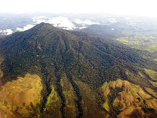
Mount Matsurai, natively known as Gunung Masurai, is a large complex of inactive stratovolcanoes in Jambi, Sumatra, Indonesia. The volcano attains an elevation of 2,916 m (9,567 ft) above sea level.


