Copley is a town in the Australian state of South Australia. At the 2006 census, Copley had a population of 104.
The lands administrative divisions of South Australia are the cadastral units of counties and hundreds in South Australia. They are located only in the south-eastern part of the state, and do not cover the whole state. 49 counties have been proclaimed across the southern and southeastern areas of the state historically considered to be arable and thus in need of a cadastre. Within that area, a total of 540 hundreds have been proclaimed, although five were annulled in 1870, and, in some cases, the names reused elsewhere.

Marananga is a locality in South Australia. It was known as Gnadenfrei before 1918 when names of "enemy origin" were changed to sound less German.
Buchfelde is now a suburb of Gawler, South Australia, on the northern outskirts of Adelaide in South Australia.

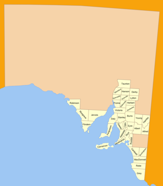
The Hundred of Bagot is a cadastral hundred in the County of Eyre in South Australia. It is located between the Mount Lofty Ranges on the west and the Murray River further to the east. The Hundred of Bagot is almost exactly spans the boundaries of the contemporary town of Sedan.

Mount Mary is a small town on the Thiele Highway between Eudunda and Morgan in South Australia. It was also served by the Morgan railway line from 1878 until 1969 and is named for the Mount Mary railway station on that line.

Rosedale is a small town in the south western Barossa Valley in South Australia. Prior to renaming placenames of enemy origin in 1918, Rosedale was named Rosenthal.

The County of Jervois is a cadastral unit in the Australian state of South Australia that covers land on the east coast of the Eyre Peninsula. It was proclaimed on 24 January 1878 and named after William Jervois, the Governor of South Australia from October 1877 to January 1883.
The Hundred of Jellicoe is a cadastral hundred in the County of Eyre in South Australia. It is located on the east Mount Lofty Ranges foothills. The Hundred of North Rhine was proclaimed in 1851 but the name was changed in 1918 to the current, after Admiral John Jellicoe, as part of a process to remove "names of enemy origin" at the time of World War I.
The Hundred of Caltowie is a cadastral unit of hundred in South Australia centred on the township of Caltowie. It is one of the 14 hundreds of the County of Victoria and was proclaimed by Governor James Fergusson in July 1871.

The Hundred of Ninnes is a cadastral unit of hundred located in the Mid North of South Australia centred on the Ninnes Plain. It is one of the 16 hundreds of the County of Daly and was proclaimed by Governor Anthony Musgrave on the last day of 1874.
The Hundred of Kongorong is a cadastral division of the County of Grey in southeastern South Australia. It was named on 12 June 1862 after an indigenous phrase thought to mean "the corner of it".
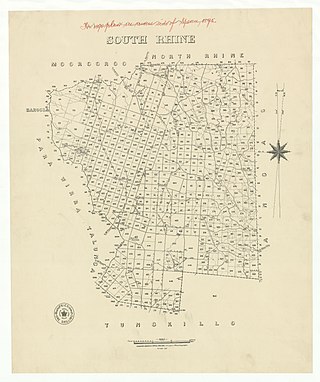
The Hundred of Jutland is a hundred of the County of Sturt in South Australia. It is located on the east Mount Lofty Ranges foothills. The Hundred of South Rhine was proclaimed in 1851 but the name was changed in 1918 to the current, after the Battle of Jutland which took place off the coast of Denmark in 1916. The name change was part of a process to remove "names of enemy origin" at the time of World War I.
The Hundred of Karcultaby is a cadastral unit of hundred located on the northern Eyre Peninsula of South Australia spanning the townships of Poochera, Karcultaby and surrounds. One of the 24 hundreds of the County of Robinson, it was proclaimed in 1913 by Governor Day Bosanquet and named for Karcultaby Homestead, in the extreme southeast of the hundred.
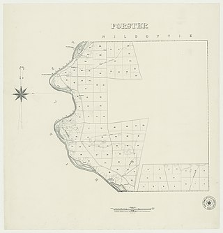
The Hundred of Forster, formerly the hundreds of Giles and Morphett, is a cadastral hundred in the County of Albert, South Australia.
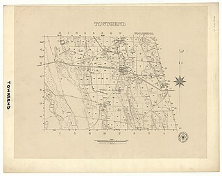
The Hundred of Townsend is a cadastral unit of hundred located in the Limestone Coast region in the south-east of South Australia.

The Hundred of Wiltunga is a cadastral unit of hundred located in the Mid North of South Australia west of the Barunga Range. It is one of the 16 hundreds of the County of Daly and was proclaimed by Governor Anthony Musgrave on the last day of 1874.

The Hundred of Nuriootpa is a cadastral unit of hundred in the County of Light, South Australia split between in the eastern Adelaide Plains and western Barossa Valley. Named in 1847 for an indigenous term officially thought to mean "bartering place" and traditionally used as neutral ground for trading between various indigenous tribes, it is bounded on the south and east by the North Para River.
Maude is a locality on the Goyder Highway in the Mid North region of South Australia.
