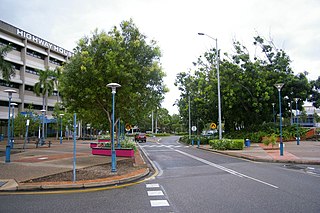
Palmerston is a planned satellite city of Darwin, the capital and largest city of Australia's Northern Territory. The city is situated approximately 20 kilometres from Darwin and 10 kilometres from Howard Springs and the surrounding rural areas. Palmerston had a population of 33,695 at the 2016 census, making it the second largest city in the Northern Territory.

The Top End of Australia's Northern Territory is a geographical region encompassing the northernmost section of the Northern Territory, which aside from the Cape York Peninsula is the northernmost part of the Australian continent. It covers a rather vaguely defined area of about 245,000 square kilometres (95,000 sq mi) behind the northern coast from the Northern Territory capital of Darwin across to Arnhem Land with the Indian Ocean on the west, the Arafura Sea to the north, and the Gulf of Carpentaria to the east, and with the almost waterless semi-arid interior of Australia to the south, beyond the huge Kakadu National Park.

The Litchfield Council is a local government area of the Northern Territory of Australia on the eastern and southeastern outskirts of the Darwin-Palmerston urban area. The municipality covers an area of 2,903 square kilometres (1,120.9 sq mi), and was created by the Northern Territory government on 6 September 1985.

Lands administrative divisions of Australia are the cadastral divisions of Australia for the purposes of identification of land to ensure security of land ownership. Most states term these divisions as counties, parishes, hundreds, and other terms. The eastern states of Queensland, New South Wales, Victoria, and Tasmania were divided into counties and parishes in the 19th century, although the Tasmanian counties were renamed land districts in the 20th century. Parts of South Australia (south-east) and Western Australia (south-west) were similarly divided into counties, and there were also five counties in a small part of the Northern Territory. However South Australia has subdivisions of hundreds instead of parishes, along with the Northern Territory, which was part of South Australia when the hundreds were proclaimed. There were also formerly hundreds in Tasmania. There have been at least 600 counties, 544 hundreds and at least 15,692 parishes in Australia, but there are none of these units for most of the sparsely inhabited central and western parts of the country.

Palmerston County is one of the five counties in the Northern Territory of Australia which are part of the Lands administrative divisions of Australia. It contains the city of Darwin. It was proclaimed on 14 September 1871 and divided into hundreds. Being on the northern coast of the territory, it is bounded on the north and west by sea, the Adelaide River on the east and on the south by a line at longitude approximately 13°15' south.
Durack is an inner-city suburb of Palmerston. It is 22 km southeast of the Darwin CBD. Its local government area is the City of Palmerston. It is located on the traditional Country and waterways of the Larrakia people.

The Hundred of Bagot is the cadastral unit of hundred for the city of Darwin, Northern Territory and the city of Palmerston. It includes the Local Government Areas of the City of Darwin, the northern part of the City of Palmerston and part of the north-western edge of the Shire of Litchfield.
The Hundred of Ayers is a hundred within Palmerston County, in the Northern Territory, Australia.
The Hundred of Hutchison is a hundred in the Northern Territory of Australia within the former County of Palmerston.
The Hundred of Strangways is a hundred of Palmerston County, Northern Territory Australia.
The Hundred of Guy is a Hundred of Palmerston County, Northern Territory Australia.
The Hundred of Goyder is a hundred in the Northern Territory of Australia which was part of the now-lapsed cadastral unit of the County of Palmerston.
The Hundred of Finniss is a hundred of Palmerston County, Northern Territory, Australia. It is located at latitude -13°01'S and longitude 130°48'E.
The Hundred of Milne is a cadastral unit of hundred in Palmerston County, Northern Territory, Australia.
The Hundred of Cavenagh is a Hundred of Palmerston County, Northern Territory Australia.
The Hundred of Howard is a hundred of Palmerston County, Northern Territory Australia.
The Hundred of Blyth is a hundred of Palmerston County, Northern Territory, Australia.
The District Council of Meningie was a local government area in the colony and then the Australian state of South Australia that existed from 1888 to 1997 on land in the state’s south-east.
Rakula is a locality in the Northern Territory of Australia, located about 72 kilometres (45 mi) south-west of the territorial capital of Darwin.
Glyde Point is a locality in the Northern Territory of Australia located about 37 kilometres (23 mi) north-east of the territory capital of Darwin.
