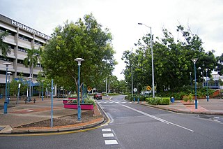
Palmerston is a planned satellite city of Darwin, the capital and largest city in Australia's Northern Territory. The city is situated approximately 20 kilometres from Darwin and 10 kilometres from Howard Springs and the surrounding rural areas. Palmerston had a population of 33,695 at the 2016 census, making it the second largest city in the Northern Territory.

Lands administrative divisions of Australia are the cadastral divisions of Australia for the purposes of identification of land to ensure security of land ownership. Most states term these divisions as counties, parishes, hundreds, and other terms. The eastern states of Queensland, New South Wales, Victoria, and Tasmania were divided into counties and parishes in the 19th century, although the Tasmanian counties were renamed land districts in the 20th century. Parts of South Australia (south-east) and Western Australia (south-west) were similarly divided into counties, and there were also five counties in a small part of the Northern Territory. However South Australia has subdivisions of hundreds instead of parishes, along with the Northern Territory, which was part of South Australia when the hundreds were proclaimed. There were also formerly hundreds in Tasmania. There have been at least 600 counties, 544 hundreds and at least 15,692 parishes in Australia, but there are none of these units for most of the sparsely inhabited central and western parts of the country.

Palmerston County is one of the five counties in the Northern Territory of Australia which are part of the Lands administrative divisions of Australia. It contains the city of Darwin. It was proclaimed on 14 September 1871 and divided into hundreds. Being on the northern coast of the territory, it is bounded on the north and west by sea, the Adelaide River on the east and on the south by a line at longitude approximately 13°15' south.

Rapid Creek is both a creek in the city of Darwin, Northern Territory, Australia and the name of a suburb north of the city, situated where the creek empties into Darwin Harbour.

Brinkin is a northern suburb of Darwin, the capital city of the Northern Territory, Australia. It is located 12 kilometres (7 mi) north of Darwin's central business district, and is home to the Casuarina campus of Charles Darwin University.

Alawa is a northern suburb of the city of Darwin, Northern Territory, Australia. It is bounded by Trower and Dripstone Roads, Lakeside Drive and the Rapid Creek. It is in the local government area of City of Darwin.

Berrimah is an eastern suburb in the city of Darwin, in the Northern Territory of Australia.

Coconut Grove is a northern suburb of the city of Darwin, Northern Territory, Australia within the local government area of City of Darwin.

The Gardens is an inner suburb of the city of Darwin, Northern Territory, Australia.

Ludmilla is a northern inner suburb of the city of Darwin, Northern Territory, Australia. Ludmilla is a predominantly residential suburb and is usually associated with the adjacent inner Darwin suburbs of Parap, Fannie Bay and Stuart Park. The indigenous community of Bagot is located in Ludmilla.

Archer is a relatively new and still sparsely populated suburb in the southwestern part of Palmerston. It is 25 km SE of the Darwin CBD and 5.4 km from Palmerston City. Its local government area is the City of Palmerston. Archer is the largest suburb of Palmerston by area.
Durack is an inner-city suburb of Palmerston. It is 22 km southeast of the Darwin CBD. Its local government area is the City of Palmerston. Durack is bound to the north by the Stuart Highway; to the west and south is University Avenue, and to the east is Roystonea Avenue. The suburb consists mostly of recent developments, beginning in the early 1990s, and includes three estates as designated by the developers of the area: Fairway Waters, The Mews, and The Heights.
Driver is an inner-city suburb of Palmerston. It is 23 km SE of the Darwin CBD. Its Local Government Area is the City of Palmerston. Durack is bounded to the north by University Ave, to the west Elrundie Avenue, to the east Temple Terrace and to the south Tilston Avenue. The suburb is mostly composed of developments from the early 1980s.
Marlow Lagoon is an outer western suburb of Palmerston 24 km SE of the Darwin CBD. Its local government area is the City of Palmerston. Marlow Lagoon is bounded to the west by the Adelaide-Darwin Railway, and to the east by Elrundie Ave.
Mitchell is a suburb in the Northern Territory of Australia located in the city of Palmerston about 18 kilometres (11 mi) south-east of Darwin City.
Bees Creek is an outer rural area of Darwin, Northern Territory, Australia. It is 33 km southeast of the Darwin central business district. It is the council seat of the local government area of the Litchfield Municipality, although most council facilities, public amenities and the actual Municipal offices are in the neighbouring locality of Freds Pass. Bees Creek is mostly rural, with large residential blocks often not served by town sewers or sealed roads. Nevertheless, the area is popular with those wishing to enjoy a rural lifestyle within an easy commuting distance of the city.

Coolalinga is an outer suburban area in Darwin. It is 29 kilometres (18 mi) south east of Darwin, 10 kilometres (6.2 mi) south east of Palmerston and 6 kilometres (3.7 mi) east of the proposed city of Weddell. Its Local Government Area is the Litchfield Municipality. The name was first used by Len Cant for his store and caravan park on the Stuart Highway. Since Coolalinga Store, the area has become an important commercial centre for the Shire.

Yarrawonga is an outer northern suburb of Palmerston. It is 21 km SE of the Darwin City and 2.1 km from Palmerston City. Its Local Government Area is the City of Palmerston.

Bagot Community is an Aboriginal community in the Northern Territory of Australia located in Ludmilla, a northern suburb of the city of Darwin. It was established in 1938 as the Bagot Aboriginal Reserve, when the Aboriginal residents were moved from the Kahlin Compound, it was also sometimes referred to as the Bagot Road Aboriginal Reserve.
The Hundred of Goyder is a hundred in the Northern Territory of Australia which was part of the now-lapsed cadastral unit of the County of Palmerston.


