A meteorite is a solid piece of debris from an object, such as a comet, asteroid, or meteoroid, that originates in outer space and survives its passage through the atmosphere to reach the surface of a planet or moon. When the original object enters the atmosphere, various factors such as friction, pressure, and chemical interactions with the atmospheric gases cause it to heat up and radiate energy. It then becomes a meteor and forms a fireball, also known as a shooting star; astronomers call the brightest examples "bolides". Once it settles on the larger body's surface, the meteor becomes a meteorite. Meteorites vary greatly in size. For geologists, a bolide is a meteorite large enough to create an impact crater.

Meteor Crater or Barringer Crater is an impact crater about 37 mi (60 km) east of Flagstaff and 18 mi (29 km) west of Winslow in the desert of northern Arizona, United States. The site had several earlier names, and fragments of the meteorite are officially called the Canyon Diablo Meteorite, after the adjacent Canyon Diablo.

An impact event is a collision between astronomical objects causing measurable effects. Impact events have physical consequences and have been found to regularly occur in planetary systems, though the most frequent involve asteroids, comets or meteoroids and have minimal effect. When large objects impact terrestrial planets such as the Earth, there can be significant physical and biospheric consequences, as the impacting body is usually traveling at several kilometres a second, though atmospheres mitigate many surface impacts through atmospheric entry. Impact craters and structures are dominant landforms on many of the Solar System's solid objects and present the strongest empirical evidence for their frequency and scale.

Manicouagan Reservoir is an annular lake in central Quebec, Canada, covering an area of 1,942 km2 (750 sq mi). The lake island in its centre is known as René-Levasseur Island, and its highest point is Mount Babel. The structure was created 214 (±1) million years ago, in the Late Triassic, by the impact of a meteorite 5 km (3 mi) in diameter. The lake and island are clearly seen from space and are sometimes called the "eye of Quebec". The lake has a volume of 137.9 km3 (33.1 cu mi).
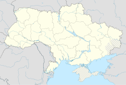
The Boltysh crater or Bovtyshka crater is a buried impact crater in the Kirovohrad Oblast of Ukraine, near the village of Bovtyshka. The crater is 24 kilometres (15 mi) in diameter and its age of 65.39 ± 0.14/0.16 million years, based on argon-argon dating techniques, less than 1 million years younger than Chicxulub crater in Mexico and the Cretaceous–Paleogene boundary. The Chicxulub impact is believed to have caused the mass extinction at the end of the Cretaceous period, which included the extinction of the non-avian dinosaurs. The Boltysh crater is currently thought to be unrelated to the Chicxulub impact, and to have not generated major global environmental effects.
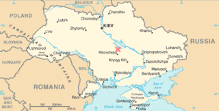
Obolon' crater is a 20 km (12 mi) diameter buried meteorite impact crater situated about 200 km (120 mi) southeast of Kyiv in Ukraine . The site has been drilled, which revealed the presence of shocked minerals and impact melt rock; the high chlorine content of the latter suggesting that the area was covered by shallow sea at the time of impact. One estimate puts the age at 169 ± 7 million years.

Rochechouart impact structure or Rochechouart astrobleme is an impact structure in France. Erosion has over the millions of years mostly destroyed its impact crater, the initial surface expression of the asteroid impact leaving highly deformed bedrock and fragments of the crater's floor as evidence of it.
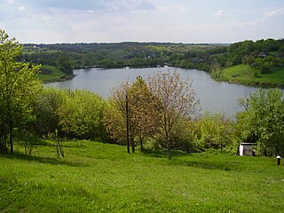
Smila

The Memnonia quadrangle is one of a series of 30 quadrangle maps of Mars used by the United States Geological Survey (USGS) Astrogeology Research Program. The Memnonia quadrangle is also referred to as MC-16.

An ejecta blanket is a generally symmetrical apron of ejecta that surrounds an impact crater; it is layered thickly at the crater's rim and thin to discontinuous at the blanket's outer edge. The impact cratering is one of the basic surface formation mechanisms of the solar system bodies and the formation and emplacement of ejecta blankets are the fundamental characteristics associated with impact cratering event. The ejecta materials are considered as the transported materials beyond the transient cavity formed during impact cratering regardless of the state of the target materials.

Illintsi is a town in Vinnytsia Oblast, Ukraine. It served as the administrative center of the former Illintsi Raion until 2020. Population: 11,095.

Koga is an impact crater on Mars, approximately 19 kilometers in diameter. It is located at 29.3°S, 103.8°W, north of the crater Virrat and northeast of the crater Dinorwic. To the north is the crater Nhill. It is named after a town in Tanzania, and its name was approved by the International Astronomical Union in 1991. According to a surface age map of Mars based on US Geological Survey data, the area around Koga is from the Noachian epoch, which places the area's age at 3.8 to 3.5 billion years ago. Sharp blocks and cliffs poke through a mantle of fine material located at the bottom of the crater. At the deepest part of the crater, it is about 5,200 meters in elevation above zero altitude, and its rim averages about 6,400 meters above zero altitude. It is therefore approximately 1.2 kilometers deep.

The Eminescu quadrangle (H-9) is one of fifteen quadrangles on Mercury. It runs from 216 to 288° longitude and from -25 to 25° latitude. Named after the Eminescu crater, it was mapped in detail for the first time after MESSENGER entered orbit around Mercury in 2011. It had not been mapped prior to that point because it was one of the six quadrangles that was not illuminated when Mariner 10 made its flybys in 1974 and 1975. These six quadrangles continued to be known by their albedo feature names, with this one known as the Solitudo Criophori quadrangle.
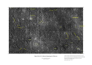
The Derain quadrangle (H-10) is one of fifteen quadrangles on Mercury. It runs from 288° to 360° west longitude and from 22° S to 22° N latitude. Named after the Derain crater, it was mapped in detail for the first time after MESSENGER entered orbit around Mercury in 2011. It had not been mapped prior to that point because it was one of the six quadrangles that was not illuminated when Mariner 10 made its flybys in 1974 and 1975. These six quadrangles continued to be known by their albedo feature names, with this one known as the Pieria quadrangle.
Joly is an impact crater on Mars, located at 74.7°S latitude and 42.7°W longitude in the Mare Australe quadrangle. It measures 79.9 kilometres (49.6 mi) in diameter and was named after Irish physicist John Joly (1857–1933). The name was approved in 1973, by the International Astronomical Union (IAU) Working Group for Planetary System Nomenclature (WGPSN).
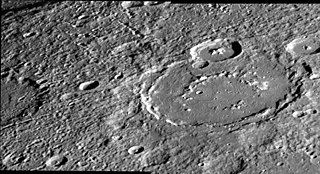
Larrocha is an impact crater on Mercury. It has a diameter of 196 km (122 mi), and it is one of 110 peak ring basins on Mercury. It is located in the Victoria quadrangle at 43.29°N 69.83°W.
Monturaqui is an impact crater in Chile. It lies south of the Salar de Atacama and was formed 663,000 ± 90,000 years ago by the impact of an IAB meteorite. It is 350 m × 370 m wide and 34 m (112 ft) deep and contains a salt pan. Only a few remnants of the meteorite that formed the crater have been collected, with most of the rocks being of local origin. The crater was discovered in 1962 and identified as an impact crater in 1966.

In modern times, numerous impact events on Mars have been detected. Although most have been inferred from the appearance of new impact craters on the planet, some have corresponded to marsquakes felt by the InSight lander. To date, no impacting meteors have been directly observed as a fireball or discovered in space before impact.