An impact event is a collision between astronomical objects causing measurable effects. Impact events have been found to regularly occur in planetary systems, though the most frequent involve asteroids, comets or meteoroids and have minimal effect. When large objects impact terrestrial planets such as the Earth, there can be significant physical and biospheric consequences, as the impacting body is usually traveling at several kilometres a second, though atmospheres mitigate many surface impacts through atmospheric entry. Impact craters and structures are dominant landforms on many of the Solar System's solid objects and present the strongest empirical evidence for their frequency and scale.

The Chicxulub crater is an impact crater buried underneath the Yucatán Peninsula in Mexico. Its center is offshore, but the crater is named after the onshore community of Chicxulub Pueblo. It was formed slightly over 66 million years ago when an asteroid, about ten kilometers in diameter, struck Earth. The crater is estimated to be 200 kilometers in diameter and 1 kilometer in depth. It is believed to be the second largest impact structure on Earth, and the only one whose peak ring is intact and directly accessible for scientific research.

The Nördlinger Ries is an impact crater and large circular depression in western Bavaria and eastern Baden-Württemberg. It is located north of the Danube in the district of Donau-Ries. The city of Nördlingen is located within the depression, about 6 kilometres (3.7 mi) south-west of its centre.

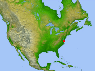
The Chesapeake Bay impact crater is a buried impact crater, located beneath the mouth of Chesapeake Bay, United States. It was formed by a bolide that struck the eastern shore of North America about 35.5 ± 0.3 million years ago, in the late Eocene epoch. It is one of the best-preserved "wet-target" impact craters in the world.

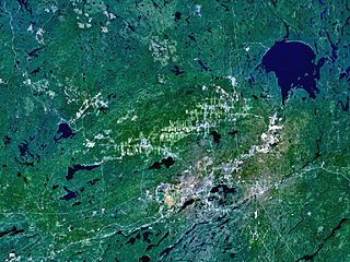
The Sudbury Basin, also known as Sudbury Structure or the Sudbury Nickel Irruptive, is a major geological structure in Ontario, Canada. It is the third-largest known impact structure on Earth, as well as one of the oldest. The structure, the eroded remnant of an impact crater, was formed by the impact of an asteroid 1.849 billion years ago in the Paleoproterozoic era.

Gow is an impact crater in Saskatchewan, Canada. It is 5 km (3 mi) in diameter and the age is estimated to be less than 250 million years. The crater contains a classic crater lake with an island formed by the central uplift. It is the smallest known crater in Canada with an uplift structure.

Karakul or Qarokul is an endorheic lake, 25 km (16 mi) in diameter, located within a 52 km (32 mi) impact crater. It is located in the Tajik National Park in the Pamir Mountains in Tajikistan.

The Kentland structure, also known as the Kentland crater or the Kentland disturbed area, is an impact structure located near the town of Kentland in Newton County, Indiana, United States.

Lappajärvi is a lake in Finland, in the municipalities of Lappajärvi, Alajärvi and Vimpeli. It is formed in a 23 km (14 mi) wide, partly eroded meteorite impact crater. The lake is part of Ähtävänjoki basin together with Lake Evijärvi that is located downstream (north) of it.

Strangways is a large impact structure, the eroded remnant of a former impact crater, located in the Northern Territory of Australia about 65 kilometres (40 mi) east-south-east of the town of Mataranka. It was named after the nearby Strangways River. The location is remote and difficult to access. Its age has been determined as approximately 646 Ma.

Woodleigh is a large meteorite impact structure (astrobleme) in Western Australia, centred on Woodleigh Station east of Shark Bay in the Gascoyne region. A team of four scientists at the Geological Survey of Western Australia and the Australian National University, led by Arthur J. Mory, announced the discovery in the 15 April 2000 issue of Earth and Planetary Science Letters.

The Manson impact structure is an impact structure near the site of Manson, Iowa where an asteroid or comet nucleus struck the Earth during the Cretaceous Period, approximately 74 Ma. It was one of the largest known impact events to have happened in North America. Previously it was thought to have led to the extinction of the dinosaurs until isotopic ages proved that it was too old.

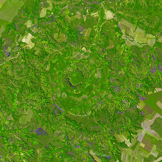
Serra da Cangalha is an impact crater in the State of Tocantins, near the border of Maranhão State, in north/northeastern Brazil. The crater is between 12 and 13 kilometres in diameter, making it the second-largest known crater in Brazil. Its age is estimated to be about 220 million years. The name means Pack-Saddle Mountains in Portuguese.
Wilkes Land crater is an informal term that may apply to two separate cases of conjectured giant impact craters hidden beneath the ice cap of Wilkes Land, East Antarctica. These are distinguished by the names Wilkes Land anomaly and Wilkes Land mascon (mass concentration), based on terms used in their principal published reference sources.

The Cretaceous–Paleogene (K–Pg) boundary, formerly known as the Cretaceous–Tertiary (K–T) boundary, is a geological signature, usually a thin band of rock containing much more iridium than other bands. The K–Pg boundary marks the end of the Cretaceous Period, the last period of the Mesozoic Era, and marks the beginning of the Paleogene Period, the first period of the Cenozoic Era. Its age is usually estimated at 66 million years, with radiometric dating yielding a more precise age of 66.043 ± 0.043 Ma.

The Yugorsky Peninsula is a large peninsula in Nenets Autonomous Okrug, Russia. It is limited by the Khaypudyr Bay in the Pechora Sea to the west and by the Baydaratsk Bay in the Kara Sea to the north and east.

Suevite is a rock consisting partly of melted material, typically forming a breccia containing glass and crystal or lithic fragments, formed during an impact event. It forms part of a group of rock types and structures that are known as impactites.

Hargraves is a Hesperian-age complex double-layered ejecta impact crater on Mars. It was emplaced near the crustal dichotomy in the vicinity of the Nili Fossae, the Syrtis Major volcanic plains, and the Isidis impact basin, and is situated within the Syrtis Major quadrangle. Hargraves has been the target of focused study because its ejecta apron is particularly well-preserved for a Martian crater of its size. It has been analogized to similar double-layered ejecta blankets on Earth, including that of the Ries impact structure, which was where the conceptual model for how such craters formed was first advanced.


