Related Research Articles

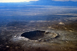
An impact crater is a depression in the surface of a solid astronomical body formed by the hypervelocity impact of a smaller object. In contrast to volcanic craters, which result from explosion or internal collapse, impact craters typically have raised rims and floors that are lower in elevation than the surrounding terrain. Impact craters are typically circular, though they can be elliptical in shape or even irregular due to events such as landslides. Impact craters range in size from microscopic craters seen on lunar rocks returned by the Apollo Program to simple bowl-shaped depressions and vast, complex, multi-ringed impact basins. Meteor Crater is a well-known example of a small impact crater on Earth.

An impact event is a collision between astronomical objects causing measurable effects. Impact events have been found to regularly occur in planetary systems, though the most frequent involve asteroids, comets or meteoroids and have minimal effect. When large objects impact terrestrial planets such as the Earth, there can be significant physical and biospheric consequences, as the impacting body is usually traveling at several kilometres a second, though atmospheres mitigate many surface impacts through atmospheric entry. Impact craters and structures are dominant landforms on many of the Solar System's solid objects and present the strongest empirical evidence for their frequency and scale.

The Chicxulub crater is an impact crater buried underneath the Yucatán Peninsula in Mexico. Its center is offshore, but the crater is named after the onshore community of Chicxulub Pueblo. It was formed slightly over 66 million years ago when an asteroid, about ten kilometers in diameter, struck Earth. The crater is estimated to be 200 kilometers in diameter and 20 kilometers in depth. It is believed to be the second largest impact structure on Earth, and the only one whose peak ring is intact and directly accessible for scientific research.

Tektites are gravel-sized bodies composed of black, green, brown or grey natural glass formed from terrestrial debris ejected during meteorite impacts. The term was coined by Austrian geologist Franz Eduard Suess (1867–1941), son of Eduard Suess. They generally range in size from millimetres to centimetres. Millimetre-scale tektites are known as microtektites.

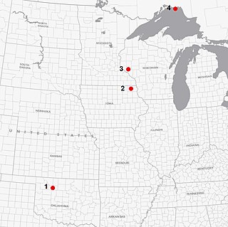
Ames crater is a meteorite crater (astrobleme) in Major County, Oklahoma, United States. Ames, Oklahoma is near the center of the structure, which is 30 miles (48 km) southwest of Enid, Oklahoma. Buried under a thick layer of sediment, it was not discovered until 1991. Subsequent drilling within the crater found a large amount of oil and gas. It is one of the largest of six meteor craters associated with oil-producing formations in the United States.

Mistastin crater is a meteorite crater in Labrador, Canada which contains the roughly circular Mistastin Lake. The lake is approximately 16 km (9.9 mi) in diameter, while the estimated diameter of the original crater is 28 km (17 mi). The age of the crater is calculated to be 36.6 ± 2 million years (Eocene).

Shatter cones are rare geological features that are only known to form in the bedrock beneath meteorite impact craters or underground nuclear explosions. They are evidence that the rock has been subjected to a shock with pressures in the range of 2–30 GPa (290,000–4,350,000 psi).

Kebira Crater is the name given to a circular topographic feature that was identified in 2007 by Farouk El-Baz and Eman Ghoneim using satellite imagery, Radarsat-1, and Shuttle Radar Topography Mission (SRTM) data in the Sahara desert. This feature straddles the border between Egypt and Libya. The name of this feature is derived from the Arabic word for "large", and also from its location near the Gilf Kebir region in southwest Egypt. Based solely on their interpretations of the remote sensing data, they argue that this feature is an exceptionally large, double-ringed, extraterrestrial impact crater. They suggest that the crater's original appearance has been obscured by wind and water erosion over time. Finally, they speculated that this feature might be the source of the yellow-green silica glass fragments, known as "Libyan desert glass", that can be found across part of Egypt's Libyan Desert. They neither conducted any fieldwork at this feature nor studied any samples collected from it. However, the Kebira Crater is currently not listed in the Earth Impact Database. Field trips to investigate the feature have found no supporting evidence. The "central uplift" clearly retains the horizontal bedding of the surrounding sandstone tableland, providing clear evidence against a possible impact origin.

An impact structure is a generally circular or craterlike geologic structure of deformed bedrock or sediment produced by impact on a planetary surface, whatever the stage of erosion of the structure. In contrast, an impact crater is the surface expression of an impact structure. In many cases, on Earth, the impact crater has been destroyed by erosion, leaving only the deformed rock or sediment of the impact structure behind. This is the fate of almost all old impact craters on Earth, unlike the ancient pristine craters preserved on the Moon and other geologically inactive rocky bodies with old surfaces in the Solar System. Impact structure is synonymous with the less commonly used term astrobleme meaning "star wound".
Umm al Binni lake is a mostly dry lake within the Central Marshes in Maysan Governorate in southern Iraq. The 3.4 km (2.1 mi) wide lake is approximately 45 km (28 mi) northwest of the Tigris–Euphrates confluence. Because of its shape, location, and other details, it was first conjectured by Sharad Master, a geoarchaeologist, to represent an impact crater. However, these claims have been disputed, with other studies finding subsidence of the underlying rock a more plausible explanation.
Shock metamorphism or impact metamorphism describes the effects of shock-wave related deformation and heating during impact events.

Traces of Catastrophe: A Handbook of Shock-Metamorphic Effects in Terrestrial Meteorite Impact Structures is a book written by Bevan M. French of the Smithsonian Institution. It is a comprehensive technical reference on the science of impact craters. It was published in 1998 by the Lunar and Planetary Institute (LPI), which is part of the Universities Space Research Association (USRA). It was originally available in hard copy from LPI, but is now only available as a portable document format (PDF) e-book free download.

A crater is a landform consisting of a hole or depression on a planetary surface, usually caused either by an object hitting the surface, or by geological activity on the planet. A crater has classically been described as: "a bowl-shaped pit that is formed by a volcano, an explosion, or a meteorite impact". On Earth, craters are "generally the result of volcanic eruptions", while "meteorite impact craters are common on the Moon, but are rare on Earth".
References
- ↑ French, Bevan M (1998). Traces of Catastrophe: A Handbook of Shock-Metamorphic Effects in Terrestrial Meteorite Impact Structures (PDF). LPI Contribution No. 954. Houston: Lunar and Planetary Institute. p. 120. ASIN B0006R1XF8. Bibcode:1998trca.book.....F. OCLC 40770730 . Retrieved 2011-09-02.


