
A volcano is a rupture in the crust of a planetary-mass object, such as Earth, that allows hot lava, volcanic ash, and gases to escape from a magma chamber below the surface. The process that forms volcanoes is called volcanism.

A stratovolcano, also known as a composite volcano, is a conical volcano built up by many layers (strata) of hardened lava and tephra. Unlike shield volcanoes, stratovolcanoes are characterized by a steep profile with a summit crater and periodic intervals of explosive eruptions and effusive eruptions, although some have collapsed summit craters called calderas. The lava flowing from stratovolcanoes typically cools and solidifies before spreading far, due to high viscosity. The magma forming this lava is often felsic, having high to intermediate levels of silica, with lesser amounts of less viscous mafic magma. Extensive felsic lava flows are uncommon, but have traveled as far as 15 km (9 mi).

The Ring of Fire is a tectonic belt of volcanoes and earthquakes.

A shield volcano is a type of volcano named for its low profile, resembling a shield lying on the ground. It is formed by the eruption of highly fluid lava, which travels farther and forms thinner flows than the more viscous lava erupted from a stratovolcano. Repeated eruptions result in the steady accumulation of broad sheets of lava, building up the shield volcano's distinctive form.

An active volcano is a volcano that has erupted during the Holocene, is currently erupting, or has the potential to erupt in the future. A volcano that is not currently erupting but could erupt in the future is known as a dormant volcano. Volcanoes that will not erupt again are known as extinct volcanoes.

Karkar Island is an oval-shaped volcanic island located in the Bismarck Sea, about 30 kilometres (19 mi) off the north coast of mainland Papua New Guinea in Madang Province, from which it is separated by the Isumrud Strait. The island is about 25 km (16 mi) in length and 19 km (12 mi) in width. In the centre is an active volcano with two nested calderas.

Langila is one of the most active volcanoes of New Britain, Papua New Guinea. It consists of four overlapping volcanic cones on the eastern flank of an older extinct volcano, Talawe. Talawe is the largest volcano in Cape Gloucester. There have been dozens of recorded eruptions since the 19th century from three separate volcanic craters at the summit of Langila. The most recent eruptive cycle of Langila began in August 2006 and continued into early 2007. Volcanic activity at Langila consists of Strombo-Vulcanian and Vulcanian eruptions and lava flows. Langila is one of the most active volcanoes in the Bismark archipelago. The smallest crater is crater number 3.

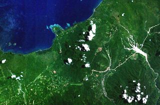
Blup Blup Island is a small forested island off the northern coast of Papua New Guinea about 30 km (19 mi) offshore from Cape Girgir and is considered part of the Schouten Islands. It is located at latitude S 3°30'46" and longitude E 144°35'16". The island has a small population and is theoretically part of the Papuan province of East Sepik, although officially it is still a protectorate.

A complex volcano, also called a compound volcano or a volcanic complex, is a mixed landform consisting of related volcanic centers and their associated lava flows and pyroclastic rock. They may form due to changes in eruptive habit or in the location of the principal vent area on a particular volcano. Stratovolcanoes can also form a large caldera that gets filled in by a lava dome, or else multiple small cinder cones, lava domes and craters may develop on the caldera's rim.

Mount Balbi is a Holocene stratovolcano located in the northern portion of the island of Bougainville, Papua New Guinea. A gentle prominence at 05°54′09″S154°59′28″E is the highest point of the island. There are five volcanic craters east of the summit, one of which contains a crater lake. The summit is composed of coalesced cones and lava domes which host a large solfatara field. There are numerous fumaroles near the craters, though Balbi has not erupted in historic time.
Bagana is an active volcanic cone located in the centre of the island of Bougainville, Papua New Guinea, the largest island of the Solomon group. It is the most active volcano in the country, occupying a remote portion of central Bougainville Island. It is one of Melanesia's youngest and most active volcanoes.
Loloru is a pyroclastic shield volcano located in the southern region of Bougainville Island, within the Autonomous Region of Bougainville of northeastern Papua New Guinea.
Takuan Group is a volcanic group located in the southern part of Bougainville Island, Papua New Guinea. It consists of three closely spaced stratovolcanoes and lava cones, Mount Takuan being the highest of them.
Tore is a volcano located in the northern part of the island of Bougainville, Papua New Guinea. Violent Pleistocene eruptions produced two ignimbrite fans stretching west to the coast, and a 6 km by 9 km caldera. A post-caldera lava cone on the caldera's southern rim is the source of lava flows. Well-preserved features suggests a recent date for this cone and a nearby ash cone.

Mount Tendürek is a shield volcano on the border of Ağrı and Van provinces in eastern Turkey, near the border with Iran. The volcano, which is mostly known for being near the supposed wreck site of Noah's Ark, is very large; its lava flows cover roughly 650 km2 (251 sq mi) across a swath of flat land. The mountain's two main features are the main summit crater Greater Tendürek, and a smaller crater known as Lesser Tendürek which lies to the east of the main crater. The slopes are very gentle and resemble a shield, after which the type is named. Mount Tendürek is known to have erupted viscous lava like that of volcanoes on the island of Hawaii.

In volcanology, a pyroclastic shield or ignimbrite shield is an uncommon type of shield volcano. Unlike most shield volcanoes, pyroclastic shields are formed mostly of pyroclastic and highly explosive eruptions rather than relatively fluid basaltic lava issuing from vents or fissures on the surface of the volcano. They typically display low-angle flank slopes and often have a central caldera caused by large eruptions. Lava is commonly extruded after explosive activity has ended. The paucity of associated Plinian fall deposits indicates that pyroclastic shields are characterized by low Plinian columns.
The Sulu Range is a small volcanic mountain range on the Papua New Guinean island of New Britain. It consists of a group of partially overlapping small stratovolcanoes and lava domes, with the highest point being 610 m (2,000 ft) Mount Malopu at the southwestern end of the range. Kaiamu, a maar at the northwestern end of the Sulu Range, forms a peninsula with a small lake extending about 1 km (0.62 mi) into Bangula Bay. Other volcanoes in the range include Mount Ululu, Mount Ruckenberg, Mount Talutu and Mount Ubia.

Lava is molten or partially molten rock (magma) that has been expelled from the interior of a terrestrial planet or a moon onto its surface. Lava may be erupted at a volcano or through a fracture in the crust, on land or underwater, usually at temperatures from 800 to 1,200 °C. The volcanic rock resulting from subsequent cooling is also often called lava.

The Solomon Islands (archipelago) is an island group in the western South Pacific Ocean, north-east of Australia. The archipelago is in the Melanesian subregion and bioregion of Oceania and forms the eastern boundary of the Solomon Sea. The many islands of the archipelago are distributed across the sovereign states of Papua New Guinea and Solomon Islands. The largest island in the archipelago is Bougainville Island, which is a part of the Autonomous Region of Bougainville along with Buka Island, the Nukumanu Islands, and a number of smaller nearby islands. Much of the remainder falls within the territory of Solomon Islands and include the atolls of Ontong Java, Sikaiana, the raised coral atolls of Bellona and Rennell, and the volcanic islands of Choiseul, Guadalcanal, Makira, Malaita, New Georgia, the Nggelas, Santa Isabel, and the Shortlands. The Santa Cruz Islands are not a part of the archipelago.
