Decade Volcanoes

Last updated

The Decade Volcanoes are 16 volcanoes identified by the International Association of Volcanology and Chemistry of the Earth's Interior (IAVCEI) as being worthy of particular study in light of their history of large, destructive eruptions and proximity to densely populated areas. The Decade Volcanoes project encourages studies and public-awareness activities at these volcanoes, with the aim of achieving a better understanding of the volcanoes and the dangers they present, and thus being able to reduce the severity of natural disasters.

Contents

They are named Decade Volcanoes because the project was initiated in the 1990s as part of the United Nations–sponsored International Decade for Natural Disaster Reduction.

A volcano may be designated a Decade Volcano if it exhibits more than one volcanic hazard (people living near the Decade Volcanoes may experience tephra fall, pyroclastic flows, lava flows, lahars, volcanic edifice instability and lava dome collapse); shows recent geological activity; is located in a densely populated area (eruptions at any of the Decade Volcanoes may threaten tens or hundreds of thousands of people, and therefore mitigating eruption hazards at these volcanoes is crucial); is politically and physically accessible for study; and there is local support for the work.

Aims of the program

Building destroyed by eruptions at Mount Unzen, Japan UnzenDevastation.jpg
Building destroyed by eruptions at Mount Unzen, Japan

The general approach of Decade Volcano projects has been to convene a planning workshop, identify the major strengths and weaknesses of risk mitigation at each volcano, and to plan how to address the weaknesses identified. One of the difficulties faced in mitigating hazards at volcanoes is ensuring that geoscientists and those who will enact the mitigation measures communicate adequately with each other, and the Decade Volcano program has attempted to ensure this by making sure both groups are well represented at Decade Volcano workshops. [1]

Colima Volcano eruption column, December 2016 Volcan de Colima 2016-12-17.jpg
Colima Volcano eruption column, December 2016

Funding

Phreatic explosion captured at the Main Crater of Taal Volcano. Photo taken from the installed IP camera of the Philippine Institute of Volcanology and Seismology (PHIVOLCS) monitoring the volcano. Taal Volcano - PHIVOLCS - 12 January 2020.JPG
Phreatic explosion captured at the Main Crater of Taal Volcano. Photo taken from the installed IP camera of the Philippine Institute of Volcanology and Seismology (PHIVOLCS) monitoring the volcano.

Hopes that United Nations funding might be available for Decade Volcano projects did not come to fruition, and funding was sought instead from a variety of sources. For example, Mexican scientific and civil defence bodies funded work at Colima, principally for Mexican scientists but also for a few foreign colleagues; major bilateral French-Indonesian and German-Indonesian programs were initiated at Merapi; and the European Union has provided funding for many of the studies carried out at European volcanoes.

One particular activity that has not been fundedbecause it typically is not allowable under most national or bilateral fundingis the exchange of scientists and civil defence leaders between the various Decade Volcano projects of developing countries, for example, between the Philippines and Indonesia, or between Mexico, Guatemala, and Colombia, or across the Pacific and Atlantic. Often, scientists and civil defence leaders from developing countries can relate better to each other's experiences than they can to the experience of counterparts from industrialized countries. Also, civil defence leaders who have experienced volcanic crises are far more credible witnesses, in the eyes of local civil defence leaders, than either local or visiting scientists might be. [1]

Achievements

A large eruption at Mount Etna, photographed from the International Space Station Etna eruption seen from the International Space Station.jpg
A large eruption at Mount Etna, photographed from the International Space Station

Since it was initiated, the Decade Volcano program has achieved a number of successes in predicting volcanic events and mitigating disasters. One of the most notable was the successful diversion of a lava flow and blanket at Mount Etna in 1992. The flow was threatening the town of Zafferana, and had overwhelmed several barriers placed perpendicular to its flow down a valley. Scientists and civil defence leaders decided to try to dam the flow higher up, and did so by dropping large concrete blocks into a skylight in a lava tube which was feeding the flow. The flow subsequently stopped short of Zafferana. [2]

The program has significantly increased what is known about the Decade Volcanoes, some of which were very poorly studied before being designated. The eruptive history of Galeras volcano is now much better established than previously, and at Taal Volcano the importance of water in driving its explosive eruptions has come to light.

Measures which have been taken to mitigate disasters which might be caused by future eruptions include a new law in the vicinity of Mount Rainier, requiring assessment of geological hazards before any new developments; limitations on high density housing developments in the Taal Caldera; and the development of an evacuation plan for parts of Naples which might be affected in the event of an eruption at Vesuvius. [1]

Problems

Teide, Tenerife (Spain). Teide 2011.jpg
Teide, Tenerife (Spain).

Although studies at many Decade volcanoes have clearly reduced the risks faced by nearby settlements, eruptions at some of the Decade Volcanoes have demonstrated the difficulties faced by the program. Eruptions at Mount Unzen which began shortly before it was designated a Decade Volcano were heavily monitored, but despite this, a large pyroclastic flow killed 43 people, including three volcanologists. [3]

Later, a 1993 Decade Volcano conference in the city of Pasto, Colombia ended in disaster when several attending scientists mounted an impromptu expedition to the crater of Galeras. An unexpected eruption while they were at the summit killed six scientists and three tourists. [4]

Civil unrest in the vicinity of several of the Decade volcanoes has also interfered with the program. The civil war in Guatemala affected studies of Volcán Santa María until a ceasefire was called in 1996, while ongoing civil war in the Democratic Republic of the Congo has hampered studies of Nyiragongo volcano. More generally, scarce resources for volcano studies have led to programs competing for limited funding. [1]

Volcanoes selected

Galeras, Narino, (Colombia). Volcan Galeras - Pasto - Colombia.jpg
Galeras, Nariño, (Colombia).

The following volcanoes were selected as the 16 current Decade Volcanoes: [5]

VolcanoElevationRegionCountryPopulation
at risk of
lava/lahar
/ash flow
Last known eruptionAffected Region/Why a Decade Volcano
Avachinsky-Koryaksky 2,741 m (8,993 ft) (Avachinsky)
3,456 m (11,339 ft) (Koryaksky)
Kamchatka Russia 179,367
(2021 est) [6]
2001 (Avachinsky), [7]

2009 (Koryaksky) [8]

Proximity of volcano to Petropavlosk-Kamchatskiy. [9]
Volcán de Colima 3,820 m (12,533 ft) Colima/ Jalisco Mexico 770,000
(2019 est) [10]
2019 [11] Whole of Colima State
Galeras 4,276 m (14,029 ft) Nariño Colombia 1,630,000
(2018 est) [12]
2014 [13] Whole of Nariño Department
Mauna Loa 4,169 m (13,678 ft) Hawaii United States  ?2022 [14] Largest of the active shield volcanoes in the Hawaiian Islands. Lower flanks populated in multiple directions, but most dangerous to the city of Hilo
Mount Etna 3,326 m (10,912 ft) Sicily Italy 1,100,000 [15] 2013–presentWhole metro city of Catania, Sicily in general due to air pollution and ash clouds. Capable of lava bombs and violent VEI 3 eruptions.
Mount Merapi 2,910 m (9,547 ft) Central Java/ Special Region of Yogyakarta Indonesia 5,050,000
(2019 est) [16]
2023Whole of Special Region of Yogyakarta, and Klaten Regency
Mount Nyiragongo 3,470 m (11,385 ft) North Kivu Democratic Republic of Congo 2,000,00022 May 2021 – present, VEI 0-2.
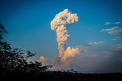
No census for decades in sprawling city of Goma. Lava known to be highly fluid and fast-moving. May 2021 eruption killed 32 people and injured thousands. [17] Currently not monitored for seismic activity.
Mount Rainier 4,392 m (14,409 ft) Washington United States795,000
(2010)
1894-1895, (minor phreatic)Whole of Pierce County, and the city of Seattle. Mount Rainier is one of the most glaciated stratovolcanoes in the Cascade Volcanic Arc. Capable of setting off massive lahars, as evidenced in the valleys below it in all directions. Known to have had both landslide type lahars or snowmelt lahars. Considered by USGS to be one of the most dangerous volcanoes in the USA. [18]
Mount Vesuvius 1,281 m (4,203 ft) Campania Italy3,085,000 [15] 17-23 March 1944, VEI 3Whole metro city of Naples. Very long record of destroying Southern Italian cities nearby, capable of large pyroclastic flows. Destroyed Herculaneum and Pompeii in 79 AD, VEI 5 eruption.
Mount Unzen 1,486 m (4,875 ft) Nagasaki/ Kumamoto Japan 1,320,000
(2019 est) [19]
1995Nagasaki Prefecture, tsunami potential
Sakurajima 1,117 m (3,665 ft) Kagoshima Japan1,470,000
(2019 est) [19]
2022 [20] Whole of Kagoshima Prefecture except Amami Islands
Santa María 3,772 m (12,375 ft) Quetzal-tenango Guatemala 1,127,000
(2018 est) [21]
23 August 2013Whole of Quetzaltenango and Retalhuleu Departments
Santorini (Thera)367 m (1,204 ft) South Aegean Greece  ?1950Entire island of Santorini once much larger. In 1646 BCE, Santorini, then called Thera, had an eruption more powerful than the 1880s eruption at Krakatoa. [22] Currently what was one island is now three with caldera hidden below surface. Risk of tsunami; record of causing one in 1646 BCE. [23]
Taal Volcano 311 m (1,020 ft) Calabarzon Philippines 24,393,000
(2020 est) [24]
2021Whole areas of Batangas, Cavite, Metro Manila and Laguna
Teide 3,715 m (12,188 ft) Canary Islands Spain 900,0001909 Tenerife, tsunami potential
Ulawun 2,334 m (7,657 ft) East New Britain / West New Britain Papua New Guinea  ?November 2023 [25]  ?

See also

Related Research Articles

<span class="mw-page-title-main">Volcano</span> Rupture in a planets crust where material escapes

A volcano is a rupture in the crust of a planetary-mass object, such as Earth, that allows hot lava, volcanic ash, and gases to escape from a magma chamber below the surface.

<span class="mw-page-title-main">Mount Tambora</span> Active stratovolcano in Sumbawa in Indonesia

Mount Tambora, or Tomboro, is an active stratovolcano in West Nusa Tenggara, Indonesia. Located on Sumbawa in the Lesser Sunda Islands, it was formed by the active subduction zones beneath it. Before 1815, its elevation reached more than 4,300 metres high, making it one of the tallest peaks in the Indonesian archipelago.

<span class="mw-page-title-main">Volcanologist</span> Scientist who studies volcanoes

A volcanologist, or volcano scientist, is a geologist who focuses on understanding the formation and eruptive activity of volcanoes. Volcanologists frequently visit volcanoes, sometimes active ones, to observe and monitor volcanic eruptions, collect eruptive products including tephra, rock and lava samples. One major focus of inquiry in recent times is the prediction of eruptions to alleviate the impact on surrounding populations and monitor natural hazards associated with volcanic activity. Geologists who research volcanic materials that make up the solid Earth are referred to as igneous petrologists.

<span class="mw-page-title-main">Nevado del Ruiz</span> Volcanic mountain in Colombia

Nevado del Ruiz, also known as La Mesa de Herveo is a volcano on the border of the departments of Caldas and Tolima in Colombia, about 129 km (80 mi) west of the capital city Bogotá. It is a stratovolcano composed of many layers of lava alternating with hardened volcanic ash and other pyroclastic rocks. Volcanic activity at Nevado del Ruiz began about two million years ago, during the Early Pleistocene or Late Pliocene, with three major eruptive periods. The current volcanic cone formed during the present eruptive period, which began 150,000 years ago.

<span class="mw-page-title-main">Mount Nyiragongo</span> Active volcano in the Democratic Republic of the Congo

Mount Nyiragongo is an active stratovolcano with an elevation of 3,470 m (11,385 ft) in the Virunga Mountains associated with the Albertine Rift. It is located inside Virunga National Park, in the Democratic Republic of the Congo, about 12 km (7.5 mi) north of the town of Goma and Lake Kivu and just west of the border with Rwanda. The main crater is about two kilometres (1 mi) wide and usually contains a lava lake. The crater presently has two distinct cooled lava benches within the crater walls – one at about 3,175 m (10,417 ft) and a lower one at about 2,975 m (9,760 ft).

<span class="mw-page-title-main">Mount Unzen</span> Group of volcanoes in Nagasaki Prefecture, Japan

Mount Unzen is an active volcanic group of several overlapping stratovolcanoes, near the city of Shimabara, Nagasaki on the island of Kyushu, Japan's southernmost m in island.

<span class="mw-page-title-main">Santa María (volcano)</span> Active volcano in Quetzaltenango Department, Guatemala

Santa María Volcano is a large active volcano in the western highlands of Guatemala, in the Quetzaltenango Department near the city of Quetzaltenango. It is part of the mountain range of the Sierra Madre.

<span class="mw-page-title-main">Soufrière Hills</span> Volcano on Montserrat in the Caribbean

The Soufrière Hills are an active, complex stratovolcano with many lava domes forming its summit on the Caribbean island of Montserrat. After a long period of dormancy, the Soufrière Hills volcano became active in 1995 and has continued to erupt ever since. Its eruptions have rendered more than half of Montserrat uninhabitable, destroying the capital city, Plymouth, and causing widespread evacuations: about two-thirds of the population have left the island. Chances Peak in the Soufrière Hills was the highest summit on Montserrat until the mid-1990s, but it has since been eclipsed by various rising and falling volcanic domes during the recent volcanic activity.

<span class="mw-page-title-main">Lava dome</span> Roughly circular protrusion from slowly extruded viscous volcanic lava

In volcanology, a lava dome is a circular, mound-shaped protrusion resulting from the slow extrusion of viscous lava from a volcano. Dome-building eruptions are common, particularly in convergent plate boundary settings. Around 6% of eruptions on Earth are lava dome forming. The geochemistry of lava domes can vary from basalt to rhyolite although the majority are of intermediate composition The characteristic dome shape is attributed to high viscosity that prevents the lava from flowing very far. This high viscosity can be obtained in two ways: by high levels of silica in the magma, or by degassing of fluid magma. Since viscous basaltic and andesitic domes weather fast and easily break apart by further input of fluid lava, most of the preserved domes have high silica content and consist of rhyolite or dacite.

<span class="mw-page-title-main">Galeras</span> Volcanic mountain in Colombia

Galeras is an Andean stratovolcano in the Colombian department of Nariño, near the departmental capital Pasto. Its summit rises 4,276 metres (14,029 ft) above sea level. It has erupted frequently since the Spanish conquest, with its first historical eruption being recorded on December 7, 1580. A 1993 eruption killed nine people, including six scientists who had descended into the volcano's crater to sample gases and take gravity measurements in an attempt to be able to predict future eruptions. It is currently the most active volcano in Colombia.

<span class="mw-page-title-main">Active volcano</span> Geological feature

An active volcano is a volcano that has erupted during the Holocene, is currently erupting, or has the potential to erupt in the future. A volcano that is not currently erupting but could erupt in the future is known as a dormant volcano. Volcanoes that will not erupt again are known as extinct volcanoes.

<span class="mw-page-title-main">Monte Vulture</span> Mountain in Italy

Mount Vulture is an extinct volcano located 56 km (35 mi) north of the city Potenza in the Basilicata region (Italy). As a prominent landmark it gave its name to the Vulture region, the most significant viticultural zone in Basilicata growing the DOC wine Aglianico del Vulture.

<span class="mw-page-title-main">Lava lake</span> Molten lava contained in a volcanic crater

Lava lakes are large volumes of molten lava, usually basaltic, contained in a volcanic vent, crater, or broad depression. The term is used to describe both lava lakes that are wholly or partly molten and those that are solidified.

<span class="mw-page-title-main">Prediction of volcanic activity</span> Research to predict volcanic activity

Prediction of volcanic activity, or volcanic eruption forecasting, is an interdisciplinary monitoring and research effort to predict the time and severity of a volcano's eruption. Of particular importance is the prediction of hazardous eruptions that could lead to catastrophic loss of life, property, and disruption of human activities.

<span class="mw-page-title-main">Mount Sinabung</span> Active volcano in North Sumatra, Indonesia

Mount Sinabung is a Pleistocene-to-Holocene stratovolcano of andesite and dacite in the Karo plateau of Karo Regency, North Sumatra, Indonesia, 40 kilometres (25 mi) from the Lake Toba supervolcano. Many old lava flows are on its flanks and the last known eruption, before recent times, occurred 1200 years before present, between 740 - 880 CE. Solfataric activities were last observed at the summit in 1912; recent documented events include an eruption in the early hours of 29 August 2010 and eruptions in September and November 2013, January, February and October 2014. The volcano has recently claimed the life of at least 23 people in a number of events since 2014. Between 2013 and 2014, the alert for a major event was increased with no significant activity. On 2 June 2015, the alert was again increased, and on 26 June 2015, at least 10,000 people were evacuated, fearing a major eruption. The long eruption of Mount Sinabung is similar to that of Mount Unzen in Japan, which erupted for five years after lying dormant for 400 years. A major eruption began on 10 August 2020.

<span class="mw-page-title-main">San Martin Tuxtla</span>

The isolated San Martin Tuxtla volcano is a shield volcano which rises above the Gulf of Mexico. It has had eruptions in historical times. It occurs in the Tuxtla volcanic field in Veracruz, Mexico. Lavas from San Martin vary between basanite and alkali basalt. Locally the volcano is also known as Tiltépetl.

Marta Lucía Calvache Velasco is a Colombian geologist and volcanologist, best known for her work on geological hazards and risk reduction in Colombia.

References

  1. 1 2 3 4 Newhall, Christopher G. (1996); IAVCEI/International Council of Scientific Unions' Decade Volcano Projects: Reducing Volcanic Disaster, Status Report, United States Geological Survey, Washington, D.C. Archived November 15, 2004, at the Wayback Machine
  2. Stevens, Nicki F.; Murray, John B.; Wadge, Geoff (1997). "The volume and shape of the 1991-1993 lava flow field at Mount Etna, Sicily". Bulletin of Volcanology . 58 (6): 449–454. Bibcode:1997BVol...58..449S. doi:10.1007/s004450050153. S2CID   129694629.
  3. Yamamoto, Takahiro; Takarada, Shinji; Suto, Shigeru (1993). "Pyroclastic flows from the 1991 eruption of Unzen volcano, Japan". Bulletin of Volcanology. 55 (3): 166–175. Bibcode:1993BVol...55..166Y. doi:10.1007/BF00301514. S2CID   129148854.
  4. Baxter, Peter J.; Gresham, Austin (1997). "Deaths and injuries in the eruption of Galeras Volcano, Colombia, 14 January 1993". Journal of Volcanology and Geothermal Research . 77 (1–4): 325–338. Bibcode:1997JVGR...77..325B. doi:10.1016/S0377-0273(96)00103-5.
  5. "IAVCEI NEWS 1/2 1996" (PDF). Archived from the original (PDF) on 2010-07-13. Retrieved 2014-10-21.
  6. "Russia:Far East Federal District (Regions, Territories & Republics) - Cities and Urban Settlements". citypopulation.de.
  7. "Global Volcanism Program | Avachinsky". Smithsonian Institution | Global Volcanism Program. Retrieved 2022-02-06.
  8. "Global Volcanism Program | Koryaksky". Smithsonian Institution | Global Volcanism Program. Retrieved 2022-02-06.
  9. Ford, Robert J. Volcano: Live, Dormant and Extinct Volcanoes Around the World. Amber Books, 2021, p. 95.
  10. "Mexico: States and Major Cities - Population Statistics, Maps, Charts, Weather and Web Information". citypopulation.de.
  11. "Global Volcanism Program | Colima". Smithsonian Institution | Global Volcanism Program. Retrieved 2022-02-06.
  12. "Colombia: Departments & Major Cities - Population Statistics, Maps, Charts, Weather and Web Information". citypopulation.de.
  13. "Global Volcanism Program | Galeras". Smithsonian Institution | Global Volcanism Program. Retrieved 2022-02-06.
  14. "Mauna Loa Has Begun Erupting". Communications and Publishing. United States Geological Survey. November 28, 2022. p. 1.
  15. 1 2 "Italy: Administrative Division (Regions and Provinces) - Population Statistics, Charts and Map". citypopulation.de.
  16. "Indonesia: Urban Population of Cities - Population Statistics, Maps, Charts, Weather and Web Information". citypopulation.de.
  17. "Mt. Nyiragongo Eruption 2021 | NASA Applied Sciences". 22 June 2021.
  18. "Mount Rainier: One of Our Nation's Most Dangerous Volcanoes".
  19. 1 2 "Japan: Administrative Division (Prefectures, Districts and Cities) - Population Statistics, Charts and Map". citypopulation.de.
  20. "Global Volcanism Program | Aira". Smithsonian Institution | Global Volcanism Program. Retrieved 2022-02-06.
  21. "Guatemala: Administrative Division (Departments and Municipalities) - Population Statistics, Charts and Map". citypopulation.de.
  22. "Minoan eruption on Santorini much larger than originally believed".
  23. Fountain, Henry (9 November 2016). "An Ancient Tsunami That Ended a Civilization Gets Another Look". The New York Times.
  24. "Philippines: Administrative Division (Regions and Provinces) - Population Statistics, Charts and Map". citypopulation.de.
  25. "Report on Ulawun (Papua New Guinea) (Sennert, S, ed.). Weekly Volcanic Activity Report, 15 November-21 November 2023". Global Volcanism Program. Smithsonian Institution and US Geological Survey. November 2023. Retrieved 27 November 2023.