Special Region of Yogyakarta

Last updated

Special Region of Yogyakarta
Daerah Istimewa Yogyakarta
Javanese transcription(s)
   Hanacaraka ꦥꦤꦒꦫꦩꦶꦫꦸꦁꦒꦤ꧀ꦔꦪꦺꦴꦒꦾꦏꦂꦠ
   Latin script Panagara Mirunggan Ngayogyakarta
Motto(s): 

ꦫꦱꦱꦸꦏꦔꦺꦱ꧀ꦛꦶꦥꦿꦗ꧈ ꦪꦺꦴꦒꦾꦏꦂꦠꦠꦿꦸꦱ꧀ꦩꦤ꧀ꦝꦶꦫꦶ
Rasa suka ngèsthi praja, Yogyakarta trus mandhiri

With a sense of joy in building the Special Region of Yogyakarta which is good and safe and continues to stand tall
Slogan: Jogja Istimewa
"Special Jogja"
Special Region of Yogyakarta in Indonesia (special marker).svg
  Special Region of Yogyakarta in    Indonesia
OpenStreetMap
Special Region of Yogyakarta
Coordinates: 7°47′S110°22′E / 7.783°S 110.367°E / -7.783; 110.367
Established4 March 1950
Capital
and largest city
Yogyakarta
Government
  Type Devolved non-sovereign diarchical special region within a unitary republic
  BodyRegional Government of the Special Region of Yogyakarta
   Governor Hamengkubuwono X (Indp.) [a]
  Vice Governor Paku Alam X [b]
Area
  Total
3,170.65 km2 (1,224.19 sq mi)
  Rank 37th in Indonesia
Highest elevation2,955 m (9,695 ft)
Population
 (mid 2023 estimate [1] )
  Total
3,736,489
  Rank 18th in Indonesia
  Density1,200/km2 (3,100/sq mi)
Demographics
   Ethnic groups 96% Javanese
0.6% Sundanese
3.4% other [2]
   Religion 92.62% Islam
7.18% Christianity
- 4.5% Catholicism
- 2.68% Protestantism
0.09% Hinduism
0.09% Buddhism
0.02% other [3]
   Languages Indonesian (official)
Javanese (co-official)
Time zone UTC+7 (WIB)
Postal code
55xxx
ISO 3166 code ID-YO
GDP (nominal)2022
 - Total [4] Rp 165.7 trillion (22nd)
US$ 11.2 billion
Int$ 34.8 billion (PPP)
 - Per capita [5] Rp 44.1 million (26th)
US$ 2,966
Int$ 9,256 (PPP)
 - Growth [6] Increase2.svg 5.15%
HDI (2024)Increase2.svg 0.816 [7] (2nd) – very high
Website jogjaprov.go.id

The Special Region of Yogyakarta [c] is a province-level special region of Indonesia in southern Java. [11] It is a semi-enclave that is surrounded by on the landward side by Central Java Province to the west, north, and east, but has a long coastline on the Indian Ocean to the south.

Contents

Co-ruled by the Yogyakarta Sultanate and the Duchy of Pakualaman, the region is the only officially recognized diarchy within the government of Indonesia. The city of Yogyakarta is a popular tourist destination and cultural center of the region. The Yogyakarta Sultanate was established in 1755 and provided unwavering support for Indonesia's independence during the Indonesian National Revolution (1945–1949). As a first-level division in Indonesia, Yogyakarta is governed by Sultan Hamengkubuwono X as the governor and Duke Paku Alam X as the vice governor. With a land area of just 3,170.65 km2, it is the second-smallest province-level entity of Indonesia after Jakarta. [12]

History

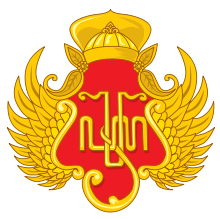
Praja Cihna (Javanese: ), coat of arms or crest of the Yogyakarta Sultanate that is upheld by Mataram society. The crest contains the Javanese script , a royal monogram of Hamengkubuwono. Yogyakarta Sultanate Hamengkubhuwono X Emblem.svg
Praja Cihna (Javanese: ꦥꦿꦗꦕꦶꦃꦤ), coat of arms or crest of the Yogyakarta Sultanate that is upheld by Mataram society. The crest contains the Javanese script ꦲꦨ꧀ꦮ, a royal monogram of Hamengkubuwono.

In Javanese, it is pronounced [joɡjaˈkartɔ] , and named after the city of Ayodhya in Javanese-Hindu mythology. [13] The Dutch name of the Special Region is Djokjakarta.

The Sultanate has existed in various forms and survived through the rule of the Dutch and the 1942 invasion of the Dutch East Indies by the Japanese Empire. In August 1945 Indonesia's first president, Sukarno proclaimed the independence of the Indonesian Republic, and by September of that year, Sultan Hamengkubuwono IX and Duke Sri Paku Alam VIII had sent letters to Sukarno expressing their support for the newly born nation of Indonesia, in which they acknowledged the Yogyakarta Sultanate as part of the Indonesian Republic. The Sunanate of Surakarta did the same, and both of the Javanese kingdoms were awarded special status as special regions within the Indonesian Republic. However, due to a leftist anti-royalist uprising in Surakarta, the Sunanate of Surakarta lost its special administrative status in 1946 and was absorbed into the province of Central Java.

Yogyakarta's overwhelming support and the Sultan's patriotism were essential in the Indonesian struggle for independence during the Indonesian National Revolution (1945–1949). The city of Yogyakarta became the capital of the Indonesian Republic from January 1946 to December 1948 after the fall of Jakarta to the Dutch. Later, the Dutch also invaded Yogyakarta causing the Indonesian Republic's capital to be transferred again to Bukittinggi in West Sumatra on 19 December 1948. In return for Yogyakarta's support, the declaration of Special Authority over Yogyakarta was granted in full in 1950 and Yogyakarta was given the status of a Special Administrative Region, making Yogyakarta the only region headed by a monarchy in Indonesia.

The Special Region was struck by a 6.3-magnitude earthquake on 27 May 2006, killing 5,782 people, injuring approximately 36,000, and leaving 600,000 people homeless. [14] The region of Bantul suffered the most damage and deaths.

Geography

View of Mount Merapi Merapi National Park.jpg
View of Mount Merapi

The Special Region is located near the southern coast of Java, surrounded on three sides by the province of Central Java, and with the Indian Ocean on the south side. The population at the 2010 Census was 3,457,491 people, [15] which then increased to 3,668,719 at the 2020 Census; [16] the official estimate for mid-2023 was 3,736,489 (comprising 1,849,540 males and 1,886,950 females). [1] It has an area of 3,170.65 km2, making it the second-smallest area of the provinces in Indonesia, after the Jakarta Capital Region. Along with surrounding areas in Central Java, it has some of the highest population densities of Java.

Mount Merapi is located to the immediate north of the city of Yogyakarta and Sleman Regency. It is the most active volcano in Indonesia and has erupted regularly since 1548. It last erupted in October–November 2010, killing and injuring many people and temporarily displacing approximately 100,000 residents. [17] [18]

Geo-heritage sites

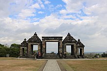
Ratu Boko Kraton Ratu Boko (Ratu Boko Temple) in Yogyakarta, Indonesia 03.jpg
Ratu Boko
Prambanan temple Prambanan Temple Yogyakarta Indonesia.jpg
Prambanan temple

Indonesia has several geo-heritage sites in the Yogyakarta Special Region. It has been declared by the Geological Agency of the Ministry of Energy and Mineral Resources. The sites consist of nine sites: Eocene limestone in Gamping (Sleman Regency), pillow lava in Berbah (Sleman), pre-historic volcanic sediment in Candi Ijo, Prambanan (Sleman), dunes in Parangtritis Beach (Bantul Regency), Kiskendo cave, and former manganese mining site in Kleripan (Kulonprogo regency), the prehistoric volcano in Nglanggeran (Gunungkidul regency), Wediombo-Siung beaches (Gunungkidul) and Bioturbasi site in Kalingalang (Gunungkidul). The most unusual one is pillow lava in Berbah (Sleman) which is a big, rough black rock that lies on the bank of the narrow Dengkeng River. The prehistoric volcano in Nglanggeran (Gunungkidul Regency) has already been developed as a tourist destination.

Government and politics

Governor and legislature

According to Act No. 22 of 1948 (which is also the basis of Act No. 3 of 1950 on the formation of DIY), the Head and Vice Head of the Special Region are appointed by the president from the descendants of the ruling family in the region before Indonesian independence with the conditions of "skill, honesty, and loyalty, and keeping in mind the customs of the area." Thus, the Head of the Special Region, until 1988, was automatically held by the reigning Sultan of Yogyakarta, and the Vice Head of the Special Region, until 1998, was automatically held by Prince Paku Alam who was on the throne. The nomenclature of the Governor and Vice Governor of the Special Region has only been used since 1999 with the issuance of Act No. 22 of 1999. Since 2012, the mechanism for filling the positions of Governor and Vice Governor of DIY is regulated by Act No. 13 of 2012 on the Uniqueness of the Special Region of Yogyakarta. [19]

The province has a regional legislature, the Special Region of Yogyakarta Regional House of Representatives, which as of the 2024 election has 55 members. The largest party in the legislature is the Indonesian Democratic Party of Struggle. [20]

Administrative divisions

The Special Region of Yogyakarta (provincial level) is subdivided into four regencies (kabupaten) and one city (kota), and divided further into districts (kapanewon or kemantren in the city of Yogyakarta) and villages (rural kalurahan or urban kelurahan, doublet); these are listed below, with their areas and their population at the 2000, 2010 [15] and 2020 [16] Censuses, with their present estimates, as of mid-2023. [1]

Kode
Wilayah
NameCapitalArea (km2)Population
2000 Census
Population
2010 Census
Population
2020 Census
Population
mid 2023
Estimate [1]
HDI [21]
2021 Estimates
34.01 Kulon Progo Regency Wates 577.22371,000388,859436,395443,0530.747 (High)
34.02 Bantul Regency Bantul 511.71781,000911,503985,7701,009,4340.802 (Very High)
34.03 Gunungkidul Regency Wonosari 1,475.15670,400675,382747,161751,0110.701 (High)
34.04 Sleman Regency Sleman 573.75901,4001,093,1101,125,8041,157,2920.840 (Very High)
34.71 Yogyakarta City Yogyakarta City32.82396,700388,627373,589375,6990.871 (Very High)
Totals3,170.653,121,0453,457,4913,668,7193,736,4890.802 (Very High)
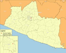
Administrative Map of Yogyakarta Special Region Special Region of Yogyakarta.png
Administrative Map of Yogyakarta Special Region

Located within the Special Region of Yogyakarta, the city of Yogyakarta is known as a center of classical Javanese fine art and culture, such as batik , ballet, drama, music, poetry, and shadow puppetry. It is also one of Indonesia's most renowned centres of higher education. At the city's core is the Sultan's palace, the Kraton . While the city sprawls outward in all directions from the Kraton, the "modern" centre of the city is located to the north.

The Special Region forms one of Indonesia's 84 national electoral districts to elect members to the People's Representative Council. The Yogyakarta S.R. Electoral District consists of all of the 4 regencies in the province, together with the city of Yogyakarta, and elects 8 members to the People's Representative Council. [22]

Demographics

Historical population
YearPop.±%
19712,489,360    
19802,750,813+10.5%
19902,913,054+5.9%
19952,916,779+0.1%
20003,122,268+7.0%
20103,457,491+10.7%
20203,668,719+6.1%
20233,736,489+1.8%
Source: Badan Pusat Statistik (BPS), 2024 and previous

Language

Aside from the Indonesian language, the Javanese language is also designated as the official language of the Special Region of Yogyakarta under Yogyakarta Special Region Regulation Number 2 of 2021. [23]

Religion

The majority of the population is Muslim, which is 92.94%, the rest are Catholic Christians 4.45%, then Protestant Christians 2.42%, Buddhists 0.08%, Hindus 0.09%, Confucianism and others 0.02%. [24]

Infrastructure

Transport

Yogyakarta railway station Stasiun Tugu 2020 2 New Signage + Nataru.jpg
Yogyakarta railway station

Yogyakarta is served by Adisutjipto International Airport and Yogyakarta International Airport, the latter being opened for minimum operations in late April 2019 and fully operational starting late March 2020. There are two main railway stations: Lempuyangan Station and Yogyakarta railway station.

Yogyakarta is considered one of the major hubs that link the west–east main railway route in Java island. Yogyakarta Station is the main train station located in the center, and Lempuyangan Station is the second train station in the city. The two stations have their schedule to and from other cities on Java island. The Prambanan Express commuter rail service operates west of Yogyakarta Station across Kulonprogo Regency to Purworejo, and KAI Commuter Yogyakarta Line electric commuter rail system operates from east of the station to Surakarta. To the south, in the Bantul region, is the Giwangan bus station, one of the largest bus stations in Indonesia. The Yogyakarta metropolitan centre is surrounded by a ring road.

In 2008, the government of the Special Region of Yogyakarta launched a bus rapid transit system, the Trans Jogja, which connects places in and around Yogyakarta City, including the airport and the Prambanan temple. Today,[ when? ] Trans Jogja has reached other points in the south side of the city. [25]

Education

Gadjah Mada University Gedung Pusat (Rektorat) UGM.jpg
Gadjah Mada University

Yogyakarta is home to more than 100 institutions [26] of higher education in Indonesia, the highest number of higher education institutions of any province in Indonesia. Hence, Yogyakarta earned its nickname "Kota Pelajar" (The City of Students).

Yogyakarta is the home of the first established state university in Indonesia, the Gadjah Mada University.

The Special Region is also the home of the first established private university in Indonesia, the Islamic University of Indonesia, which was founded in 1945. The Indonesia Institute of Arts, the first-established university in fine arts, is also in the region. Other large universities include Yogyakarta State University, Sunan Kalijaga State Islamic University, Sanata Dharma University, Muhammadiyah University of Yogyakarta, and the University of Atma Jaya Yogyakarta.

Sister relationships

Yogyakarta Special Region has signed a sister province relationship or friendly ties agreement with the region/state:

See also

Notes

  1. 1 2 3 4 Badan Pusat Statistik, Jakarta, 28 February 2024, Provinsi Daerah Istimewa Yogyakarta Dalam Angka 2024 (Katalog-BPS 1102001.34)
  2. Indonesia's Population: Ethnicity and Religion in a Changing Political Landscape. Institute of Southeast Asian Studies. 2003.
  3. Kementerian Agama Republik Indonesia Wilayah DIY (15 March 2010). "Kementerian Agama RI | Kantor Wilayah DI Yogyakarta". Yogyakarta.kemenag.go.id. Archived from the original on 21 July 2011. Retrieved 7 February 2011.
  4. Badan Pusat Statistik (2023). "Produk Domestik Regional Bruto (Milyar Rupiah), 2022" (in Indonesian). Jakarta: Badan Pusat Statistik.
  5. Badan Pusat Statistik (2023). "Produk Domestik Regional Bruto Per Kapita (Ribu Rupiah), 2022" (in Indonesian). Jakarta: Badan Pusat Statistik.
  6. Badan Pembangunan Nasional (2023). "Capaian Indikator Utama Pembangunan" (in Indonesian). Jakarta: Badan Pembangunan Nasional.
  7. "Indeks Pembangunan Manusia 2024" (in Indonesian). Statistics Indonesia. 2024. Retrieved 15 November 2024.
  8. Album seni budaya Daerah Istimewa Yogyakarta = cultural album of the special territory of Yogyakarta, Proyek Media Kebudayaan, Departemen Pendidikan dan Kebudayaan = Project of Cultural Media, Ministry of Education and Culture, 1982/1983, 1982, retrieved 12 April 2022
  9. Yogyakarta (Indonesia : Daerah Istimewa). Jawatan Penerangan (1974), A short guide to Jogjakarta, Inter Documentation Company, retrieved 12 April 2022
  10. "Definition of YOGYAKARTA". www.merriam-webster.com. Retrieved 16 November 2022.
  11. "Nomenklatur Daerah Istimewa Yogyakarta dan Penggunaannya" (PDF).
  12. "Luas wilayah". jogjaprov.go.id. 1 June 2010.
  13. "Raffles and the British Invasion of Java," Tim Hannigan, Monsoon Books, 2012, ISBN   9789814358866, .. Its full formal name was Ngayogyakarta Hadiningrat. Like the Thai town of Ayutthaya, Yogyakarta was named for Ayodhya, the mythical birthplace of the Hindu god Rama ..
  14. "Indonesia lowers quake death toll". CNN. 6 June 2006. Archived from the original on 15 June 2006. Retrieved 6 June 2006.
  15. 1 2 Biro Pusat Statistik, Jakarta, 2011.
  16. 1 2 Badan Pusat Statistik, Jakarta, 2021.
  17. "Update: Indonesia Volcano Death Toll Soars Past 100; 'Many Children Dead, by Gandang Sajarw". Jakarta Globe. 5 November 2010. Archived from the original on 17 September 2012. Retrieved 5 November 2010.
  18. "Pictures: Indonesia's Mount Merapi Volcano Erupts". News.nationalgeographic.com. 26 October 2010. Archived from the original on 29 October 2010. Retrieved 7 February 2011.
  19. Undang-undang Nomor 13 Tahun 2012 tentang Keistimewaan Daerah Istimewa Yogyakarta (Act 13) (in Indonesian). People's Representative Council. 2012.
  20. "Terpilih 55 Caleg untuk DPRD DIY hasil Pemilu 2024". Pikiran Rakyat . 8 March 2024. Retrieved 24 March 2024.
  21. "Human Development Indices by Province, 2020-2021 (New Method)" (in Indonesian). Retrieved 3 July 2022.
  22. Law No. 7/2017 (UU No. 7 Tahun 2017) as amended by Government Regulation in Lieu of Law No. 1/2022 and Regulation of General Elections Commission No. 6/2023.
  23. Peraturan Daerah Daerah Istimewa Yogyakarta Nomor 2 Tahun 2021 tentang Pemeliharaan dan Pengembangan Bahasa, Sastra, dan Aksara Jawa (Regional Regulation 2) (in Indonesian). Governor of Special Region of Yogyakarta. 2021.
  24. "Jumlah Penduduk Menurut Agama" (in Indonesian). Ministry of Religious Affairs. 31 August 2022. Retrieved 29 October 2023.
  25. "Trans Jogja Busway: Yogyakarta, Central Java". Indonesialogue.com. 26 February 2008. Archived from the original on 10 March 2012. Retrieved 7 February 2011.
  26. "List of private higher education institutions in the Province of Yogyakarta". Kopertis4.or.id. Archived from the original on 26 August 2004. Retrieved 7 February 2011.
  27. "Kyoto prefecture List of Friendly and Sister City". pref.kyoto.jp. Retrieved 7 February 2011.
  28. "California's Sister-State Relationship with Special Province of Yogyakarta, Indonesia". senate.ca.gov. Retrieved 6 January 2020.
  29. "Gyeongsangbuk-do Province Website".
  30. Biro Kerjasama (2006). Bunga Rampai Kerjasama Luar Negeri Propinsi DIY. Yogyakarta: Pemerintah Propinsi DIY.
  31. สภาพทั่วไปของจังหวัดเชียงใหม [General condition of Chiang Mai Province](PDF) (in Thai). Archived from the original (PDF) on 16 August 2016. Retrieved 23 June 2016.
  1. Concurrently as Yogyakarta Sultanate.
  2. Concurrently as Duke of Pakualam.
  3. also known as Special Territory of Yogyakarta [8] [9]
    English: /ˌjɡjəˈkɑːrtə/ ; [10] Indonesian: Daerah Istimewa Yogyakarta, Javanese: ꦥꦤꦒꦫꦩꦶꦫꦸꦁꦒꦤ꧀ꦔꦪꦺꦴꦒꦾꦏꦂꦠ, romanized: Panagara Mirunggan Ngayogyakarta

Related Research Articles

<span class="mw-page-title-main">Banten</span> Province of Indonesia in western Java

Banten is the westernmost province on the island of Java, Indonesia. Its capital city is Serang and its largest city is Tangerang. The province borders West Java and the Special Capital Region of Jakarta on the east, the Java Sea on the north, the Indian Ocean on the south, and the Sunda Strait on the west and shares a maritime border with Lampung to the west. The province covers an area of 9,352.77 km2 (3,611.12 sq mi). It had a population of over 11.9 million in the 2020 census, up from about 10.6 million in 2010. The estimated mid-2023 population was 12.308 million. Formerly part of the province of West Java, Banten was split off to become a province on 17 October 2000.
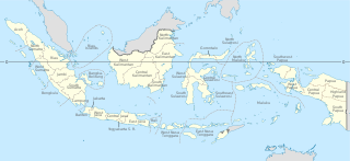
<span class="mw-page-title-main">Provinces of Indonesia</span> First-level divisions of Indonesia

Provinces are the first-level administrative divisions of Indonesia. It is formerly called the first-level provincial region before the Reform era. Provinces have a local government, consisting of a governor and a regional legislative body. The governor and members of local representative bodies are elected by popular vote for five-year terms, but governors can only serve for two terms. Provincial governments have the authority to regulate and manage their own government affairs, subject to the limits of the central government. The average land area of all 38 provinces in Indonesia is about 49,800 km2 (19,200 sq mi), and they had an average population in mid 2023 of 7,334,111 people.

<span class="mw-page-title-main">West Java</span> Province of Indonesia

West Java is an Indonesian province on the western part of the island of Java, with its provincial capital in Bandung. West Java is bordered by the province of Banten and the country's capital region of Jakarta to the west, the Java Sea to the north, the province of Central Java to the east and the Indian Ocean to the south. With Banten, this province is the native homeland of the Sundanese people, the second-largest ethnic group in Indonesia.

<span class="mw-page-title-main">Central Java</span> Province of Indonesia

Central Java is a province of Indonesia, located in the middle of the island of Java. Its administrative capital is Semarang. It is bordered by West Java in the west, the Indian Ocean and the Special Region of Yogyakarta in the south, East Java in the east, and the Java Sea in the north. It has a total area of 33,750.37 km2, with a population of 36,516,035 at the 2020 Census making it the third-most populous province in both Java and Indonesia after West Java and East Java. The official population estimate in mid-2023 was 37,608,336 The province also includes a number of offshore islands, including the island of Nusakambangan in the south, and the Karimun Jawa Islands in the Java Sea.
<span class="mw-page-title-main">Jambi</span> Province of Indonesia

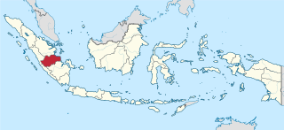
Jambi is a province of Indonesia. It is located on the east coast of central Sumatra and stretches to the Barisan Mountains in the west. Its capital and largest city is also called Jambi. It is bordered by the provinces of Riau to the north, West Sumatra to the west, Bengkulu to the southwest, South Sumatra to the south, and shares a maritime border with the Riau Islands to the east and the Pacific Ocean to the east. The province has a land area of 49,026.58 km2, and a sea area of 3,274.95 km2. Its area is comparable to the European country of Slovakia. It had a population of 3,092,265 according to the 2010 census and 3,548,228 according to the 2020 census; the official estimate of population as of mid-2023 was 3,679,169.

<span class="mw-page-title-main">Surakarta</span> City in Java, Indonesia

Surakarta, known colloquially as Solo, is a major city in Central Java, Indonesia. The 46.72 km2 (18.04 sq mi) city adjoins Karanganyar Regency and Boyolali Regency to the north, Karanganyar Regency and Sukoharjo Regency to the east and west, and Sukoharjo Regency to the south. On the eastern side of Solo lies Solo River. Its metropolitan area, consisting of Surakarta City and the surrounding six regencies, was home to 6,837,753 inhabitants according to the official estimates for mid 2023, 526,870 of whom reside in the city proper.

<span class="mw-page-title-main">Tegal</span> City in Java, Indonesia

Tegal is a city in the northwest part of Central Java of Indonesia. It is situated on the north coast of the province of Central Java, about 175 km (109 mi) from Semarang, the capital of the province. It had a population of 239,599 at the 2010 Census and 273,825 at the 2020 Census; the official estimate as of mid-2023 was 262,781.

<span class="mw-page-title-main">Yogyakarta Sultanate</span> Javanese monarchy in Yogyakarta Special Region, Indonesia

The Sultanate of Yogyakarta, officially the Sultanate of Ngayogyakarta Hadiningrat is a Javanese monarchy in Yogyakarta Special Region, in the Republic of Indonesia. The current head of the sultanate is Hamengkubuwono X.

<span class="mw-page-title-main">Vorstenlanden</span> Four native states on Java, Dutch East Indies

The Vorstenlanden were four native, princely states on the island of Java in the colonial Dutch East Indies. They were nominally self-governing vassals under suzerainty of the Kingdom of the Netherlands. Their political autonomy however became increasingly constrained by severe treaties and settlements. Two of these continue to exist as a princely territory within the current independent republic of Indonesia.

<span class="mw-page-title-main">Bantul Regency</span> Regency in Yogyakarta, Indonesia

Bantul is a regency located in the Special Region of Yogyakarta, Indonesia. It is located on the island of Java. The regency's population was 911,503 at the 2010 Census, but has risen to 985,770 at the 2020 Census and to 1,009,434 at the official estimates for mid 2023 - comprising 502,280 males and 507,160 females. Like many regencies on the island of Java, it is densely populated with roughly 1,973 people per square kilometre in 2023, although this is largely because the north of the regency partly surrounds the city of Yogyakarta and contains many suburban communities, notably in the densely-populated districts of Banguntapan, Sewon and Kasihan, which border the city to the east, south and west.

<span class="mw-page-title-main">Yogyakarta</span> Capital of the Special Region of Yogyakarta, Indonesia

Yogyakarta is the capital city of the Special Region of Yogyakarta in Indonesia, in the south-central part of the island of Java. As the only Indonesian royal city still ruled by a monarchy, Yogyakarta is regarded as an important centre for classical Javanese fine arts and culture such as ballet, batik textiles, drama, literature, music, poetry, silversmithing, visual arts, and wayang puppetry. Renowned as a centre of Indonesian education, Yogyakarta is home to a large student population and dozens of schools and universities, including Gadjah Mada University, the country's largest institute of higher education and one of its most prestigious.
<span class="mw-page-title-main">Klaten Regency</span> Regency in Indonesia

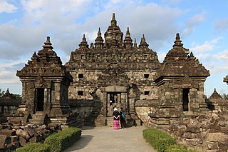
Klaten Regency is a regency in Central Java province in Indonesia. It covers an area of 701.52 km2 and had a population of 1,130,047 at the 2010 Census and 1,260,506 at the 2020 Census; the official estimate as at mid 2023 was 1,284,386. Its administrative centre is in the town of the same name; the town extends over 35.85 km2 to encompass three of the regency's districts, with a combined total of 135,681 inhabitants in mid 2023; a fourth district (Kalikotes) is part of its urban area.

<span class="mw-page-title-main">Sleman Regency</span> Regency in Yogyakarta, Indonesia

Sleman Regency is an Indonesian regency on the island of Java. It is located in the north of the Yogyakarta Special Administrative Region, Indonesia, and has an area of 574.82 square kilometres (221.94 sq mi), with a population of 1,093,110 at the 2010 Census and 1,125,804 at the 2020 Census; the official estimate as at mid 2023 was 1,157,292 - comprising 573,760 males and 583,540 females. Its capital is the town of Sleman. The current regent is Kustini Sri Purnomo.

<span class="mw-page-title-main">Gunung Kidul Regency</span> Regency in Yogyakarta, Indonesia

Gunungkidul is a regency area located in the Special Province of the Daerah Istimewa Yogyakarta, Indonesia. The administrative centre is the town of Wonosari. The name "Gunungkidul" comes from the Javanese language mountains in the south of Java Land, whose area is located in the Thousand Mountains range of the province.
<span class="mw-page-title-main">Blora Regency</span> Regency in Indonesia

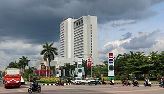
Blora is a regency in the northeastern part of Central Java province in Indonesia. Its capital is the town of Blora. The regency is located in the easternmost part of Central Java and borders the Bengawan Solo River and the East Java province. It covers an area of 1,955.83 km2 and it had a population of 829,728 at the 2010 Census and 884,333 at the 2020 Census; the official estimate as of mid-2023 was 901,621, comprising 450,993 males and 450,628 females.

<span class="mw-page-title-main">Demak Regency</span> Regency of Indonesia

Demak is a regency located in the Indonesian province of Central Java, on the northern coast of the island. It is bordered by Jepara Regency and the Java Sea to the north, Kudus and Grobogan Regencies to the east, Grobogan and Semarang Regencies to the south, while to the west are Semarang Regency and the city of Semarang, to which the districts of Mranggen and Sayung within Demak Regency are essentially suburban. The regency covers an area of 995.32 km2 (384.30 sq mi) and had a population of 1,055,579 at the 2010 Census and 1,203,956 at the 2020 Census; the official estimate as at mid 2023 was 1,240,510. It was originally the centre of the Demak Sultanate, once a dominant power in the region. Due to its strong relation with the spread of Islam in Java and the Wali Sanga, it is sometimes referred to with the nickname Kota Wali.

<span class="mw-page-title-main">Surakarta Sunanate</span> Javanese monarchy

Surakarta Sunanate is a Javanese monarchy centred in the city of Surakarta, in the province of Central Java, Indonesia.

Wonosari is the administrative centre of Gunungkidul Regency, in the Special Region of Yogyakarta on Java, Indonesia. Wonosari District is bordered to the north by the district of Nglipar, to the east by the districts of Karangmojo and Semanu, to the south by the district of Tanjungsari, and to the west by the districts of Paliyan and Playen. It had a population of 87,454 as of 2020 Census.

<span class="mw-page-title-main">Yogyakarta metropolitan area</span> Metropolitan area in Special Region of Yogyakarta, Indonesia

The Greater Yogyakarta, known locally as Kartamantul, an acronym of Yogyakarta–Sleman–Bantul, is a built-up area in Special Region of Yogyakarta, Indonesia. Although unofficial, the Greater Yogyakarta sometimes referred to as the Yogyakarta metropolitan area.

<span class="mw-page-title-main">Surakarta metropolitan area</span> Metropolitan area in Indonesia

The Surakarta metropolitan area or known locally as or Greater Solo is one of the metropolitan areas in Indonesia where the former Kerasidenan of Surakarta and the Special Region of Surakarta were established. This area includes the city of Surakarta and its buffer areas such as Sukoharjo Regency, Karanganyar Regency.

References

  1. "Prabowo Cabut Status DKI dari Jakarta, Berlaku Mulai Ini Ditetapkan!", Emir Yanwardhana, CNBC Indonesia, retrieved 10 December 2024