Pyapon is a town and seat of Pyapon District as well as Pyapon Township in the Ayeyarwady Region of Myanmar, along the Pyapon River, a distributary of the Ayeyarwady River. It is located about 15 kilometres (9.3 mi) inland from the Andaman Sea, about 75 miles (121 km) south of the previous capital, Yangon. In 2023, it had a population of 47,082. It serves as a center for collecting rice from the surrounding agricultural areas, and is home to a diesel-run power plant, using equipment by the German firm Siemens.

Pathein Township is a township of Pathein District in the Ayeyawady Region of Myanmar. The administrative seat of the Township, District and Region is Pathein. The city of Pathein is the largest city in the Region and has historically been an important center of trade, including a deepwater port.

Ingapu Township is a township of Myanaung District in the Ayeyarwady Division of Myanmar. It is located in southern Myanaung District bordering Kyangin Township to the north. To the south, it borders Hinthada Township's townships of Hinthada Township and Lemyethna Township. The Township borders Letpadan Township and Monyo Township in Bago Region to the east and Gwa Township in Rakhine State to the east.

Kangyidaunt Township is a township of the Pathein District in the Ayeyarwady Division of Myanmar. It is located on the eastern edge of Pathein District, bordering the townships of Einme and Myaunmya in Myaungmya District. Within Pathein District, Kangyidaunt Township is bordered by Kyaunggon Township to the northeast, Thabaung Township to the north, Pathein Township to the west, and Ngapudaw Township to the southwest. Kangyidaunt Township consists of 1 town, 7 wards, 73 village tracts and 386 villages. The principal town is Kangyidaunt. It may also be spelled as Kangyidaung.

Ngapudaw Township or Ngaputaw Township is a township of Pathein District in the Ayeyarwady Region of Myanmar. The western portion of the township includes Ngayokaung Subtownship and the southern portion of the township includes Hainggyikyun Subtownship, both unofficial divisions used by the Township for statistical and administrative ease. The small village of Kyounku within Hainggyikyun Subtownship is the birthplace of former President of Myanmar Thein Sein.

Einme Township is a township of Myaungmya District in the Ayeyarwady Region of Myanmar. The area is believed to be where the Battle of Naungyo took place in 1539. Einme Township is one of the few townships in the Bamar-majority regions of Myanmar that is not Bamar majority itself. Instead, Karen people comprise 52.62% of the township’s population. The principal town is Einme.

Putao Township is a township of Putao District in the Kachin State of Burma. The principal town is Putao.
Einme is a town in the Ayeyarwady Division of south-west Myanmar. It is the seat of the Einme Township in the Myaungmya District.
Kangyidaunt is a town in the Ayeyarwady Region, Myanmar. It is the seat of the Kangyidaunt Township in the Pathein District.
Thabaung is a town in the Ayeyarwady Region of south-west Myanmar. It is the seat of the Thabaung Township in the Pathein District. The Ngawun river runs through the town.
Ngapudaw is a town in the Ayeyarwady Region of south-west Burma (Myanmar). It is the seat of the Ngapudaw Township in the Pathein District. The town is divided into 4 wards and lies on the Ngawun river.
Kyaunggon is a town in the Ayeyarwady Region of south-west Myanmar. It is the seat of the Kyaunggon Township in the Pathein District.
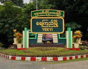
Yekyi is a town in the north-central Ayeyarwady Region,south-west Myanmar. It is the seat of the Yekyi Township in the Kyonpyaw District and is divided into 5 wards. The town sits on the southern bank of the Shwegu creek and curves with the meander of the creek.
Hainggyi Island is a town on the island of Hainggyi Island located at the mouth of the Pathein River in the Ayeyarwady Region of south-west Myanmar. It is the primary town within Hainggyikyun Subtownship within Ngapudaw Township in the Pathein District.

The Pathein River, formerly called the Bassein River, is the westernmost distributary of the Irrawaddy river in the Irrawaddy delta of Myanmar flowing through Ayeyarwady Region. The river is also interchangeably known as the Ngawun River.
Ngathaingchaung or Ngathinechaung and sometimes Ngathainggyaung is a town and the second largest town in Yegyi Township, Kyonpyaw District in north-central Ayeyarwady Region, Myanmar and is divided into 6 urban wards. It is the namesake of Ngathaingchaung Subtownship, an informal division sued for statistical and administrative convenience. As such, it is the administrative seat for some local functions for 31 village tracts, which group together 196 of Yegyi Township's western half.

Ngwesaung Subtownship is a subtownship of Pathein Township in Pathein District, Ayeyarwady Region, Myanmar. The namesake of the subtownship is Ngwesaung, a popular beach resort with a white sand shore. The subtownship is relatively urban with 27.3% of the population in 2019 living within the town of Ngwesaung.

Shwethaungyan Subtownship, also spaced out as Shwe Thaung Yan, is a subtownship in Pathein District, Ayeyarwady Region, Myanmar. The subtownship is split between Pathein Township and Thabaung Township; it has a total area of 178.50 square miles (462.3 km2), with 153.16 square miles (396.7 km2) in Pathein and 25.34 square miles (65.6 km2) in Thabaung.

Ngayokaung Subtownship is a subtownship of Ngapudaw Township in Pathein District, Ayeyarwady Region, Myanmar. The namesake of the subtownship is the town of Ngayokaung, which literally translates to pepper. The subtownship is coastal, bordering the Bay of Bengal to the west. To its north, it borders Pathein Township. To its east and south, it borders the rest of Ngapudaw Township. The eastern bound of the subtownship follows the Mawtin-Pathein road. The Subtownship is mountainous with the southern portions of the Arakan Mountains within the township making the area historically difficult to reach and hard to develop. The subtownship is divided into 11 village tracts consisting of 68 villages and one town, Ngayokaung, split into 2 wards. and a population of only 3,254 people in 2014.
Ngayokaung is a town in southwestern Ayeyarwady Region within the Ngayokaung Subtownship, Ngapudaw Township, Pathein District, Myanmar. It is a coastal town on the Bay of Bengal near Goyingyi Island. The Ngayokaung Road connects the Mawtin-Pathein road to the town across the southern end of the Arakan Mountains. It is the primary town within Ngayokaung Subtownship, Ngapudaw Township, Pathein District. The town of Ngayokaung has an area of 0.72 square miles (1.9 km2)

