
Mount Foresta is an 11,000+ ft multi-peak massif located in Wrangell–St. Elias National Park, in the Saint Elias Mountains of Alaska in the United States. Rising high above the lower western margin of the Hubbard Glacier, the summit of Mount Foresta is just over nine miles (14 km) from tidewater at Disenchantment Bay, 12 mi (19 km) northwest of Mount Seattle, 14.5 mi (23 km) southeast of Mount Vancouver, and 46 mi (74 km) north of Yakutat.

Mount Bertha is a 10,204-foot (3,110-meter) glaciated mountain summit located in the Fairweather Range of the Saint Elias Mountains, in southeast Alaska, United States.

McGinnis Peak is an 11,400 ft (3,470 m) elevation glaciated summit located at the head of McGinnis Glacier in the eastern Alaska Range, in Alaska, United States. It is the eighth-highest peak in the Hayes Range, a subset of the Alaska Range. This remote peak is situated 14 mi (23 km) southeast of Mount Hayes, and 95 mi (153 km) southeast of Fairbanks. Mount Moffit, the nearest higher neighbor, is set 3.33 mi (5 km) to the northwest, and Mount Shand is positioned 4.5 mi (7 km) to the west. The Richardson Highway is 15 mi (24 km) to the east, with Hayes, McGinnis, and Moffit dominating the landscape along the drive south.
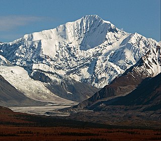
Hess Mountain, also known as Mount Hess, is an 11,940 ft (3,640 m) elevation glaciated summit located on the crest of the Alaska Range, in Alaska, United States. It is the seventh-highest peak in the Hayes Range which is a subrange of the Alaska Range. This remote peak is situated 13.3 mi (21 km) west of Mount Hayes, and 90 mi (145 km) south of Fairbanks. Mount Deborah, the nearest higher neighbor, is positioned 2.8 mi (5 km) to the west. Precipitation runoff from the mountain drains into tributaries of the Susitna and Tanana River drainage basins. The mountain's name was reported in 1912 by the United States Geological Survey. The first ascent was made May 24, 1951, by Alston Paige, Dick Holdren, Ed Huizer, Howard Bowman, and Elton Thayer. The first ascent via the North Ridge was made May 23, 1976, by Steven Hackett and Thomas Hillis.
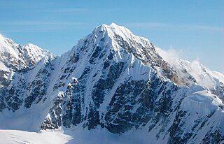
Kahiltna Queen is a 12,380-foot-elevation (3,773-meter) mountain summit in the U.S. state of Alaska.
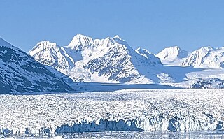
Lindita Peak is a 7,910-foot-elevation (2,411-meter) mountain summit located 17 miles (27 km) north-northwest of Valdez in the U.S. state of Alaska. Lindita is the highest peak at the head of the Tazlina Glacier when viewed from the Glenn Highway at Mile 156 near the Tazlina Glacier Lodge. This remote glaciated mountain is set in the Chugach Mountains on land managed by Chugach National Forest. Precipitation runoff from the mountain drains south to Prince William Sound and north to Tazlina Lake → Tazlina River → Copper River. Topographic relief is significant as the summit rises 2,400 feet (732 m) above the East Branch of the Columbia Glacier in 0.4 mile (0.64 km). The mountain's name Lindita, meaning "little beauty" in Spanish, was applied in 1955 by mountaineer and glaciologist Lawrence E. Nielsen (1917–1992), and the toponym was officially adopted in 1965 by the U.S. Board on Geographic Names. The first ascent of the summit was made on July 1, 1977, by Lawrence E. Nielsen, Halford Joiner, Tom Lamb, and Dr. Randall Travis via the northeast face and the north-facing knife-edged ridge from the Tazlina Glacier.
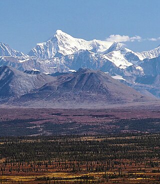
Mount Balchen is an 11,205-foot-elevation (3,415-meter) mountain summit in Alaska, United States.
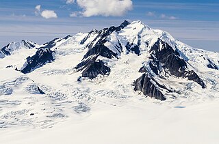
Mount Leeper is a 9,603-foot-elevation (2,927-meter) mountain summit in Alaska, United States.

Mount Gakona is a 9,865-foot-elevation (3,007-meter) mountain summit in Alaska.

Mount Tlingit Ankawoo is a 7,550-foot-elevation (2,301-meter) mountain summit in Alaska.

Mount Dech is a 7,475-foot-elevation (2,278-meter) mountain summit in Alaska.

Bellicose Peak is a 7,640-foot (2,329 m) mountain summit in Alaska, United States.

Royal Tower is an 8,130-foot-elevation (2,478-meter) mountain summit in Alaska.

Mount Gerdine is an 11,258-foot-elevation (3,431-meter) mountain summit in Alaska.

Paradise Peak is a 6,050-foot-elevation (1,844-meter) mountain summit in Alaska, United States.

Mount Skarland is a 10,375-foot-elevation (3,162-meter) mountain summit in Alaska, United States.

Mount Geist is a 10,716-foot-elevation (3,266-meter) mountain summit in Alaska, United States.

Ice Cream Cone Mountain is an 8,675-foot-elevation (2,644-meter) mountain summit located 22 miles (35 km) east of Palmer, in the northern Chugach Mountains of Alaska. This peak is visible from the Glenn Highway near Mile 70 west of Kings Mountain. Precipitation runoff from the mountain's north slope drains into Carpenter Creek, a tributary of the Matanuska River, whereas the south slope drains into Metal Creek, a tributary of the Knik River. Topographic relief is significant as the summit rises 5,200 feet above Metal Creek in 1.5 mile (2.4 km) and 5,675 feet above Carpenter Creek in 1.9 mile (3 km). The first ascent of the summit was made on July 3, 1967, by David P. Johnston, John Samuelson, and Hans Van der Laan via the Northeast Ridge. This mountain's local descriptive toponym has not been officially adopted by the United States Board on Geographic Names, so it is only marked as "8675" on USGS maps. Some climbers in Anchorage call this peak the "Sky Buster" which was the name applied by mountaineer Vin Hoeman.

Rainbow Mountain is a 6,841-foot-elevation (2,085-meter) summit in Alaska, United States.

Troublemint Peak is a 6,801-foot-elevation (2,073-meter) summit in Alaska, United States.


