
Mount Hayes is the highest mountain in the eastern Alaska Range, in the U.S. state of Alaska. Despite not being a fourteener, it is one of the largest peaks in the United States in terms of rise above local terrain. For example, the Northeast Face rises 8,000 feet (2,440 m) in approximately 2 miles (3.2 km). This large vertical relief contributes to Mount Hayes being the 51st most topographically prominent peak in the world.

Mount Huxley is a 12,216-foot glaciated mountain summit located in the Saint Elias Mountains of Wrangell-St. Elias National Park and Preserve, in the U.S. state of Alaska. The remote peak is situated 75 mi (121 km) northwest of Yakutat, and 8.7 mi (14 km) west-northwest of Mount Saint Elias. The peak rises above the Columbus Glacier and Bagley Icefield to its north, the Tyndall Glacier to the south, and the Yahtse Glacier to the west. Precipitation runoff from the mountain drains into the Gulf of Alaska. The mountain was named in 1886 by English mountaineer Harold Ward Topham for Thomas Henry Huxley (1825-1895), an English biologist. The mountain was officially named Huxley Peak in 1917, but the name was officially changed to Mount Huxley in 1968 by the U.S. Board on Geographic Names. The first ascent of the peak was made June 9, 1996 by Paul Claus who landed his plane at 11,500 feet elevation on the western flank and climbed the remaining distance to the summit. The second ascent of Mt. Huxley, and first complete ascent from base to summit, was made in June 2018 by Scott Peters, Andrew Peter, and Ben Iwrey starting from the Columbus Glacier.

Hogback Ridge is a 6,135-foot (1,870 m) glaciated mountain ridge located in the Chugach Mountains, in the U.S. state of Alaska. This landform is situated 9 mi (14 km) east of Valdez, 9 mi (14 km) west of Thompson Pass, and the Richardson Highway traverses the southern base of the mountain. This feature takes its name from the Hogback Glacier on its northern slopes, and in turn the glacier was named in 1898 by Captain William R. Abercrombie. Abercrombie led an 1898 expedition seeking a route from coastal Alaska to the Klondike. Precipitation runoff and meltwater from the mountain's glaciers drains into tributaries of the Lowe River, which in turn empties to Prince William Sound. The famous Horsetail Falls, which is located in Keystone Canyon, receives its source from the south slope of the mountain.
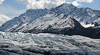
Mount Wickersham is a 7,415-foot (2,260 m) elevation mountain summit located 48 mi (77 km) east of Palmer, in the northern Chugach Mountains of the U.S. state of Alaska. This landmark of the Matanuska Valley is set midway between Anchorage and Glennallen, at mile 101 of the Glenn Highway. It is situated immediately west of Matanuska Glacier, and 10.5 mi (17 km) east of Amulet Peak. The mountain was named in 1960 by Senator Bob Bartlett and Secretary of the Interior Fred A. Seaton, to remember James Wickersham (1857–1939), attorney, District Judge, and Territorial Delegate to Congress from Alaska. In June 1903, Wickersham was also leader of the (unsuccessful) first attempt to climb Denali. His attempt was stymied by steep cliffs which also now bear his name, Wickersham Wall.

McGinnis Peak is an 11,400 ft (3,470 m) elevation glaciated summit located at the head of McGinnis Glacier in the eastern Alaska Range, in Alaska, United States. It is the eighth-highest peak in the Hayes Range, a subset of the Alaska Range. This remote peak is situated 14 mi (23 km) southeast of Mount Hayes, and 95 mi (153 km) southeast of Fairbanks. Mount Moffit, the nearest higher neighbor, is set 3.33 mi (5 km) to the northwest, and Mount Shand is positioned 4.5 mi (7 km) to the west. The Richardson Highway is 15 mi (24 km) to the east, with Hayes, McGinnis, and Moffit dominating the landscape along the drive south.
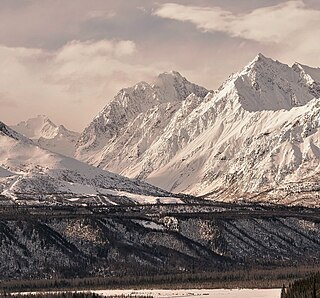
Awesome Peak is an 8,645-foot-elevation (2,635-meter) mountain summit located 35 miles (56 km) east-northeast of Palmer, in the northern Chugach Mountains of Alaska. This peak of the Matanuska Valley is set midway between Anchorage and Glennallen, near mile 90 of the Glenn Highway. It is situated 15 miles (24 km) west of Matanuska Glacier and 3.7 mi (6 km) southwest of Amulet Peak. Precipitation runoff from the mountain drains into Monument and Coal creeks, which are tributaries of the Matanuska River. Topographic relief is significant as the summit rises 5,650 feet above Coal Creek in 3.75 miles (6 km) and 4,650 feet above Monument Creek in 1.9 mile (3 km). This mountain's toponym has not been officially adopted by the United States Board on Geographic Names, so it is only marked as "8645" on USGS maps.
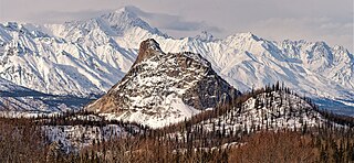
Lion Head is a 3,185-foot-elevation (971-meter) summit located 49 miles (79 km) east-northeast of Palmer, in the northern Chugach Mountains of Alaska. This iconic landmark of the Matanuska Valley is set alongside the Glenn Highway midway between Anchorage and Glennallen. It is situated at the confluence of Caribou Creek with Matanuska River and less than two miles (3.2 km) northeast of the terminus of Matanuska Glacier. Precipitation runoff from the mountain drains into the Matanuska River and topographic relief is significant as the summit rises 1,500 feet above the river in 0.3 mile (0.5 km). An ascent of the summit involves hiking 2.3 miles (round-trip) with 1,100 feet of elevation gain, on land owned by AT&T. This landform's descriptive toponym has been officially adopted by the United States Board on Geographic Names.
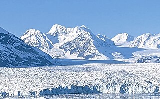
Lindita Peak is a 7,910-foot-elevation (2,411-meter) mountain summit located 17 miles (27 km) north-northwest of Valdez in the U.S. state of Alaska. Lindita is the highest peak at the head of the Tazlina Glacier when viewed from the Glenn Highway at Mile 156 near the Tazlina Glacier Lodge. This remote glaciated mountain is set in the Chugach Mountains on land managed by Chugach National Forest. Precipitation runoff from the mountain drains south to Prince William Sound and north to Tazlina Lake → Tazlina River → Copper River. Topographic relief is significant as the summit rises 2,400 feet (732 m) above the East Branch of the Columbia Glacier in 0.4 mile (0.64 km). The mountain's name Lindita, meaning "little beauty" in Spanish, was applied in 1955 by mountaineer and glaciologist Lawrence E. Nielsen (1917–1992), and the toponym was officially adopted in 1965 by the U.S. Board on Geographic Names. The first ascent of the summit was made on July 1, 1977, by Lawrence E. Nielsen, Halford Joiner, Tom Lamb, and Dr. Randall Travis via the northeast face and the north-facing knife-edged ridge from the Tazlina Glacier.
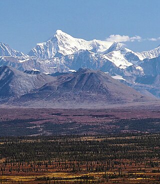
Mount Balchen is an 11,205-foot-elevation (3,415-meter) mountain summit in Alaska, United States.
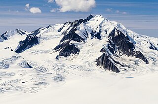
Mount Leeper is a 9,603-foot-elevation (2,927-meter) mountain summit in Alaska, United States.

Mount Gakona is a 9,865-foot-elevation (3,007-meter) mountain summit in Alaska.

Mount Emmerich is a 6,877-foot-elevation (2,096-meter) mountain summit in Alaska.
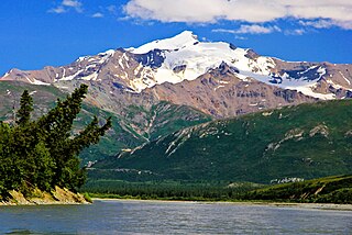
Mount Silvertip is a 9,400-foot-elevation (2,865-meter) mountain summit in Alaska.

Institute Peak is an 8,022-foot-elevation (2,445-meter) mountain summit in Alaska.

Tiehacker Mountain is a 4,435-foot-elevation (1,352-meter) mountain summit in Alaska, United States.
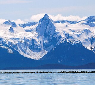
Nun Mountain is a 4,329-foot-elevation (1,319-meter) mountain summit in Alaska.

Paradise Peak is a 6,050-foot-elevation (1,844-meter) mountain summit in Alaska, United States.

Alabaster Peak is an 8,065-foot-elevation (2,458-meter) mountain summit located 35 miles (56 km) east of Palmer, in the northern Chugach Mountains of Alaska. This peak of the Matanuska Valley is set midway between Anchorage and Glennallen, and can be seen from the Glenn Highway. It is situated 15 miles (24 km) west of Matanuska Glacier and 1.8 miles (2.9 km) south of Awesome Peak. Precipitation runoff from the mountain drains into Coal, Monument, and Gravel creeks, which are tributaries of the Matanuska River. Topographic relief is significant as the summit rises 3,065 feet along the west slope in one mile (1.6 km). The first ascent of the summit was made on July 4, 1970, by Robert Spurr, Bob Pelz, and Royce Purinton via the Spectrum Glacier and North Ridge. This mountain's toponym has not been officially adopted by the United States Board on Geographic Names, so it is only marked as "8065" on USGS maps.

Mount Skarland is a 10,375-foot-elevation (3,162-meter) mountain summit in Alaska, United States.

Mount Geist is a 10,716-foot-elevation (3,266-meter) mountain summit in Alaska, United States.


