Agra is one of the 75 districts in the northern Indian state of Uttar Pradesh. The district headquarters is the historical city of Agra. Agra district is a part of Agra division.

Kulpahar is a city in Mahoba district in the Indian state of Uttar Pradesh. It is a historical town in the Bundelkhand region. Before 11 Feb 1995 Kulpahar was a Tehsil of Hamirpur District. On 11 Feb 1995 Mahoba District was carved out of Hamirpur, and Kulpahar is now a part of the Mahoba District. Kulpahar is the largest Subdivision of Uttar Pradesh. Kulpahar is known for its closeness to Khajuraho and other historic places like Mahoba, Charkhari, Kalinjar Rath, Orchha, and Jhansi. This town holds relics of temples and man-made water bodies of the Chandela Dynasty
Bah is a Block and sub-division in Agra district of Uttar Pradesh in India. The township is on the State Highway 62 of Uttar Pradesh. The place is surrounded by three rivers giving it its name.
Burhar is a town and nagar panchayat in Shahdol district in the state of Madhya Pradesh, India. Burhar was named after Budhi Mata, a local deity. It also has a temple belonging to her, in Purani Basti. Burhar is one of the fastest emerging commercial hubs of the division due to its geographical location.

Sarokhipura is a village in Panchayat Mukutpura of Jaitpur Kalan Block at Bah Tehsil of Agra, Uttar Pradesh, India India. It is situated on Fatehabad road 85 km from Agra City. This village mainly has Rajput Bhadauria and Brahmin communities.
Rurka Kalan is a village in the Tehsil Phillaur, Jalandhar, Punjab, India. Khurd and Kalan Persian language word which means small and Big respectively when two villages have same name then it is distinguished as Kalan means Big and Khurd means Small with Village Name.
Nagar Palika Parishad Bah is an institution of local governance comprising three blocks: Bah, Jaitpur and Pinahat. A Nagar Palika or municipality is an urban local body that administers a city. Nagar Palika is a municipality of Bah, Agra, Uttar Pradesh, India. Nagar Palika is constituted as per the provisions in the Constitution of India Act, 1992.
Chandma Kalan is a patwar circle and village in ILRC Madhorajpura in Phagi tehsil in Jaipur district, Rajasthan. Chandma Kalan is also a patwar circle for nearby villages, Ajnota, Unt Ka Khera, Chandarpura and Bisaloo.

Jaitpur State was a princely state in the Bundelkhand region. It was centered on Jaitpur, in present-day Mahoba district, Uttar Pradesh, which was the capital of the state. There were two forts in the area.

Sowaddi Kalan or Swaddi Khas is a village in Ludhiana district in the Indian state of Punjab. Kalan is Persian language word which means Big. It is one of the most educated villages in the area. Swaddi Kalan is a large village in Jagraon of Ludhiana district with a total of 954 families and 4,804 residents in 2011.
Mandholi Kalan, next to Mandholi Khurd, Rambass situated 5 km from Mandholi Gopalwas, Kasni Kalan and Isharwal, is a village and administrative unit with a democratically elected panchayat samiti in the Loharu, Loharu Tehsil of Bhiwani District under Bhiwani-Mahendragarh Lok Sabha constituency and Hisar Division of Haryana state.
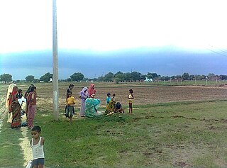
Rurka Khurd is a large size village in Phillaur tehsil of Jalandhar District of Punjab State, India. Kalan is Persian language word which means Big and Khurd is Persian word which means small when two villages have same name then it is distinguished with Kalan means Big and Khurd means Small used with Village Name. It is located 1.6 km away from postal head office Goraya, 16.7 km from Phillaur, 35 km from district headquarter Jalandhar and 129 km from state capital Chandigarh. The village is administrated by a sarpanch who is an elected representative of village as per Panchayati raj (India). The man in the photograph is native to this village. It was his first time getting his picture taken as well. He is a cattle herder. His name is Jattmandeep Singh and has a rich knowledge of the village
Jhander Kalan is a village in Shaheed Bhagat Singh Nagar district of Punjab State, India. Kalan is a Persian word for big and Khurd is a Persian word for small, when two villages have the same name they are distinguished by using Kalan or Khurd with the village name. It is located 9.2 kilometres (5.7 mi) away from postal head office Banga, 23 kilometres (14 mi) from Phagwara, 20 kilometres (12 mi) from district headquarter Shaheed Bhagat Singh Nagar and 113 kilometres (70 mi) from state capital Chandigarh. The village is administrated by Sarpanch an elected representative of the village.
National Highway 547 is a national highway in states of Maharashtra and Madhya Pradesh in India. It is a branch of National Highway 47. It connects two primary national highways, NH47 and NH44.

Government Engineering College, Kaimur is a government engineering college in Jaitpur Kalan, Po+Ps Bhagwanpur(821102) in Kaimur district of Bihar. It was established in the year 2019 under Department of Science and Technology, Bihar. It is affiliated with Bihar Engineering University and approved by All India Council for Technical Education.

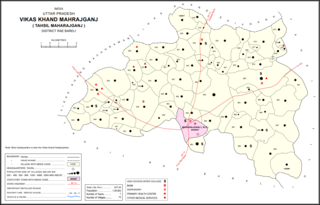
Para Kalan is a village in Maharajganj block of Rae Bareli district, Uttar Pradesh, India. As of 2011, its population is 2,217, in 435 households. It has one primary school and no healthcare facilities. It is located 9 km from Maharajganj, the block headquarters. The main staple foods are wheat and rice.

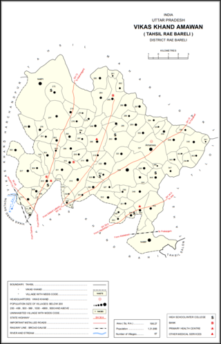
Pindari Kalan is a village in Amawan block of Rae Bareli district, Uttar Pradesh, India. As of 2011, its population is 3,960, in 671 households. It has one primary school and no healthcare facilities.

Behta Kalan is a village in Lalganj block of Rae Bareli district, Uttar Pradesh, India. It is located 8 km (5.0 mi) from Lalganj, the block and tehsil headquarters, a bit to the north of the road connecting it and Rae Bareli, the district headquarters.

Ramaipur Kalan is a village in Sareni block of Rae Bareli district, Uttar Pradesh, India. It is located 15 km from Lalganj, the tehsil headquarters. As of 2011, it has a population of 1,579 people, in 251 households. It has one primary school and no healthcare facilities, and does not host a weekly haat or a permanent market. It belongs to the nyaya panchayat of Sareni.


