Janaki Rural Municipality (Kailali District)

Last updated
Janaki Rural Municipality
जानकी गाउँपालिका
Nepal Sudurpashchim Pradesh rel location map.svg
Red pog.svg
Janaki Rural Municipality
Location in Sudurpashchim Province
Nepal rel location map.svg
Red pog.svg
Janaki Rural Municipality
Janaki Rural Municipality (Nepal)
Coordinates: 28°33′35″N81°06′27″E / 28.559795°N 81.107626°E / 28.559795; 81.107626 Coordinates: 28°33′35″N81°06′27″E / 28.559795°N 81.107626°E / 28.559795; 81.107626
CountryFlag of Nepal.svg    Nepal
Province Sudurpashchim
District Kailali
No. of wards9
Established10 March 2017
Incorporated (VDC) Janakinagar, Pathraiya, Durgauli, and Munuwa
Government
  ChairpersonGanesh Chaudhary (NUP)
  Vice-chairpersonLalmati Devi Kathriya (NC)
Area
  Total107.27 km2 (41.42 sq mi)
Population
 (2011)
  Total48,540
  Density450/km2 (1,200/sq mi)
Time zone UTC+5:45 (Nepal Standard Time)
Headquarter Durgauli
Website Official Website

Janaki is a rural municipality in Kailali District located in Sudurpashchim Province of Nepal.

The rural municipality was established In 2017 while the Nepalese government restructured 753 new local level units cancelling the old thousands of local level units. The rural municipality was created merging the then four following VDCs: Janakinagar, Pathraiya, Durgauli, and Munuwa. [1] [2] [3] [4] Total area of this rural municipality is 107.27 square kilometres (41.42 sq mi) and it is divided into 9 wards. 48,540 individuals lived here according to the 2011 Nepal census. [2] [5]

Demographics

At the time of the 2011 Nepal census, Janaki Rural Municipality had a population of 48,540. Of these, 60.1% spoke Tharu, 21.6% Nepali, 11.4% Achhami, 3.9% Doteli, 1.0% Dailekhi, 0.6% Urdu, 0.4% Magar, 0.4% Maithili, 0.2% Jumli, 0.1% Awadhi, 0.1% Bajureli, 0.1% Hindi and 0.1% other languages as their first language. [6]

In terms of ethnicity/caste, 60.4% were Tharu, 10.1% Hill Brahmin, 9.8% Chhetri, 8.4% Kami, 3.1% Thakuri, 1.8% Damai/Dholi, 1.7% Magar, 1.3% Lohar, 0.8% Sanyasi/Dasnami, 0.7% Musalman, 0.7% Sarki, 0.3% other Dalit, 0.2% Badi, 0.1% Bengali, 0.1% Gurung, 0.1% Kumal, 0.1% Newar, 0.1% Teli, 0.1% other Terai and 0.2% others. [7]

In terms of religion, 95.3% were Hindu, 2.5% Christian, 1.4% Buddhist, 0.7% Muslim and 0.1% others. [8]

In terms of literacy, 64.7% could read and write, 2.0% could only read and 33.2% could neither read nor write. [9]

Related Research Articles

Sangurigadhi is a rural municipality (gaunpalika) out of four rural municipality located in Dhankuta District of Koshi Province of Nepal. There are a total of 7 municipalities in Dhankuta in which 3 are urban and 4 are rural.

Chaubise is a rural municipality (gaunpalika) out of four rural municipality located in Dhankuta District of the Koshi Province of Nepal. There are a total of 7 municipalities in Dhankuta in which 3 are urban and 4 are rural.

Buddhashanti is a rural municipality (gaunpalika) out of seven rural municipality located in Jhapa District of Koshi Province of Nepal. There are a total of 15 municipalities in Jhapa in which 8 are urban and 7 are rural. Buddhashanti, according to Ministry of Federal Affairs and Local Development has an area of 79.78 square kilometres (30.80 sq mi) and the total population of the municipality is 41,615 as of Census of Nepal 2011.

Bheri is an urban municipality located in Jajarkot District of Karnali Province of Nepal.

Barbardiya Municipality is a municipality located in Bardiya District in Lumbini Province of Nepal.

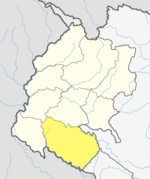
Madhuwan is a municipality located in Bardiya District of Lumbini Province of Nepal. It is one out of six municipality of Bardiya District. The municipality is surrounded by Gulariya and Barbardiya in the east, India borders from the west, Thakurbaba and Geruwa Rural Municipality in the north. Bardiya National Park touches the border of the municipality by north.

Badhaiyatal is a rural municipality located in Bardiya District of Lumbini Province of Nepal.

Geruwa is a rural municipality located in Bardiya District of Lumbini Province of Nepal.

Benighat Rorang is a rural municipality located within the Dhading District of the Bagmati Province of Nepal. The rural municipality spans 29.17 square kilometres (11.26 sq mi), with a total population of 31,475 according to a 2011 Nepal census.

Roshi is a Rural municipality located within the Kavrepalanchowk District of the Bagmati Province of Nepal. The municipality spans 176 square kilometres (68 sq mi) of area, with a total population of 28,746 according to a 2011 Nepal census.

Khanikhola is a Rural municipality located within the Kavrepalanchowk District of the Bagmati Province of Nepal. The municipality spans 132 square kilometres (51 sq mi) of area, with a total population of 14,398 according to a 2011 Nepal census.

Bethanchok is a Rural municipality located within the Kavrepalanchowk District of the Bagmati Province of Nepal. The municipality spans 101 square kilometres (39 sq mi) of area, with a total population of 16,777 according to a 2011 Nepal census.

Bakaiya is a Rural municipality located within the Makwanpur District of the Bagmati Province of Nepal. The municipality spans 393.75 square kilometres (152.03 sq mi) of area, with a total population of 39,620 according to a 2011 Nepal census.

<span class="mw-page-title-main">Indrasarowar Rural Municipality</span> Rural Municipality in Bagmati, Nepal

Indrasarowar is a Rural municipality located within the Makwanpur District of the Bagmati Province, Nepal. The municipality spans 97.33 square kilometres (37.58 sq mi) of area, with a total population of 17,585 according to a 2011 Nepal census.

Likhutamakoshi is a Rural municipality located within the Ramechhap District of the Bagmati Province of Nepal. The municipality spans 124.51 square kilometres (48.07 sq mi) of area, with a total population of 23,109 according to a 2011 Nepal census.

Khandadevi is a Rural municipality located within the Ramechhap District of the Bagmati Province of Nepal. The municipality spans 150.7 square kilometres (58.2 sq mi) of area, with a total population of 25,761 according to a 2011 Nepal census.

Sarumarani is a Rural municipality located within the Pyuthan District of the Lumbini Province of Nepal. The rural municipality spans 157.97 square kilometres (60.99 sq mi) of area, with a total population of 18,627 according to a 2011 Nepal census.

Makawanpurgadhi is a Rural municipality located within the Makwanpur District of the Bagmati Province of Nepal. The rural municipality spans 148.72 square kilometres (57.42 sq mi) of area, with a total population of 25,322 according to a 2011 Nepal census.

Bhimphedi is a Rural municipality located within the Makawanpur District of the Bagmati Province of Nepal. The rural municipality spans 245.27 square kilometres (94.70 sq mi) of area, with a total population of 23,344 according to a 2011 Nepal census.

Janaki is a rural municipality in Banke District located in Lumbini Province of Nepal.

References

  1. "District Corrected Last for RAJAPATRA" (PDF). www.mofald.gov.np. Retrieved 17 July 2018.
  2. 1 2 "स्थानीय तहहरुको विवरण" [Details of the local level bodies]. www.mofald.gov.np/en (in Nepali). Ministry of Federal Affairs and Local Development . Retrieved 17 July 2018.
  3. "New local level structure comes into effect from today". www.thehimalayantimes.com. The Himalayan Times. 10 March 2017. Retrieved 17 July 2018.
  4. "New local level units come into existence". www.kathmandupost.ekantipur.com. 11 March 2017. Retrieved 18 July 2018.
  5. "राष्ट्रिय जनगणना २०७८ प्रारम्भिक नतिजा". www.cbs.gov.np. Central Bureau of Statics, Nepal. 26 January 2022. Retrieved 29 May 2022.
  6. NepalMap Language
  7. NepalMap Caste
  8. NepalMap Religion
  9. NepalMap Literacy