Jatun Q'asa (Potosí)

Last updated
Jatun Q'asa
Bolivia physical map.svg
Red triangle with thick white border.svg
Jatun Q'asa
Location in Bolivia
Highest point
Elevation 5,023 m (16,480 ft) [1]
Coordinates 19°39′56″S65°39′26″W / 19.66556°S 65.65722°W / -19.66556; -65.65722 Coordinates: 19°39′56″S65°39′26″W / 19.66556°S 65.65722°W / -19.66556; -65.65722
Geography
Location Bolivia,
Potosí Department
Parent range Andes, Khari Khari mountain range

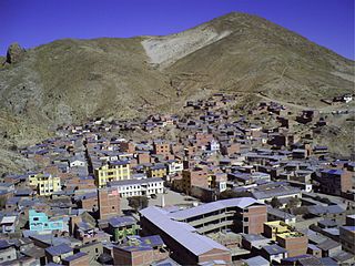
Jatun Q'asa (Quechua jatun, hatun big, great, q'asa mountain pass, "great mountain pass", hispanicized spelling Jatún Casa) is a mountain in the Khari Khari mountain range of the Bolivian Andes, about 5,023 m (16,480  ft) high. It is located in the Potosí Department, Tomás Frías Province, Potosí Municipality. It lies north of the plain called Jatun Molino Pampa and the Sip'uruni River. Jatun Q'asa lies near Q'illu Q'asa, Q'illu Urqu and Yuraq Yuraq. [1] [2]

Potosí mountain range Mountain range in Bolivia

The Potosí mountain range in Bolivia is situated east and southeast of the city of Potosí. It is at least 25 km long stretching from north to south. Its highest mountain is Khunurana (Anaruyu) rising up to 5,071 m (16,637 ft). The features of the range are considered the product of volcanic activity known as the Khari Khari caldera. The caldera is about 40 km long and 25 km at its widest point.

Bolivia country in South America

Bolivia, officially the Plurinational State of Bolivia is a landlocked country located in western-central South America. The capital is Sucre while the seat of government and financial center is located in La Paz. The largest city and principal industrial center is Santa Cruz de la Sierra, located on the Llanos Orientales a mostly flat region in the east of Bolivia.

Andes mountain range running along the tu mamide of South America

The Andes or Andean Mountains are the longest continental mountain range in the world, forming a continuous highland along the western edge of South America. This range is about 7,000 km (4,300 mi) long, about 200 to 700 km wide, and of an average height of about 4,000 m (13,000 ft). The Andes extend from north to south through seven South American countries: Venezuela, Colombia, Ecuador, Peru, Bolivia, Chile and Argentina.


Related Research Articles

Ayopaya Province province of Bolivia

Ayopaya is a province in the Cochabamba Department, Bolivia. Its capital is Ayopaya.

Quillacollo Province Province in Cochabamba Department, Bolivia

Quillacollo is a province in the Cochabamba Department, Bolivia. It is known for its festival in August where people from all over Bolivia come and pay homage to the Virgin of Urqupiña. Quillacollo is said to be one of the fastest growing cities in Bolivia.

Tomás Frías Province Province in Potosí Department, Bolivia

Tomás Frías is a province in the northern parts of the Bolivian Potosí Department. Its capital is Potosí which is also the capital of the department. The province is named after the former president Tomás Frías Ametller.

José María Linares Province Province in Potosí Department, Bolivia

José María Linares is a province in the eastern parts of the Bolivian department of Potosí. Its capital is Puna.

Nor Chichas Province Province in Potosí Department, Bolivia

Nor Chichas is a province in the Eastern parts of the Bolivian Potosí Department. Its seat is Cotagaita.

Chayanta Province Province in Potosí Department, Bolivia

Chayanta is a province in the northern parts of the Bolivian Potosí Department. Its capital is Colquechaca.

Morochata Municipality is the second municipal section of the Ayopaya Province in the Cochabamba Department, Bolivia. Its seat is Morochata.

Potosí Municipality Municipality in Potosí Department, Bolivia

Potosí Municipality is the capital municipality of the Tomás Frías Province in the Potosí Department in Bolivia. Its seat is Potosí which is the capital of the department as well.

Porco Municipality Municipality in Potosí Department, Bolivia

Porco Municipality is the third municipal section of the Antonio Quijarro Province in the Potosí Department in Bolivia. Its seat is Porco.

Ravelo Municipality Municipality in Potosí Department, Bolivia

Ravelo Municipality is the second municipal section of the Chayanta Province in the Potosí Department in Bolivia. Its seat is Ravelo.

Qillu Qasa (Bolivia)

Q'illu Q'asa is a mountain in the Potosí mountain range of the Bolivian Andes, about 4,960 m high. It is situated in the Potosí Department, southeast of Potosí. Q'illu Q'asa lies near Q'illu Urqu.

Yuraq Yuraq mountain in Bolivia

Yuraq Yuraq is a mountain in the Khari Khari mountain range of the Bolivian Andes, about 4,920 m high. It is situated southeast of Potosí in the Potosí Department. Yuraq Yuraq lies southeast of Illimani and northeast of Q'illu Urqu.

Jatun Q'asa or Hatun Q'asa may refer to:

Yuraq Q'asa may refer to:

Jatun Qasa (Umallani)

Jatun Q'asa is a 4,590-metre-high (15,059 ft) mountain in the Bolivian Andes. It is situated in the Potosí Department, Tomás Frías Province, Potosí Municipality. Some of the nearest settlements are Umallani and Salla K'uchu. Jatun Q'asa lies east Wayra Wasi, between the Ch'aki Mayu in the west and the Challwiri River (Challviri) in the east. Both rivers flow to the north as right tributaries of the Pillku Mayu.

Q'illu Q'asa may refer to:

Jatun Yuraq Qasa mountain in Bolivia

Jatun Yuraq Q'asa is a mountain in the Bolivian Andes which reaches a height of approximately 4,160 m (13,650 ft). It is located in the Cochabamba Department, Ayopaya Province, Morochata Municipality. It lies northwest of Liqiliqini.

Yuraq Qasa (Bolivia)

Yuraq Q'asa is a mountain in the Bolivian Andes which reaches a height of approximately 4,320 m (14,170 ft). It is located in the Potosí Department, at the border of the Antonio Quijarro Province, Porco Municipality, and the Tomás Frías Province, Potosí Municipality. The Misk'i Mayu flows along its eastern slope. It is a left tributary of the Jatun Mayu.

Jatun Qasa (Yocalla)

Jatun Q'asa is a 4,398-metre-high (14,429 ft) mountain in the Bolivian Andes. It is located in the Potosí Department, Tomás Frías Province, Yocalla Municipality. It lies east of the village of Puka Wasi (Puca Huasi).

References

  1. 1 2 Evelio Echevarría, Cordillera de Potosí, Bolivia, The Alpine Journal, 1995
  2. "Potosí". INE, Bolivia. Archived from the original on May 30, 2016. Retrieved October 6, 2014. (unnamed)