
Jebel Musa is a mountain in the northernmost part of Morocco, on the African side of the Strait of Gibraltar. It is part of the Rif mountain chain. The mountain is generally identified as the southern Pillar of Hercules, Abila Mons.

The Rif or Riff, also called Rif Mountains, is a geographic region in northern Morocco. This mountainous and fertile area is bordered by Cape Spartel and Tangier to the west, by Berkane and the Moulouya River to the east, by the Mediterranean to the north, and by the Ouergha River to the south. The Rif mountains are separated into the eastern Rif mountains and western Rif mountains.

Chefchaouen, also known as Chaouen, is a city in northwest Morocco. It is the chief town of the province of the same name and is noted for its buildings in shades of blue, for which it is nicknamed the "Blue City". Chefchaouen is situated just inland from Tangier and Tétouan.

Tangier-Tétouan was formerly one of the sixteen regions of Morocco from 1997 to 2015. It covered an area of 11,570 km² and had a population of 3,157,075. The capital was Tangier. In 2015, Al Hoceïma Province from Taza-Al Hoceima-Taounate was added to it to form the region of Tanger-Tétouan-Al Hoceïma.

El Jebha is a little port town in the northern part of Morocco. This Mediterranean coastal place is situated in the Rif Mountains, and across the route that takes traffic from the Northwestern part to the Northeastern part of Morocco. El Jebha, is the capital of the district (cercle) Mtiwa, which is part of Chefchaouen Province in the region of Tanger-Tetouan-Al Hoceima.

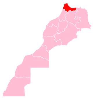
Chefchaouen is a province in the Moroccan economic region of Tanger-Tetouan-Al Hoceima. According to the 2014 national census in Morocco, the province has more than 457,432 inhabitants. The population is 87.45% rural.
Amtar is a small town and rural commune in Chefchaouen Province, Tanger-Tetouan-Al Hoceima, Morocco. At the time of the 2004 census, the commune had a total population of 10,038 people living in 1,459 households. The town's postcode is 91173.
Bni Ahmed Cherqia is a small town and rural commune in Chefchaouen Province, Tanger-Tetouan-Al Hoceima, Morocco. At the time of the 2004 census, the commune had a total population of 10,365 people living in 2021 households.
Bni Selmane is a small town and rural commune in Chefchaouen Province, Tanger-Tetouan-Al Hoceima, Morocco. At the time of the 2004 census, the commune had a total population of 23,396 people living in 3090 households.
Bni Rzine is a small town and rural commune in Chefchaouen Province, Tanger-Tetouan-Al Hoceima, Morocco. At the time of the 2004 census, the commune had a total population of 19,585 people living in 2630 households. Some of the families in Bni Rzine, like Acha(e)ffay, Mesbih, El Nasla, Amenchar, Nadi, Ahmadan, Azzouz, Tannan have their roots in the Hoceima region. Some famous people come from this village, such as Dutch journalist Ikram Akachaou Achaffaye (rip), author Saida Nadi or Khadija Nadi, entrepreneur in the impact field.
Bni Smih is a small town and rural commune in Chefchaouen Province, Tanger-Tetouan-Al Hoceima, Morocco. At the time of the 2004 census, the commune had a total population of 15,577 people living in 2109 households.
Bni Darkoul is a small town and rural commune in Chefchaouen Province, Tanger-Tetouan-Al Hoceima, Morocco. At the time of the 2004 census, the commune had a total population of 11,706 people living in 1888 households.
Bni Salah is a small town and rural commune in Chefchaouen Province, Tanger-Tetouan-Al Hoceima, Morocco. At the time of the 2004 census, the commune had a total population of 9662 people living in 1384 households.
Fifi is a small town and rural commune in Chefchaouen Province, Tanger-Tetouan-Al Hoceima, Morocco. At the time of the 2004 census, the commune had a total population of 7720 people living in 1312 households.
M'Tioua is a rural commune in Chefchaouen Province, Tanger-Tetouan-Al Hoceima, Morocco. At the time of the 2004 census, the commune had a total population of 12,076 people living in 1867 households.
Mansoura is a small town and rural commune in Chefchaouen Province, Tanger-Tetouan-Al Hoceima, Morocco. At the time of the 2004 census, the commune had a total population of 16,559 people living in 2664 households.
Mount Tidighin, Jbel Tidighin, Adrar N Tidighin, is a mountain in Al Hoceïma Province, Tanger-Tetouan-Al Hoceima, Morocco. Its summit elevation is 2,456 m.
Tangier-Tetouan-Al Hoceima is the northernmost of the twelve regions of Morocco. It covers an area of 15,090 km² and recorded a population of 3,556,729 in the 2014 Moroccan census. The capital of the region is Tangier.

Ouezzane is a province in the Moroccan region of Tanger-Tetouan-Al Hoceima. It was created in 2009 from parts of Chefchaouen Province and Sidi Kacem Province, and recorded a population of 300,637 in the 2014 Moroccan census. The capital is Ouezzane.

M'diq-Fnideq is a prefecture in Tanger-Tetouan-Al Hoceima, Morocco. It covers an area of 178.5 square kilometres (68.9 sq mi) and recorded a population of 209,897 in the 2014 Moroccan census. The seat of the prefecture is M'diq.

