This article has multiple issues. Please help improve it or discuss these issues on the talk page . (Learn how and when to remove these messages)
|
Jonaicha Khurd Jonayacha Khurd, Udiyapur (old name) | |
|---|---|
village | |
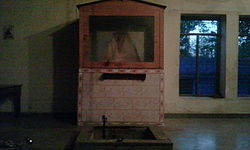 Baba Kundan Das Temple, Jonaicha Khurd | |
| Nickname: Chhota Jonayacha | |
 Jonaicha Khurd Location in Rajasthan, India  Jonaicha Khurd Jonaicha Khurd (India) | |
| Coordinates: 28°01′23″N76°26′46″E / 28.023°N 76.446°E | |
| Country | |
| State | Rajasthan |
| District | Alwar |
| Elevation | 363 m (1,191 ft) |
| Population (2008) | |
• Total | 3,500+ |
| Languages | |
| • Official | Hindi |
| Time zone | UTC+5:30 (IST) |
| PIN | 301706 |
| ISO 3166 code | RJ-IN |
Jonaicha Khurd is a village of Neemrana tehsil and the Alwar district in Rajasthan state, India, with a population around 3,500+.