Urban-type settlement is an official designation for lesser urbanized settlements, used in several Central and Eastern European countries. The term was primarily used in the Soviet Union and later also for a short time in socialist Bulgaria and socialist Poland. It remains in use today in nine of the post-Soviet states.

Sverdlovsk Oblast is a federal subject of Russia located in the Ural Federal District. Its administrative center is the city of Yekaterinburg, formerly known as Sverdlovsk. Its population is 4,268,998.

Türkmenabat, formerly Amul, Cärjew/Chardzhou, and Novy Chardzhuy, is the second-largest city in Turkmenistan and the administrative centre of Lebap Province. As of 2009, it had a population of approximately 254,000 people. From 1924 to 1927, it was also named Leninsk in honor of Vladimir Lenin.

Navoiy is a city and the capital of Navoiy Region in the central part of Uzbekistan. Administratively, it is a district-level city, that includes the urban-type settlement Tinchlik. It is located at latitude 40° 5' 4N; longitude 65° 22' 45E, at an altitude of 382 meters. The city is named after Alisher Navoiy. As of 2024, its population was 161,300 inhabitants.

Kattakurgan is a city in the Samarqand Region of Uzbekistan. Administratively, it is a district-level city, that includes the urban-type settlement Ingichka. It has 90,600 inhabitants (2021). It is located on the road and railway between Bukhara and Samarkand.

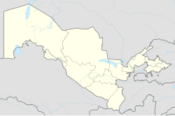
This article discusses the administrative-territorial division of the Republic of Uzbekistan. The Article 68 of the constitution of Uzbekistan defines:
The Republic of Uzbekistan shall consist of regions, districts, cities, towns, settlements, kishlaks and auls (villages) in Uzbekistan and the Republic of Karakalpakstan.

Ural Economic Region is one of twelve economic regions of Russia. This prominent industrial region consists of the following subdivisions : Bashkortostan (Ufa), Chelyabinsk Oblast (Chelyabinsk), Kurgan Oblast (Kurgan), Orenburg Oblast (Orenburg), Perm Krai (Perm), Sverdlovsk Oblast (Yekaterinburg) and Udmurt Republic (Izhevsk). It is mostly located in the Central, and partly in the Southern and Northern parts of the Urals, but also includes parts of the East European and West Siberian Plains. Its extent is different from that of the Ural Federal District; Bashkortostan, Orenburg Oblast, Perm Krai and Udmurtia are in the Volga Federal District while the other three are in the Ural Federal District.

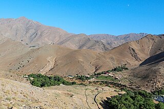
Surxondaryo Region is a region (viloyat) of Uzbekistan, located in the extreme south-east of the country. Established on 6 March 1941, it borders on Qashqadaryo Region internally, and Turkmenistan, Afghanistan and Tajikistan externally, going anticlockwise from the north. It takes its name from the river Surxondaryo, that flows through the region. It covers an area of 20,100 km². The population is estimated at 2,743,201, with 80% living in rural areas. According to official data, 83% of the population are Uzbeks and 12,5% Tajiks, but several sources argue that the Tajik population might be significantly higher in this region, as well as in Samarkand and Bukhara. The highest point of the Region and also of Uzbekistan is Khazrati Sulton peak reaching 4,643 m/15,233 ft in Gissar Range.

Qashqadaryo Region is one of the regions of Uzbekistan, located in the south-eastern part of the country in the basin of the river Qashqadaryo and on the western slopes of the Pamir-Alay mountains. It borders with Tajikistan, Turkmenistan, Samarqand Region, Bukhara Region and Surxondaryo Region. It covers an area of 28,570 km2. The population is an estimated 3,408,345 (2022), with 57% living in rural areas. The regional capital is Qarshi.

Samarqand Region is the most populous region of Uzbekistan. It is located in the center of the country in the basin of the Zarafshan River. It borders Tajikistan, Navoiy Region, Jizzakh Region and Qashqadaryo Region. It covers an area of 16,773 km2. The population is estimated to be around 4,031,324, with some 63% living in rural areas.

Bukhara Region is a region of Uzbekistan located in the southwest of the country. The Kyzyl Kum desert takes up a large portion of its territory. It borders Turkmenistan, Navoiy Region, Qashqadaryo Region, a small part of the Xorazm Region, and the Karakalpakstan Republic. It covers an area of 40,216 km2. The population is estimated at 1,976,823, with 63% living in rural areas.
Navoiy Region is one of the regions of Uzbekistan. It is located in the central north/northwest of the country. It covers an area of 111,095 km2 (42,894 sq mi), which makes it the largest of the regions of Uzbekistan. The Navoiy region borders with Kazakhstan, Samarqand Region, Buxoro Region, Jizzakh Region, and the Karakalpakstan Republic. The population is estimated to be 1,033,857 in 2022, with 51% living in rural areas. The capital is Navoiy. The region and its capital are named after the poet Ali-Shir Nava'i.
Khorazm Region, also known as the Khorezm or Xorazm Region, is a viloyat (region) of Uzbekistan located in the northwest of the country in the lower reaches of the Amu Darya River. It borders with Turkmenistan, Karakalpakstan, and the Bukhara Region. It covers an area of 6,050 square kilometres (2,340 sq mi). The population is estimated at 1,959,300 (2023), with 67% living in rural areas. The capital is Urgench. Other major towns include Xonqa, Khiva, Shovot, and Pitnak.

Suzak is a village in Jalal-Abad Region, Kyrgyzstan. Its population was 30,534 in 2021. It is the administrative seat of Suzak District.

Guliston also spelled as Gulistan, formerly known as Mirzachül and Qayroqqum, is the capital of Sirdaryo Region in eastern Uzbekistan. It is a district-level city.
Aktobe Region is a region of Kazakhstan. The name Aktobe comes from Kazakh aq 'white' and töbe 'hill' or 'top '; supposedly, Aktobe's initial settlers were able to see white mountains far to the north. The Aktobe regional capital is the city of Aktobe. The region is located in the western part of Kazakhstan. Its area is 300,629 km2, which is 11 per cent of the territory of Kazakhstan. The population is 909 673 as of June 1, 2022.
Angren is a district-level city in Tashkent Region, eastern Uzbekistan. The city is located on the Angren River 70 mi (110 km) to the east of Tashkent. The City of Angren was created in 1946 from the villages of Jigariston, Jartepa, Teshiktosh, and Qoʻyxona which had emerged in the rich Angren coal basin during World War II. It has an area of 150 km2 (58 sq mi) and the population of the city is 191,300 (2021).

Aksubayevsky District is a territorial administrative unit and municipality of the Republic of Tatarstan within the Russian Federation. The district is located in the south of the Republic of Tatarstan, in the Zakamsk economic region. The administrative center of the district is the urban-type settlement Aksubaevo. The Aksubayevsky district is the only district in the republic where the Chuvash population is the prevailing ethnic group by comparison to the Tatar and Russian population of the district.

Baltasinsky District is a territorial administrative unit and municipality of the Republic of Tatarstan within the Russian Federation. The district is located in the north of the republic and occupies an area of 1,094.5 square kilometers (422.6 sq mi). According to the 2010 census, the municipality had a population of 33,879 people. Its administrative center — an urban-type settlement of Baltasi — accounts for 22.8% of the district's total population.

Yakkabogʻ is a city in Yakkabogʻ District of Qashqadaryo Region in Uzbekistan. It is the administrative center of Yakkabogʻ District. The town population was 17,402 people in 1989, and 20,600 in 2016.