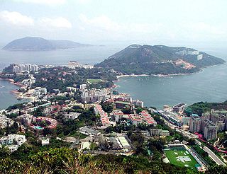
Stanley, or Chek Chue, is a coastal town and a popular tourist attraction in Hong Kong. It is located on a peninsula on Hong Kong Island. It is east of Repulse Bay and west of Shek O, adjacent to Chung Hom Kok and Tai Tam. Administratively, it is part of the Southern District.

Sai Kung District is one of the 18 districts of Hong Kong. The district comprises the southern half of the Sai Kung Peninsula, the Clear Water Bay Peninsula in the New Territories and a strip of land to the east of Kowloon. Areas in the district include Sai Kung Town, Hong Kong UNESCO Global Geopark, Tseung Kwan O and over 70 islands of different sizes. The administrative centre had been located in Sai Kung Town until the Sai Kung District Office was relocated to Tseung Kwan O recently. The district's population is concentrated in Tseung Kwan O, as of 2011. In 2011, the district was the third youngest district, with a median age of 39.3. Known as the "back garden of Hong Kong", Sai Kung has been able to retain its natural scenery. Many traditional customs and cultures are still retained in the rural villages.
Hong Kong counts approximately 600 temples, shrines and monasteries. While Buddhism and Christianity are the most widely practiced religions, most religions are represented in the Special Administrative Region.
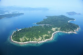
Grass Island or Tap Mun is an island in Hong Kong, located in the northeastern part of the territory. Its area is 1.69 km2 (0.65 sq mi). Administratively, it is part of the Tai Po District. There are about 100 people living on the island, and feral cattle are known on the island.

Tung Ping Chau is an island in Hong Kong, part of Hong Kong UNESCO Global Geopark. It is also known as Ping Chau (平洲). Tung is prepended to the name at times so as to avoid possible confusion with Peng Chau, another island in Hong Kong with an identically pronounced name in Cantonese. Administratively, the island is part of the Tai Po District in the New Territories.

Clear Water Bay is a bay on the eastern shore of Clear Water Bay Peninsula of Hong Kong, located within Clear Water Bay Country Park. There are two beaches at Clear Water Bay: "Clear Water Bay First Beach" and "Clear Water Bay Second Beach". The name is also used to describe the area around the bay on the peninsula.
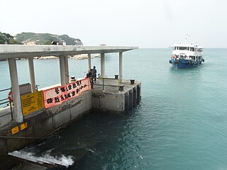
Po Toi is the main island of the Po Toi Islands and the southernmost island of Hong Kong, with an area of 3.69 km2.

Tai Wai is an area in the New Territories, Hong Kong, located between Sha Tin and the Lion Rock, within the Sha Tin District.

Sai Kung Town, or simply Sai Kung, is a town on the Sai Kung Peninsula facing Sai Kung Hoi in the New Territories, Hong Kong. Sai Kung is the central hub of nearby surrounding villages, and, hence the name, may also refer to the areas in its immediate surroundings.

A Man Mo temple, or Man Mo Miu, is a temple for the of the or literature god Man Tai (文帝), or Man Cheong (文昌), and the martial god Mo Tai (武帝), or Kwan Tai (關帝). The two deities were popularly patronized by scholars and students seeking progress in their study or ranking in the civil examinations in the Ming and Qing dynasties. There are several Man Mo temples in Hong Kong, the best known of which is the temple in Sheung Wan.

High Island or Leung Shuen Wan Chau is a former island located in the southeast of Sai Kung Peninsula in Hong Kong, within Sai Kung District. Two sets of dams constructed between 1969 and 1979 and crossing the former Kwun Mun Channel (官門海峽), connect the island to the peninsula, thereby forming the High Island Reservoir. Before being connected to the mainland, the island had an area of 8.511 km² (3.29 square miles) and was the 4th largest island of Hong Kong in 1960.
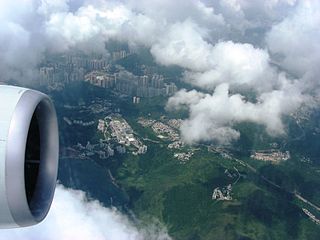
Tai Po Tsai is an area and a village, clustering in a small plain around Clear Water Bay Road in Clear Water Bay Peninsula, Sai Kung District, Hong Kong.
Articles related to Hong Kong include:

Tin Hau temples in Hong Kong are dedicated to Tin Hau (Mazu). Over 100 temples are dedicated to Tin Hau in Hong Kong. A list of these temples can be found below.
The Chinese Temples Committee is a statutory body in Hong Kong established in 1928 under the Chinese Temples Ordinance (華人廟宇條例). It is mainly responsible for the operation and management of twenty-four temples directly under its management. It also handles temple registration. There are 20 additional temples, of which management has been delegated to other organisations.
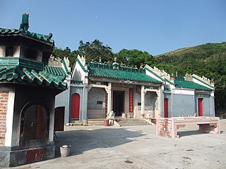
The Tin Hau Temple in Joss House Bay, sometimes referred to as Tai Miu, is Hong Kong's oldest and largest Tin Hau Temple. It is also said to be the most popular Tin Hau temple both for fishermen and for others in Hong Kong.

Tai Long Wan is a 3 kilometer-wide bay on the east coast of the Sai Kung Peninsula in Sai Kung District, Hong Kong. Considered one of the most beautiful places in Hong Kong, it is a popular surf destination.

Tsam Chuk Wan is a bay of the Sai Kung Peninsula in Hong Kong. By extension, it is also the name of the area around the bay. Tsam Chuk Wan Village (斬竹灣村) is one of the villages located within this area.
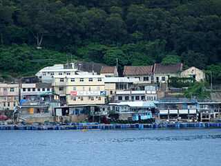
Ko Lau Wan aka. Kau Lau Wan (較流灣) is a remote village in the north of Sai Kung Peninsula, Hong Kong. Administratively, it is under the jurisdiction of Tai Po District.


