Kahaluu, Hawaii

Last updated
Kahaluʻu, Hawaii
Census-designated place
Honolulu County Hawaii Incorporated and Unincorporated areas Kahaluu Highlighted.svg
Location in Honolulu County and the state of Hawaii
Coordinates: 21°27′40″N157°50′28″W / 21.46111°N 157.84111°W / 21.46111; -157.84111 Coordinates: 21°27′40″N157°50′28″W / 21.46111°N 157.84111°W / 21.46111; -157.84111
Country United States
State Hawaiʻi
Area
  Total 4.5 sq mi (11.7 km2)
  Land 3.5 sq mi (9.0 km2)
  Water 1.0 sq mi (2.7 km2)
Elevation 7 ft (2 m)
Population (2010)
  Total 4,738
  Density 1,000/sq mi (400/km2)
Time zone Hawaii-Aleutian (UTC-10)
Area code(s) 808
FIPS code 15-21200
GNIS feature ID 0359686

Kahaluʻu ( /ˌkɑːhəˈlʔ/ ; Hawaiian pronunciation:  [ˈkɐhɐˈluʔu] ) is a residential community and census-designated place (CDP) in the City and County of Honolulu, Hawaii, United States, in the District of Koolaupoko on the island of Oahu. In Hawaiian ka haluʻu means "diving place". As of the 2010 Census, the CDP had a total population of 4,738. [1]

A census-designated place (CDP) is a concentration of population defined by the United States Census Bureau for statistical purposes only. CDPs have been used in each decennial census since 1980 as the counterparts of incorporated places, such as self-governing cities, towns, and villages, for the purposes of gathering and correlating statistical data. CDPs are populated areas that generally include one officially designated but currently unincorporated small community, for which the CDP is named, plus surrounding inhabited countryside of varying dimensions and, occasionally, other, smaller unincorporated communities as well. CDPs include small rural communities, colonias located along the U.S. border with Mexico, and unincorporated resort and retirement communities and their environs.

Honolulu County, Hawaii Consolidated city-county

Honolulu County is a consolidated city–county in the U.S. state of Hawaii. The city–county includes both the city of Honolulu and the rest of the island of Oʻahu, as well as several minor outlying islands, including all of the Northwestern Hawaiian Islands except Midway Atoll.

Hawaii State of the United States of America

Hawaii is the 50th and most recent state to have joined the United States, having received statehood on August 21, 1959. Hawaii is the only U.S. state located in Oceania, the only U.S. state located outside North America, and the only one composed entirely of islands. It is the northernmost island group in Polynesia, occupying most of an archipelago in the central Pacific Ocean.

Contents

Overview

At Kahaluʻu, visitors to the windward side travelling via the Pali Highway, H-3, or Likelike Highway first encounter the ocean (actually Kaneohe Bay) close beside the highway (Kamehameha Highway or Route 83). Kahaluʻu is a mostly rural area transforming into a denser residential community.

Interstate H-3 is an intrastate Interstate Highway located on the island of O'ahu in the state of Hawaii in the United States. H-3 is also known as the John A. Burns Freeway. It crosses the Ko'olau Range along a viaduct and through the 5,165-foot-long (1,574 m) Tetsuo Harano Tunnels as well as the much smaller Hospital Rock Tunnels.

Kamehameha Highway is one of the main highways serving suburban and rural O‘ahu in the U.S. state of Hawaii. Starting from Nimitz Highway near Pearl Harbor and Hickam Air Force Base in Honolulu, it serves the island's older western suburbs, turning north across the O‘ahu Central Valley to the North Shore. At the North Shore, Kamehameha Highway heads northeast around the northern tip of O‘ahu, then southeast to and just beyond Kāne‘ohe Bay on the windward coast. The road was named after King Kamehameha I.

The U.S. postal code for Kahaluʻu is 96744.

Geography

Kahaluʻu is located at 21°27′40″N157°50′28″W / 21.46111°N 157.84111°W / 21.46111; -157.84111 (21.461146, -157.841155). [2] It is directly adjacent to Ahuimanu to the south and Waiahole to the north.

Ahuimanu, Hawaii Census-designated place in Hawaii, United States

Ahuimanu is a census-designated place (CDP) in the City & County of Honolulu, Hawaii, United States, on the island of Oahu. In Hawaiian ʻāhui-manu means "cluster of birds".

North Koolaupoko, Hawaii An area of a census-designated place in Hawaii, United States

North Koʻolaupoko is an area in the County of Honolulu, Hawaii, United States, on the island of Oʻahu. It corresponds to the Waikane census-designated place, with a population of 778 at the 2010 census. In Hawaiian, koʻolau poko means "short windward", referring to the fact that this is the shorter of the two windward districts on the island. Koʻolaupoko extends from Makapuʻu Point on the southeast to Kaʻōʻio Point on the north. Included within the district, south of North Koʻolaupoko, are the largest windward towns of Kāneʻohe, Kailua, and Waimānalo.

According to the United States Census Bureau, the CDP has a total area of 4.5 square miles (11.7 km2), of which 3.5 square miles (9.0 km2) is land and 1.0 square mile (2.7 km2) is water. The total area is 23.07% water. [3]

United States Census Bureau Bureau of the United States responsible for the census and related statistics

The United States Census Bureau is a principal agency of the U.S. Federal Statistical System, responsible for producing data about the American people and economy. The Census Bureau is part of the U.S. Department of Commerce and its director is appointed by the President of the United States.

Demographics

As of the census of 2000, [4] there were 2,935 people, 927 households, and 716 families residing in the CDP. The population density was 2,410.8 people per square mile (928.9/km²). There were 980 housing units at an average density of 805.0 per square mile (310.1/km²). The racial makeup of the CDP was 26.85% White, 0.37% Black or African American, 0.07% Native American, 22.18% Asian, 17.51% Pacific Islander, 0.99% from other races, and 32.03% from two or more races. Hispanic or Latino of any race were 6.81% of the population.

Population density A measurement of population numbers per unit area or volume

Population density is a measurement of population per unit area or unit volume; it is a quantity of type number density. It is frequently applied to living organisms, and most of the time to humans. It is a key geographical term. In simple terms population density refers to the number of people living in an area per kilometer square.

There were 927 households out of which 31.8% had children under the age of 18 living with them, 54.7% were married couples living together, 15.7% had a female householder with no husband present, and 22.7% were non-families. 13.5% of all households were made up of individuals and 3.7% had someone living alone who was 65 years of age or older. The average household size was 3.17 and the average family size was 3.50.

Marriage social union or legal contract between people called spouses that creates kinship

Marriage, also called matrimony or wedlock, is a socially or ritually recognised union between spouses that establishes rights and obligations between those spouses, as well as between them and any resulting biological or adopted children and affinity. The definition of marriage varies around the world not only between cultures and between religions, but also throughout the history of any given culture and religion, evolving to both expand and constrict in who and what is encompassed, but typically it is principally an institution in which interpersonal relationships, usually sexual, are acknowledged or sanctioned. In some cultures, marriage is recommended or considered to be compulsory before pursuing any sexual activity. When defined broadly, marriage is considered a cultural universal. A marriage ceremony is known as a wedding.

In the CDP the population was spread out with 25.3% under the age of 18, 8.2% from 18 to 24, 27.5% from 25 to 44, 27.8% from 45 to 64, and 11.1% who were 65 years of age or older. The median age was 38 years. For every 100 females, there were 102.0 males. For every 100 females age 18 and over, there were 96.9 males.

The median income for a household in the CDP was $61,098, and the median income for a family was $61,184. Males had a median income of $41,310 versus $28,194 for females. The per capita income for the CDP was $22,204. About 7.4% of families and 7.4% of the population were below the poverty line, including 6.7% of those under the age of 18 and 3.0% of those 65 and older.

Notable residents

Related Research Articles

Bellview, Florida Census-designated place in Florida, United States

Bellview is a census-designated place (CDP) in Escambia County, Florida, United States. The population was 23,355 at the 2010 census. It is part of the Pensacola–Ferry Pass–Brent Metropolitan Statistical Area.

Holualoa, Hawaii Census-designated place in Hawaii, United States

Holualoa is a census-designated place (CDP) in Hawaii County, Hawaii, United States. The population was 8,538 at the 2010 census, up from 6,107 at the 2000 census.

Honalo, Hawaii Census-designated place in Hawaii, U.S.

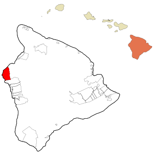
Honalo is a census-designated place (CDP) in Hawaiʻi County, Hawaiʻi, United States. The population was 2,423 at the 2010 census, up from 1,987 at the 2000 census.

Kahaluu-Keauhou, Hawaii Census-designated place in Hawaii, U.S.

Kahaluu-Keauhou is a census-designated place (CDP) in Hawai‘i County, Hawaii, United States. The population was 3,549 at the 2010 census, up from 2,414 at the 2000 census.

Kalaoa, Hawaii Census-designated place in Hawaii, U.S.

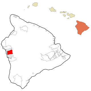
Kalaoa is a census-designated place (CDP) in Hawaiʻi County, Hawaiʻi, United States. The population was 9,644 as of the 2010 census, up from 6,794 residents at the 2000 census.

Kurtistown, Hawaii Census-designated place in Hawaii, U.S.

Kurtistown is a census-designated place (CDP) in Hawaiʻi County, Hawaiʻi, United States, in the District of Puna. The population was 1,298 at the 2010 census, up from 1,157 at the 2000 census.

Papaikou, Hawaii Census-designated place in Hawaii, U.S.

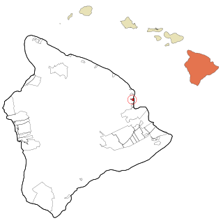
Papaikou is a census-designated place (CDP) in Hawaii County, Hawaii, United States, and is a few miles north of the county seat, Hilo. The population of Papaikou was 1,314 at the 2010 census, down from 1,414 at the 2000 census.

Hauʻula, Hawaii Census-designated place in Hawaii, United States

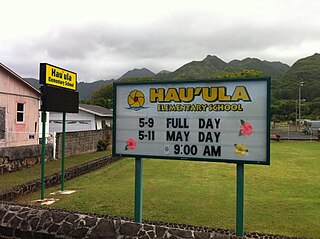
Hauʻula is a census-designated place and rural community in the Koʻolauloa District on the island of Oʻahu, City & County of Honolulu. In Hawaiian, hauʻula means "red hau". There is a small commercial center. As of the 2010 Census, the CDP population was 4,148.

Kaʻaʻawa, Hawaii Census-designated place in the United States

Kaʻaʻawa is a small community and census-designated place (CDP) located in the windward district of Koʻolauloa, City & County of Honolulu on the island of Oʻahu, Hawaiʻi, United States. As of the 2010 Census, the total population for Kaʻaʻawa was 1,379. In Hawaiian, kaʻaʻawa means "the wrasse (fish)". From the Hawaiian spelling Kaʻaʻawa it is seen that each a is pronounced separately and distinctly, set apart by the two ʻokinas: [ˈkɐʔəˈʔɐvə] or [ˈkɐʔəˈʔɐwə].

Maunawili, Hawaii Census-designated place in Hawaii, United States

Maunawili is a residential census-designated place (CDP) in the City & County of Honolulu, Koʻolaupoko District, Island of Oʻahu, Hawaii, United States. As of the 2010 Census, the CDP had a population of 2,040. Situated mauka of Kalanianaʻole Highway between Castle Junction and Castle Hospital, Maunawili is nearly all private homes, schools, and a few churches; horse stables complete the rural setting. There are no commercial establishments. However, residents are only minutes from Kailua.

Punaluu, Hawaii Census-designated place in Hawaii, United States

Punaluʻu is a census-designated place and rural community in the Koʻolauloa District on the island of Oʻahu, City & County of Honolulu, Hawaii, United States. In Hawaiian, punaluʻu means "coral dived for", or in the case of the fishpond once located here, possibly "spring dived for". There is a very small commercial center located beside Punaluʻu Stream, and several condominium projects, including a high-rise building, located at Haleaha Beach and Kaluanui Beach. At the 2010 Census, the CDP had a population of 1,164.

Waimalu, Hawaii Census-designated place in Hawaii, United States

Waimalu is a census-designated place (CDP) in Honolulu County, Hawaiʻi, United States. The population was 13,730 at the 2010 census.

Waimānalo, Hawaii Census-designated place in Hawaii, United States

Waimānalo is a census-designated place (CDP) in the City & County of Honolulu, in the District of Koʻolaupoko on the island of Oʻahu, Hawaii, United States. This small windward community is located near the eastern end of the island. In the Hawaiian language Waimānalo means "potable water"; it is so named for the many brackish ponds in the area that were used for irrigation. As of the 2010 Census, the CDP had a population of 5,451.

Waimanalo Beach, Hawaii Census-designated place in the United States

Waimānalo Beach is a census-designated place (CDP) located in the City & County of Honolulu, in the District of Koʻolaupoko, on the island of Oʻahu in the U.S. state of Hawaiʻi. This small windward community is located near the eastern end of the island, and the climate is dry. As of the 2010 Census, the CDP had a population of 4,481. This neighborhood is close to, but somewhat separate from Waimānalo, although the two form a single community.

Haiku-Pauwela, Hawaii Census-designated place in Hawaii, United States

Haiku-Pauwela is a census-designated place (CDP) in Maui County, Hawaii, United States. The population was 8,118 at the 2010 census.

Maunaloa, Hawaii Census-designated place in Hawaii, United States

Maunaloa or Mauna Loa is a census-designated place (CDP) in Maui County, Hawaiʻi, United States, in the western part of the island of Molokai. The population was 376 at the 2010 census.

Hickam Housing is a census-designated place comprising part of Joint Base Pearl Harbor-Hickam in the City & County of Honolulu, Hawaii, United States. The population was 6,920 at the 2010 census. The CDP occupies the area that was formerly Hickam Air Force Base.

Washoe Valley, Nevada Census-designated place in Nevada, United States

Washoe Valley is a census-designated place (CDP) in Washoe County, Nevada, United States. It corresponds closely to the unincorporated community of New Washoe City. The population was 3,019 at the 2010 census. It is part of the Reno–Sparks Metropolitan Statistical Area. The CDP takes its name from the Washoe Valley, a region between Reno and Carson City centered on Washoe Lake.

References